Leah and I have had a yearly tradition of traveling to an outdoor adventure every labor day weekend. It usually coincides with Leah’s birthday which makes it a great opportunity to plan something fun for the two of us.
This year we chose Isle Royale National Park (IRNP). It had been high on our list of national parks to visit considering its relative proximity to Minneapolis and its well-documented beauty. Isle Royale is an island in Lake Superior about 15 miles off the coast of Grand Portage, Minnesota (the northeastern tip of Minnesota). Oddly enough (and we got more info about this during a ranger talk), the island is part of Michigan and not Minnesota.
Isle Royale National Park is comprised of over 400 islands that make up an archipelago. Isle Royale, the largest of the islands, measures roughly 50 miles long and 9 miles wide making it the 4th largest island in the United States. Leah also loved to quote an unconfirmed source that said it was the least visited National Park (outside of Alaska) but the most returned to. Another fun fact that I remember from the trip and don’t have a source on is that IRNP is the only National Park that officially closes in the winter.
Trip Logistics
I thought I’d dedicate a section to trip logistics because I found that to be one of the more challenging barriers to visiting IRNP. Like some National Parks, just getting to Isle Royale was part of the adventure.
First off, Isle Royale is an island so the only way to get there (when Lake Superior isn’t frozen) is by boat or seaplane. You are allowed to park private watercraft at certain docks in the park so that’s technically an option but I’m assuming that most people don’t have access to a private boat in northern Lake Superior.
The most common way to get to the island is on one of the four ferries that provide passenger service. The Ranger III (the largest moving piece of equipment owned and operated by the National Park Service) leaves from Houghton, Michigan and stops at Rock Harbor on Isle Royale. Rock Harbor is the main port on the eastern side of the island with Windigo being the main port on the western side. The journey from Houghton to Rock Harbor takes about 6 hours which is why we learned that the Ranger III is also known as the “barf barge”.
The other ferry option from Michigan is the Isle Royale Queen IV which leaves from Copper Harbor and also arrives at Rock Harbor. The journey takes a little over 3 hours so it’s not quite as arduous of a journey as the Ranger III.
If you’re traveling from Minnesota there are two ferry options that both leave from the same location in Grand Portage, Minnesota. They also both operate on central time whereas IRNP is on eastern time (since it’s part of Michigan—though part of Michigan is on central time, but I digress). The Sea Hunter III is the fastest way to get to Isle Royale by ferry. The trip to Windigo takes around 1.5 hours and also includes a few sightseeing announcements over the PA system.
The other ferry that leaves from Grand Portage is the Voyageur II. The trip from Grand Portage to Windigo takes about 2 hours. The other important aspect of the Voyageur II is that it’s the only ferry that provides transportation from point to point on Isle Royale. It has an outbound and an inbound schedule. The complete outbound schedule starts in Grand Portage and ends at Rock Harbor while stopping at Windigo, McCargoe Cove, and Belle Isle along the way (it navigates the northern side of the island while doing this). The inbound schedule starts in Rock Harbor and ends at Grand Portage while stopping at Daisy Farm, Chippewa Harbor, Malone Bay, and Windigo along the way (it navigates the southern side of the island).
This makes the Voyageur II very helpful if you’re hiking from end-to-end on Isle Royale or if your starting or ending point isn’t Windigo or Rock Harbor. It also makes it a little harder to schedule transportation on the Voyageur II because the outbound and inbound schedules alternate days (since the trip from Grand Portage to Rock Harbor takes about 7 hours).
The other way to get to IRNP is by seaplane. The seaplanes leave from either Houghton, Michigan or Grand Marais, Minnesota and land at either Windigo or Rock Harbor. This option was faster, but also more expensive. I didn’t look into it too much because the ferries seemed to make more sense for us.
I found the hard part of the planning to be trying to fit our vacation schedule into the ferry schedule in a way that made sense, was relaxing, and didn’t require stressful amounts of travel and hiking. After a couple scheduling snafus with the ferry (mostly it being full when I tried to book), we finally committed to going. I booked the ferry about 3 or 4 weeks before we were leaving. It was also a holiday weekend (Labor Day). I would recommend booking earlier than that if you can to avoid running into issues with trying to book the ferry. We allotted four nights and five days on the island.
We were leaving on the Sea Hunter III and returning on the Voyageur II (the Voyageur II was our only return option because we were planning to hike across the island and it was the only method of intra-island travel). I was also worried that maybe hiking across Isle Royale in 5 days was too optimistic so I called the ferry service and asked if we would be able to get on the Voyageur II at a different pickup point that was part of their inbound service in case we couldn’t make the whole distance. They said that we could, but now that I know more about how the ferry operates I’m not so sure that would have worked. Communication on the island is spotty or non-existent. Unless you’re at Windigo or Rock Harbor you’re kind of on your own (with the exception of the other hikers and boaters). My advice is to have a backup plan, but hope that you never have to use it and understand that it probably won’t work very well.
I’d also highly recommend visiting the Isle Royal National Park transportation website (https://www.nps.gov/isro/planyourvisit/transportation-services.htm) for the most up-to-date information and schedules.
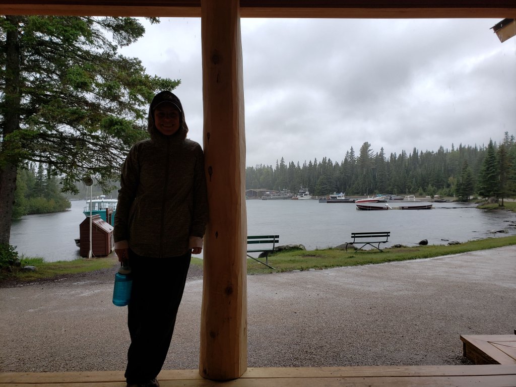
We left Thursday after work to complete the 5.5 hour drive to Grand Portage where we stayed at the lodge at the Grand Portage Casino. It was the most convenient option given our late arrival time and its proximity to the marina. Part of the hotel package included $5 in free play for each of us at the casino. We declined, though I told Leah that we should take that $10 and let it ride on the roulette table until we had paid for the entire trip.
Day 1
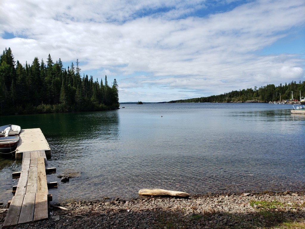
We woke up early and packed everything for the ferry ride to the island. The marina, as it turned out, was basically someone’s yard with a gravel parking lot. We grabbed our packs and headed to the ferry. They had us queue up on the dock before the departure time and then called out the boarding order by group name. The Sea Hunter III operates as a day trip service so there were many people on the boat that were not spending the night on the island. They also got to board the ferry first—such luxury treatment. Here she is in all of her glory.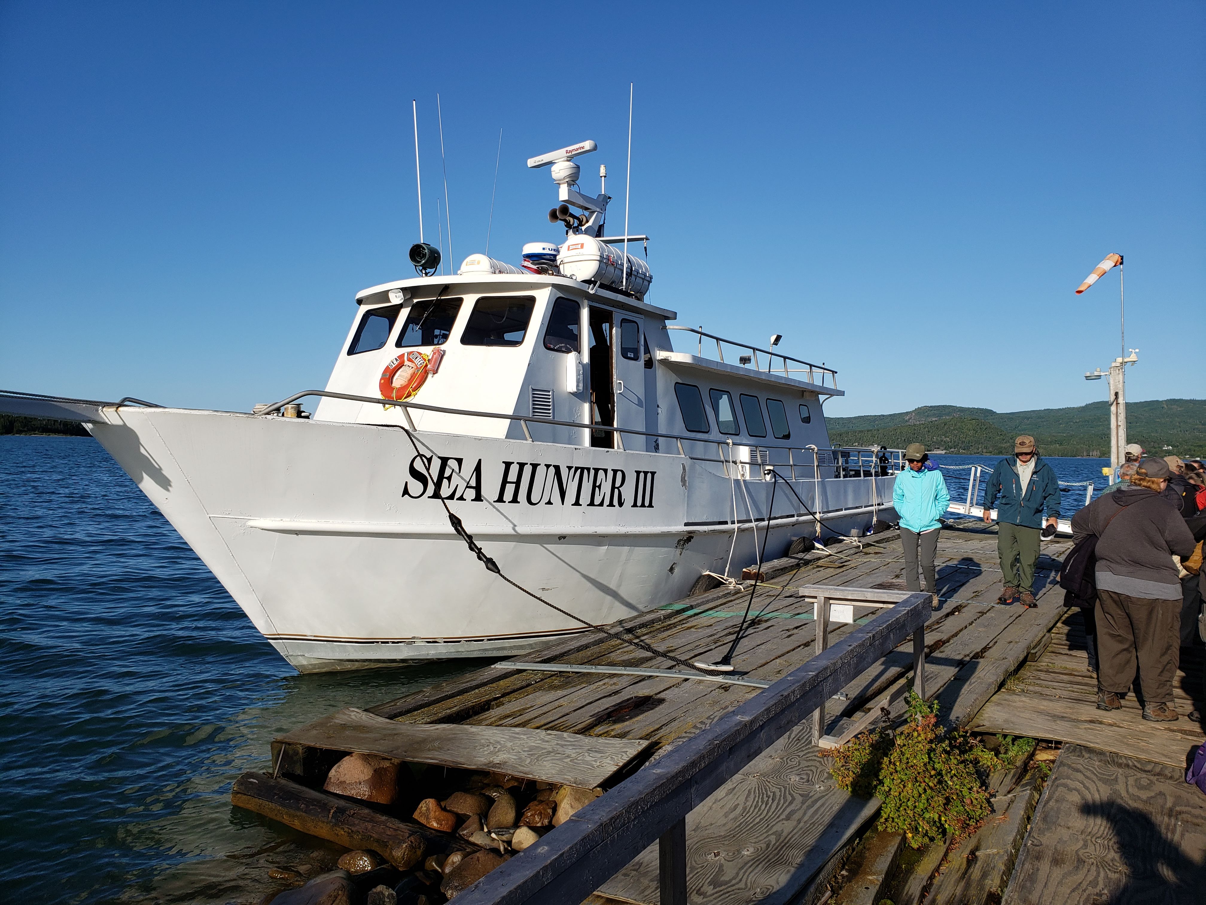
The ferry ride was pleasant. We sat on the outer deck and took in the sights. The ferry captain threw in a few tour guide style stops along the way. We saw the Little Cedar Spirit Tree—a sacred tree to the Ojibwe that has grown on a rocky cliff of Lake Superior. We also stopped to look at the wreck of the SS America. Here’s a photo of the Little Cedar Spirit Tree taken from the ferry. It’s the scrawny-looking one smack dab in the middle of the photo.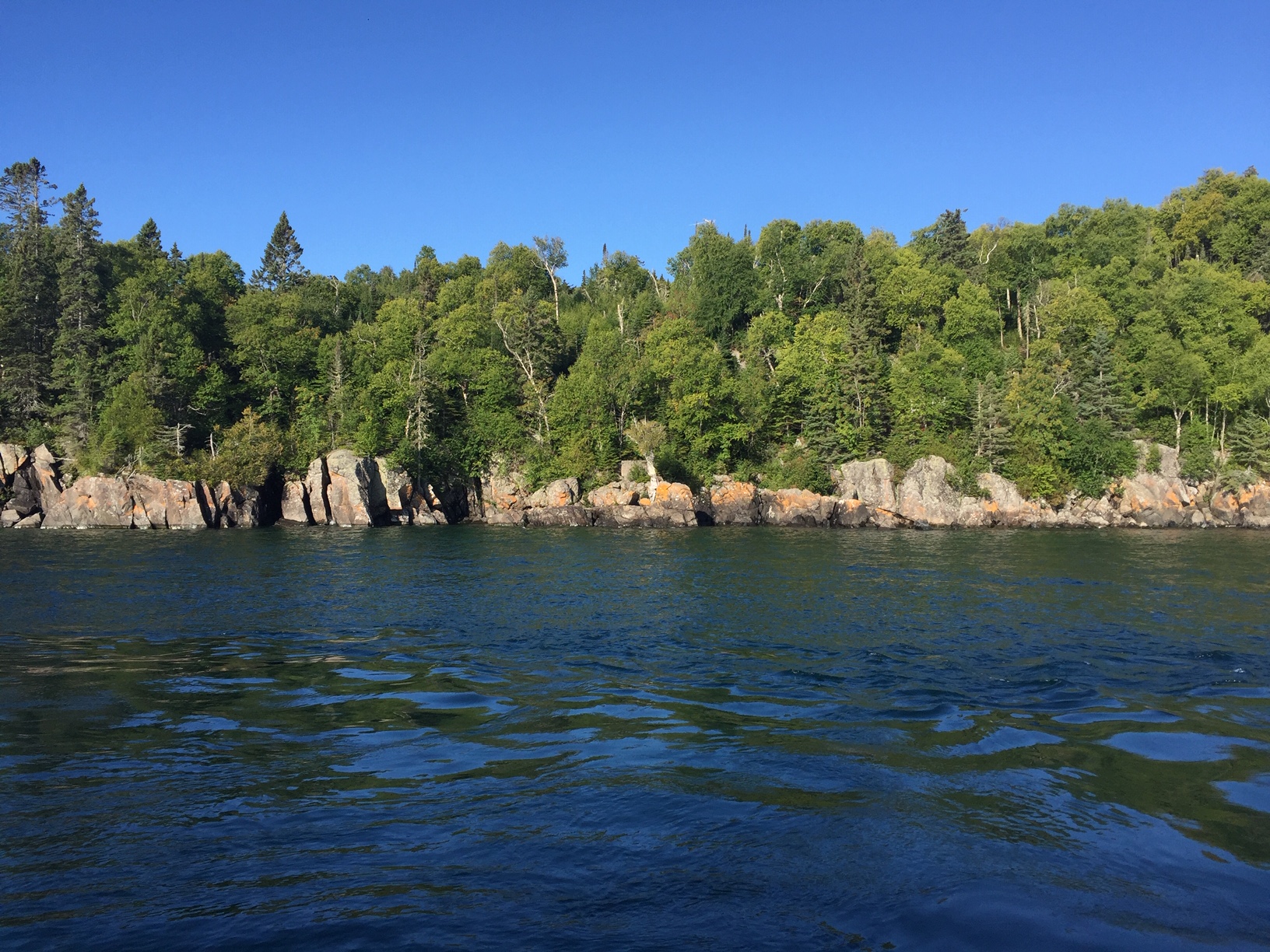
Here’s a photo of Leah enjoying the warm sunshine and cool breeze during the ride.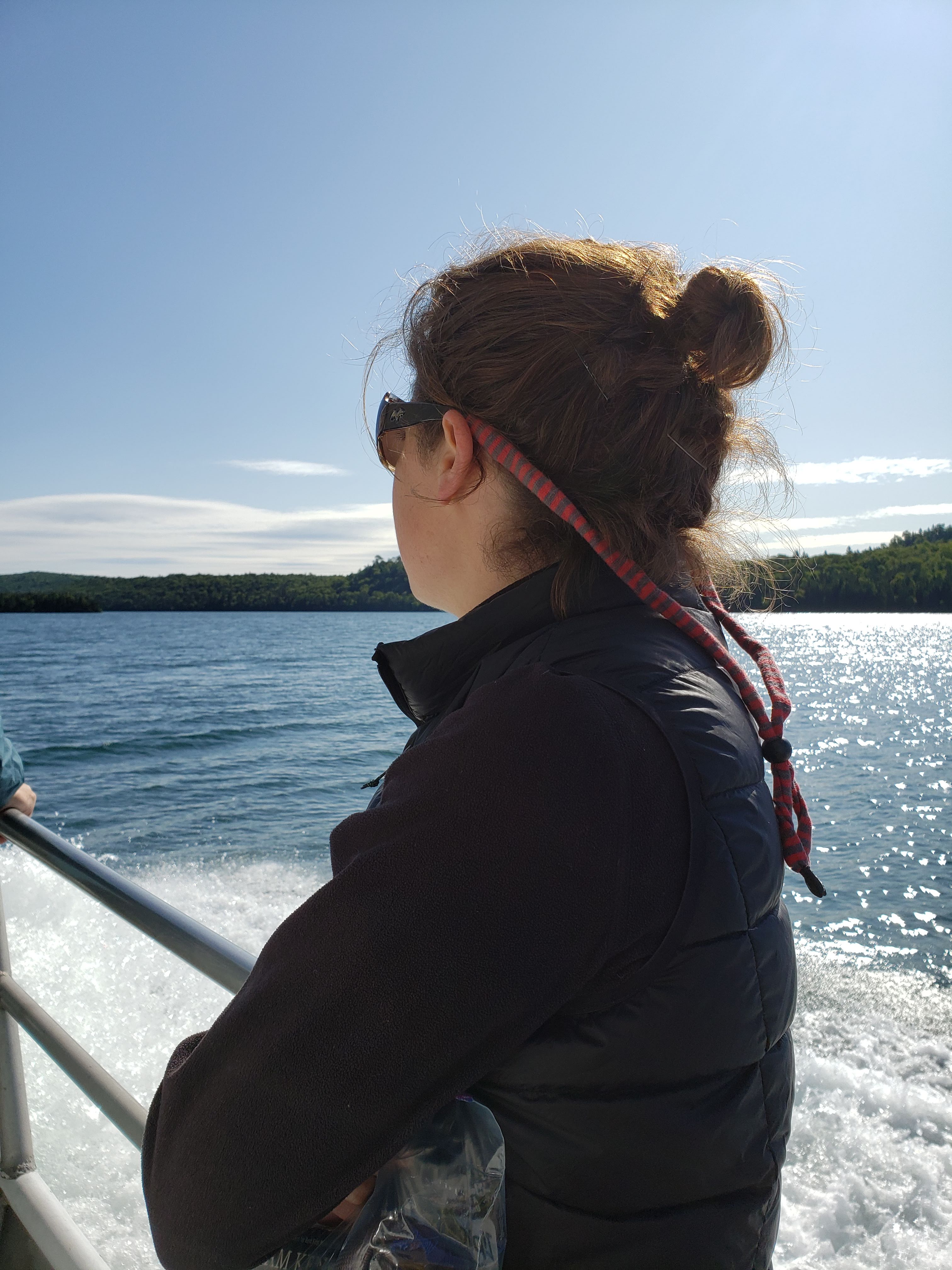
Once at Windigo we unloaded from the ferry. They split us up into two groups, one for the day trip folks and one for the overnight people. Each group had a park ranger give them a presentation about the island and basically explain the rules and regulations. Apparently every person that arrives on the island must sit through one of these presentations.
Next we headed to the visitor center. All overnight backpackers had to register for back-country permits in order to camp on the island. The permits were free but served as a way for the park rangers to keep tabs on who was on the island and where they were planning to be. We had been a little anxious about being able to hike the entire length of Isle Royale in our time allotted so we made sure to clear our plans with the ranger just as a sanity check. She explained that our chosen trail, the Greenstone Ridge Trail, was mostly flat as it followed the middle ridge line of the island. Also, the most elevation change that we would face each day would likely be when hiking to or from a campsite as there were no campsites along the ridge. All of the campgrounds were next to a permanent water source. The majority of the sites that we were targeting were next to inland lakes that were off the ridge trail.
We mentioned to the ranger that our first intended campsite was one called Island Mine (6.9 miles from where the ferry dropped us off). She said that we should be able to make it to the next campground called South Lake Desor (about 11.6 miles from where the ferry dropped us off). With her boost of confidence we felt better about our planned mileage. We also spent some time perusing the park store. I got my coveted passport sticker and we picked up some other stickers and postcards.
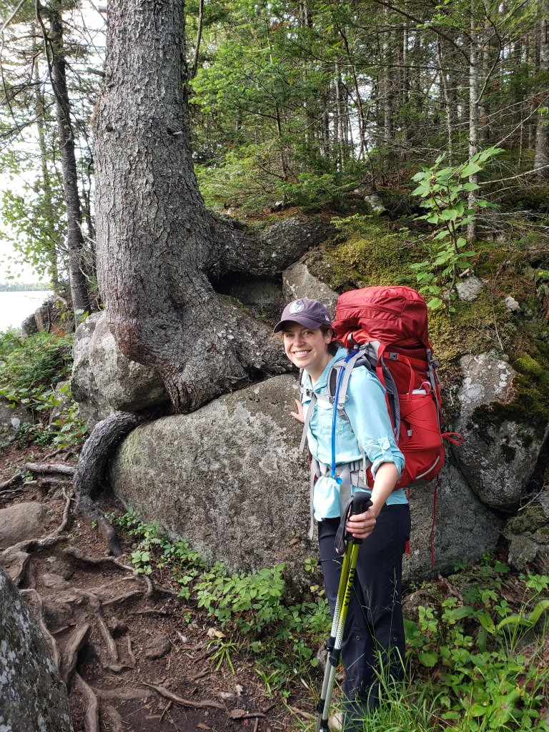
We left the visitor center, took a quick bathroom break (at the last flush toilets and running water we would see for the next four days), and headed out on the trail. Here’s a photo from the start of the hike as we were climbing slightly up to the top of the ridge.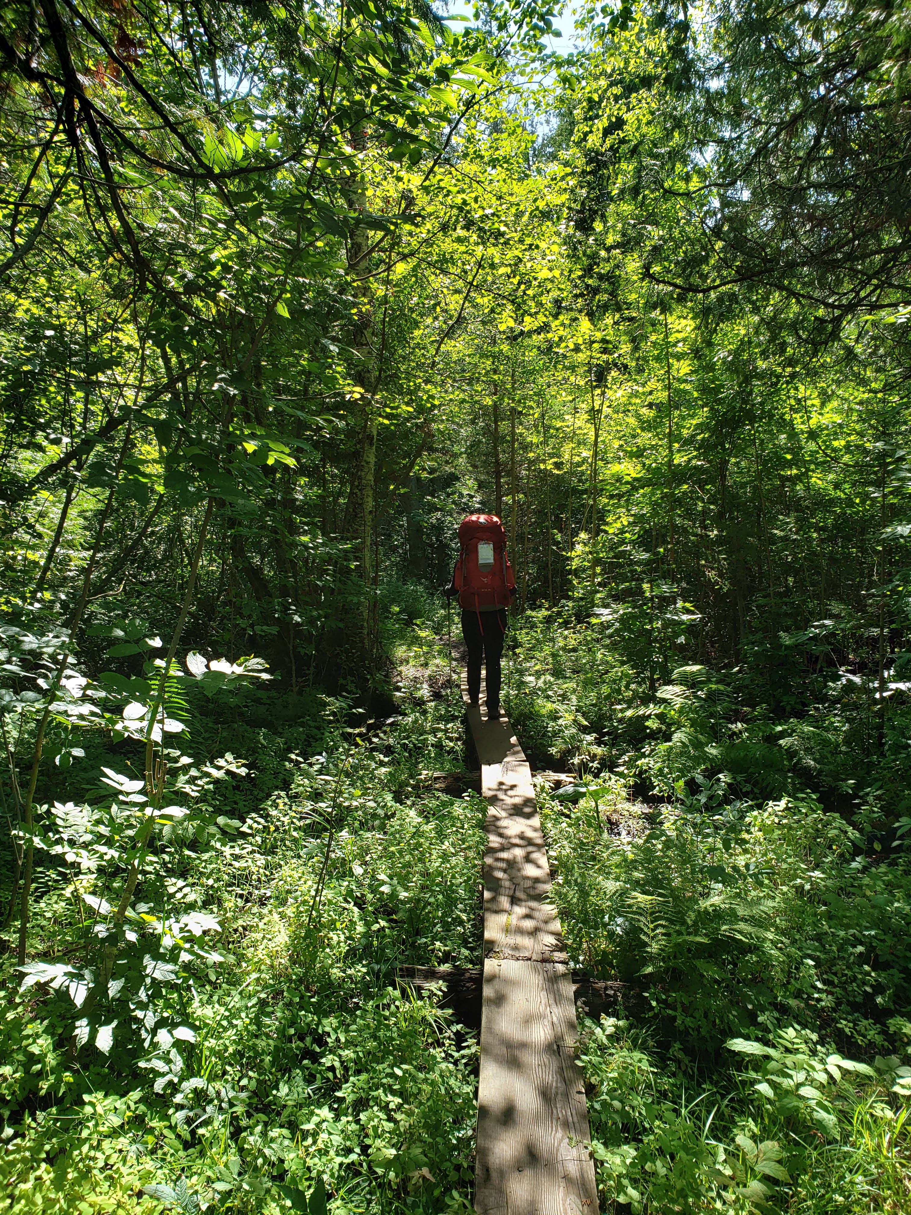
There weren’t many views in the first stretch of the trail since we weren’t on top of the ridge yet. The hiking was pretty easy going and it felt like we were making good time. We stopped for lunch on a log and enjoyed the peace and quiet of Isle Royale. After putting some distance between us and the visitor center, we didn’t see very many people.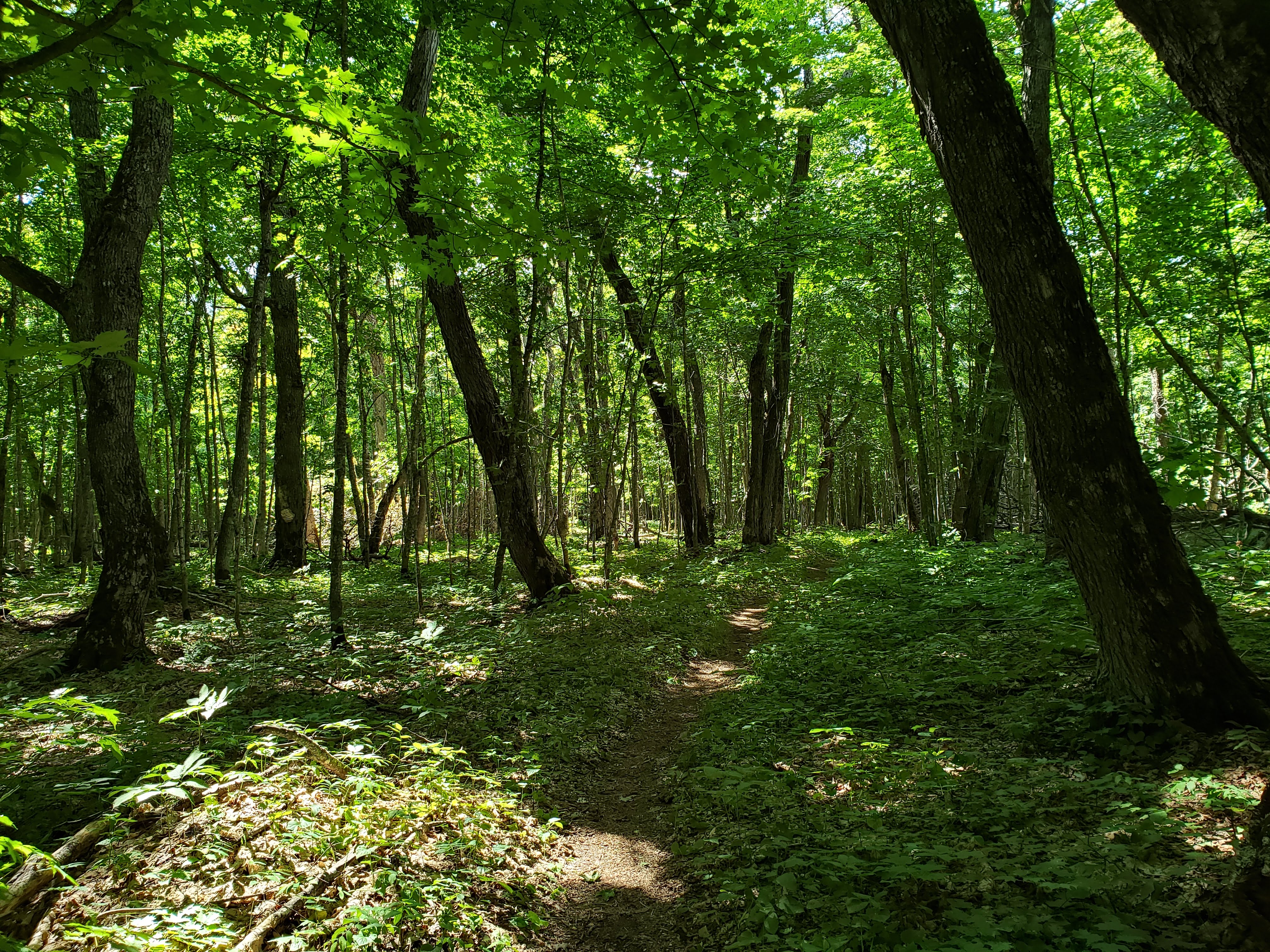
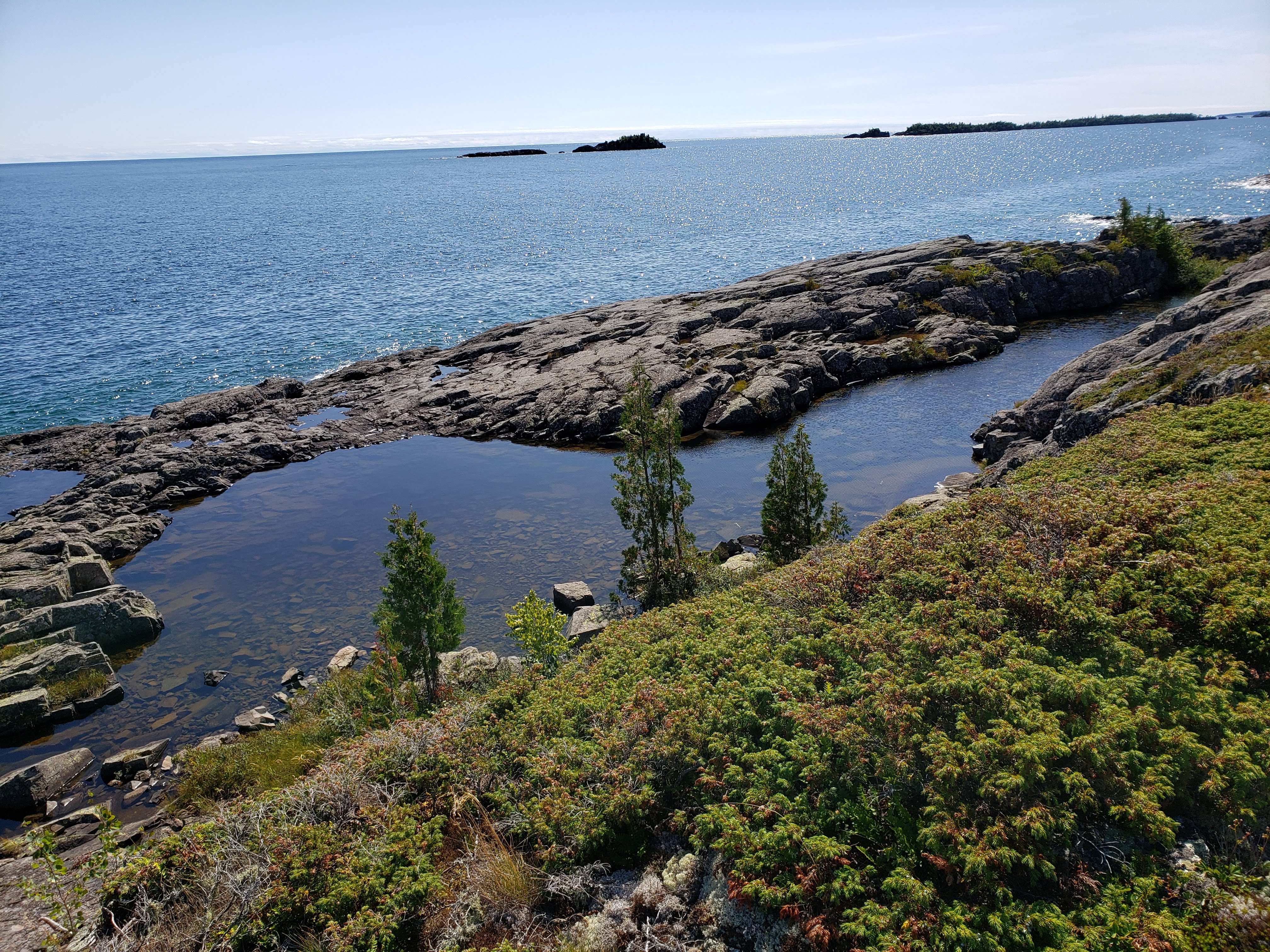
We were also keeping our eyes peeled for a moose. One of the main draws of IRNP is the opportunity to see moose in the wild. The moose population is estimated at about 2000 and the island only has about 200 square miles of land. So at about 5 moose per square mile you feel like your chances are pretty good. We eventually cleared the forest and made it to the ridge. Here’s one of the photos I took from along the ridge. That blue water down the hillside is the Siskiwit Bay.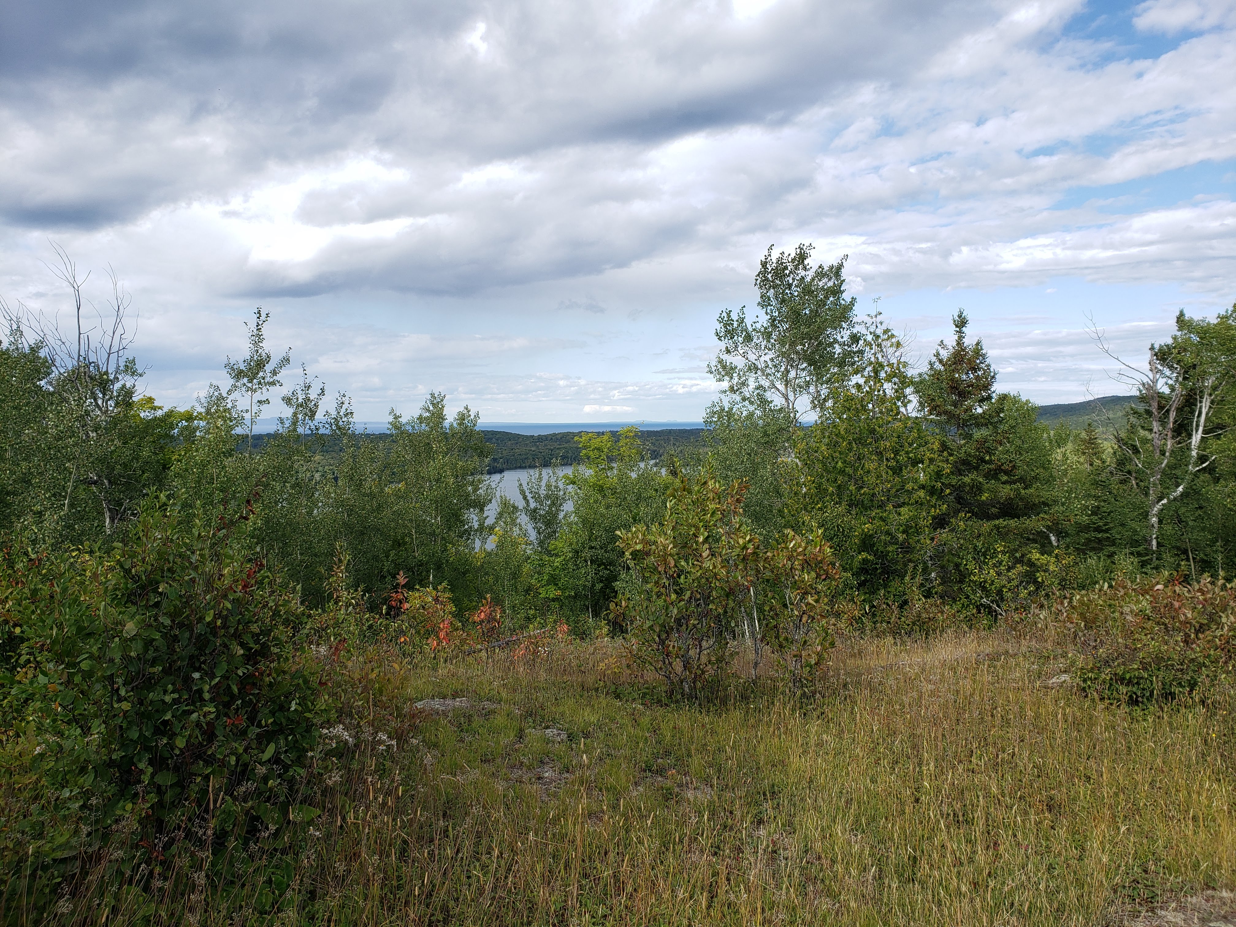
We eventually made it to the South Lake Desor campsite. All of the campsites on the island are first come, first served. We were able to pick a nice spot and only found one other campsite occupied. We set up the tent and got settled in. Here’s Leah’s photo of our campsite.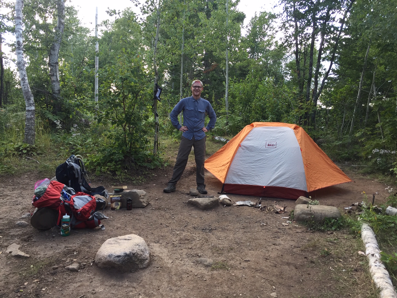
We headed down to Lake Desor to relax and take a load off. There was some discussion while packing for this trip whether or not we should bring sandals for lounging around the campsite. I said that I wasn’t going to bring sandals and ended up convincing Leah to also not bring sandals. After a long day of hiking and sore feet, Leah was a little upset that she didn’t have sandals. She blamed me for this. I also mostly agreed, and we decided that on our next backpacking trip we would bring sandals. Here’s some ducks swimming in the lake.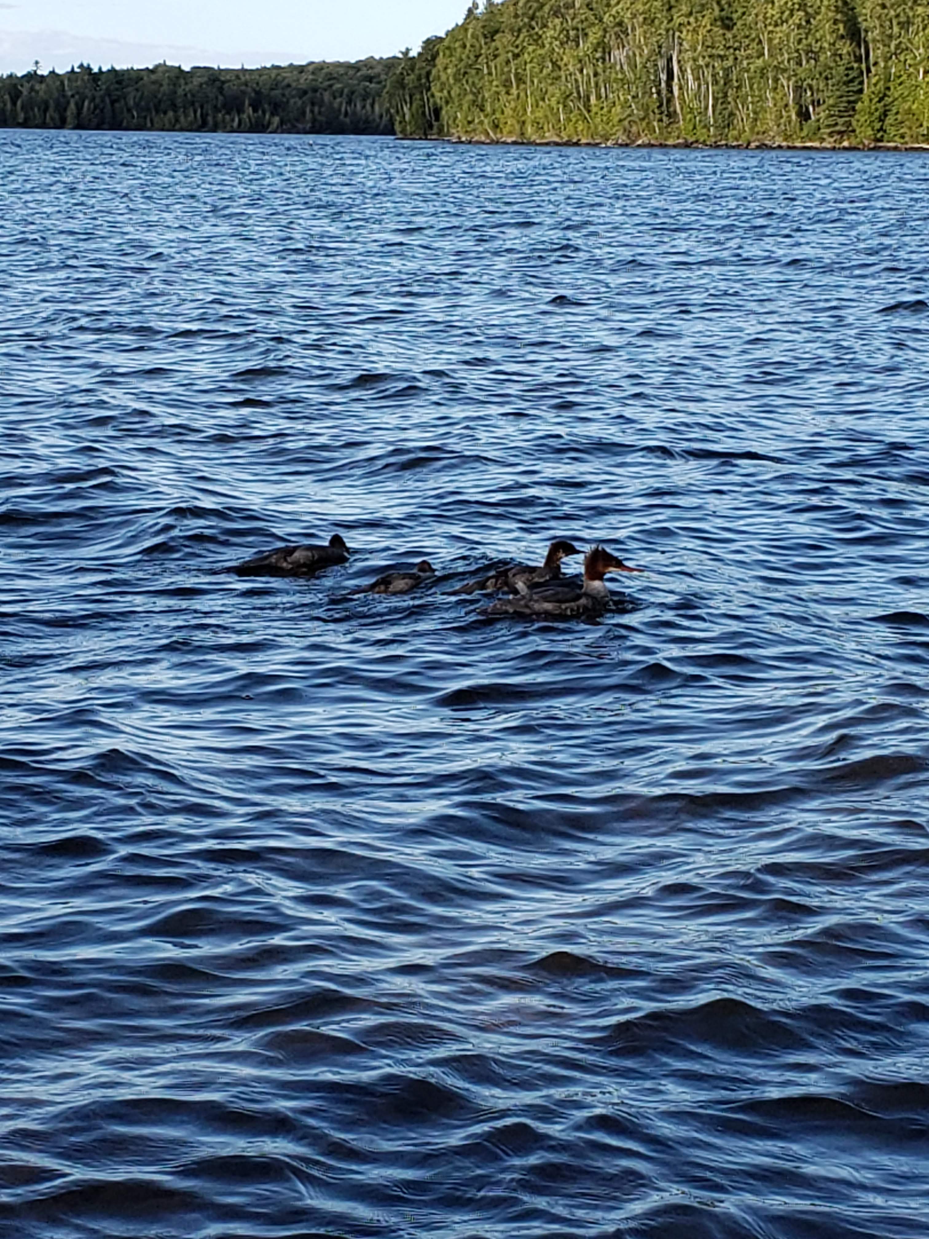
We took photos of each other sitting by the lake side. I feel like mine looks like a senior portrait.


While we were sitting by the lake, two women sat down near us. Leah recognized one of them as someone that she had recently worked with. We briefly chatted and agreed how strange it was that we ran into someone that we knew while on Isle Royale.
Leah and I filtered some water from the lake (for the remainder of the trip all of our drinking water would be filtered from either one of the inland lakes or from Lake Superior). Then we headed back to the campsite and cooked some freeze dried food for dinner. We headed to bed and crashed pretty quickly. It had been a long day.
Hiking: Windigo to South Lake Desor campground – 11.6 miles
Day 2
We woke up and made our hiking plan for the day. We were ahead of schedule due to hiking further than we had expected on the first day. Our original plan had us going to Hatchet Lake, but since we were closer than originally planned it would have only been an 8.1 mile hike. The weather was beautiful and the forecast for later in the week was a little more sketchy, so we made the decision to try to make it to the next campground on the Greenstone Ridge Trail which was West Chickenbone Lake. The new mileage for the day would be 15—a little ambitious but we could always stop if we weren’t up to it.
There’s an interesting relationship between wolves and moose on Isle Royale. The park service has been working to balance the populations over the last few decades (more info can be found here https://www.nps.gov/isro/learn/nature/wolf-moose-populations.htm). During the previous night I had heard wolves howling somewhere off in the distance. According to the park rangers, wolf sightings are very rare. Early on in the hike I spotted some wolf tracks in the mud.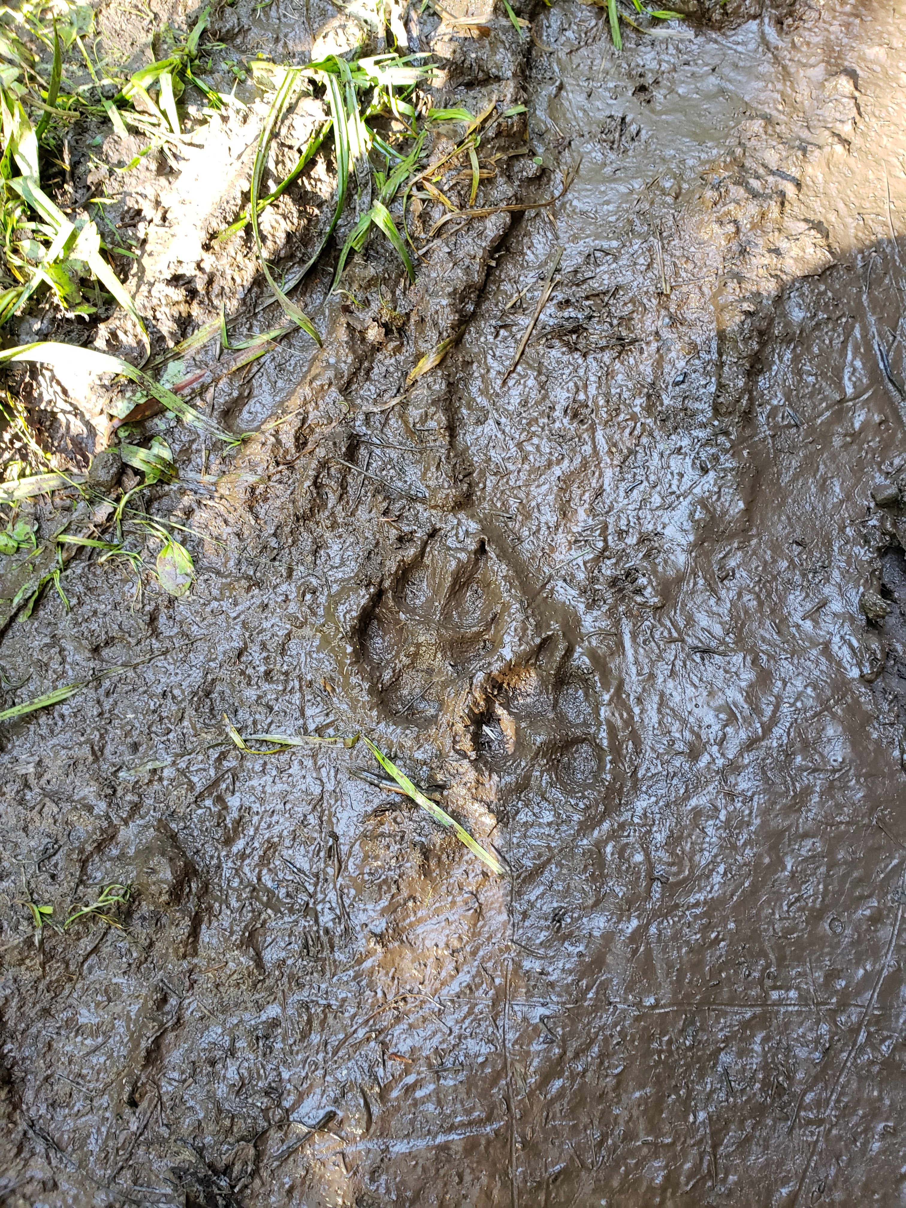
I was working on my tracking skills. I also spotted a moose track. I knew there must be a moose somewhere nearby. Maybe we were following one? I was determined to see a moose at some point.
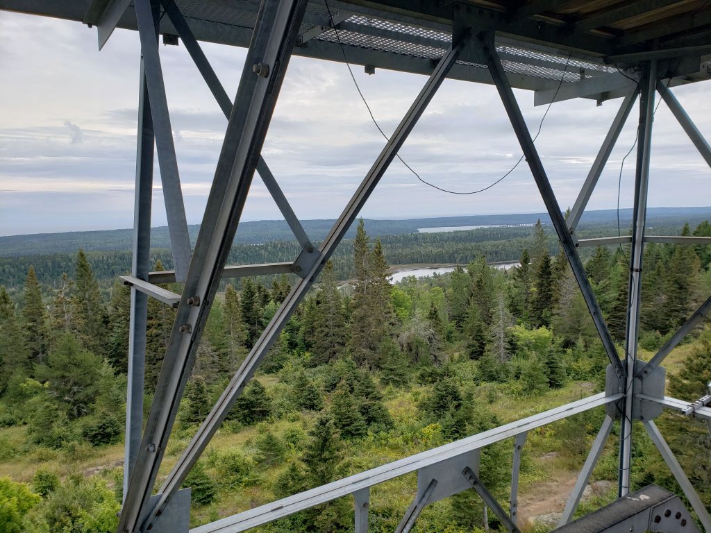
There is a lookout tower called Ishpeming Point that we stopped at. Unfortunately, we could not climb the tower because it was locked. Here’s me getting as high as we were allowed.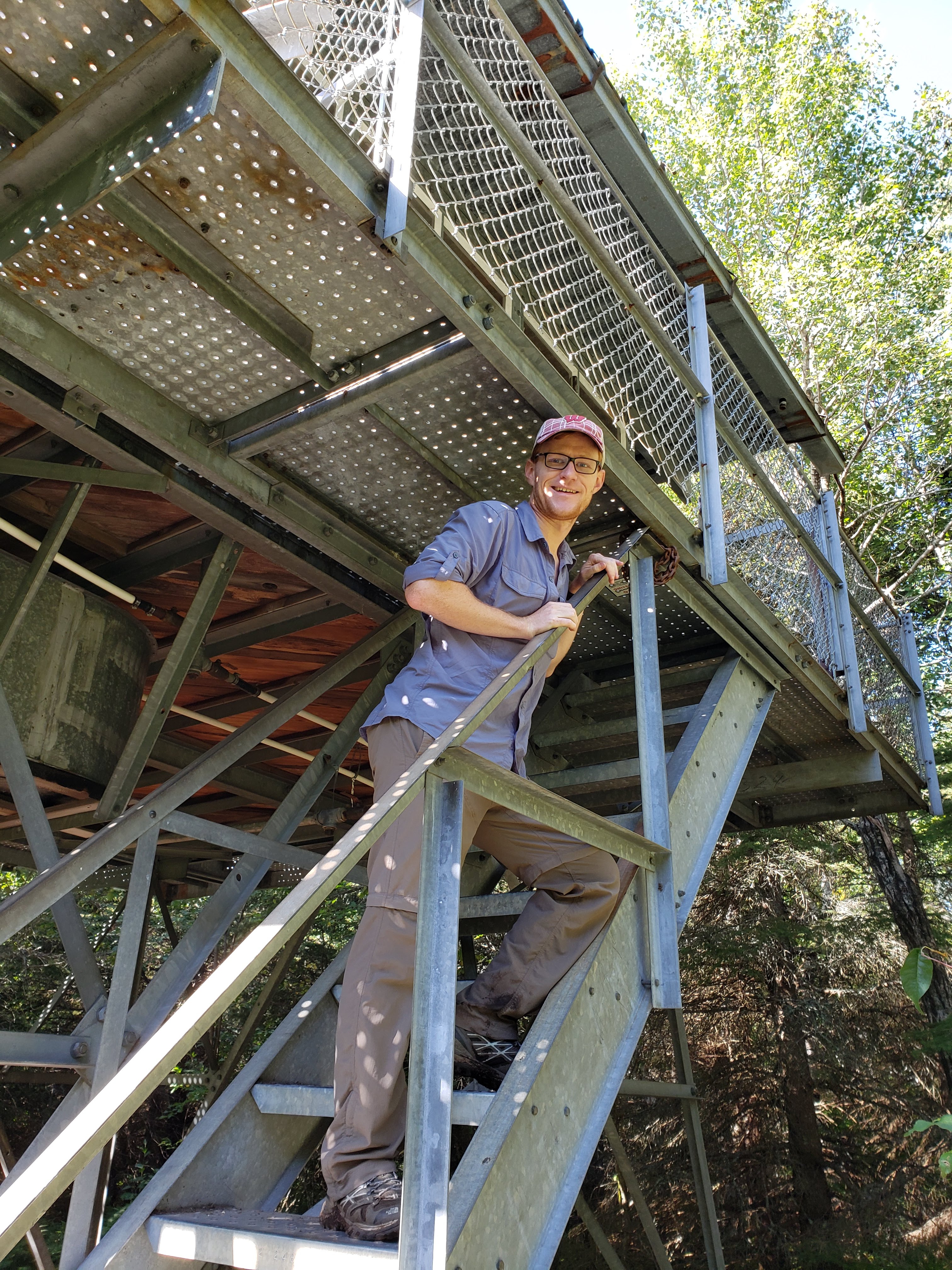
Here’s a photo of a single tree that was showing its leaf colors. I can only image what IRNP looks like during peak fall colors.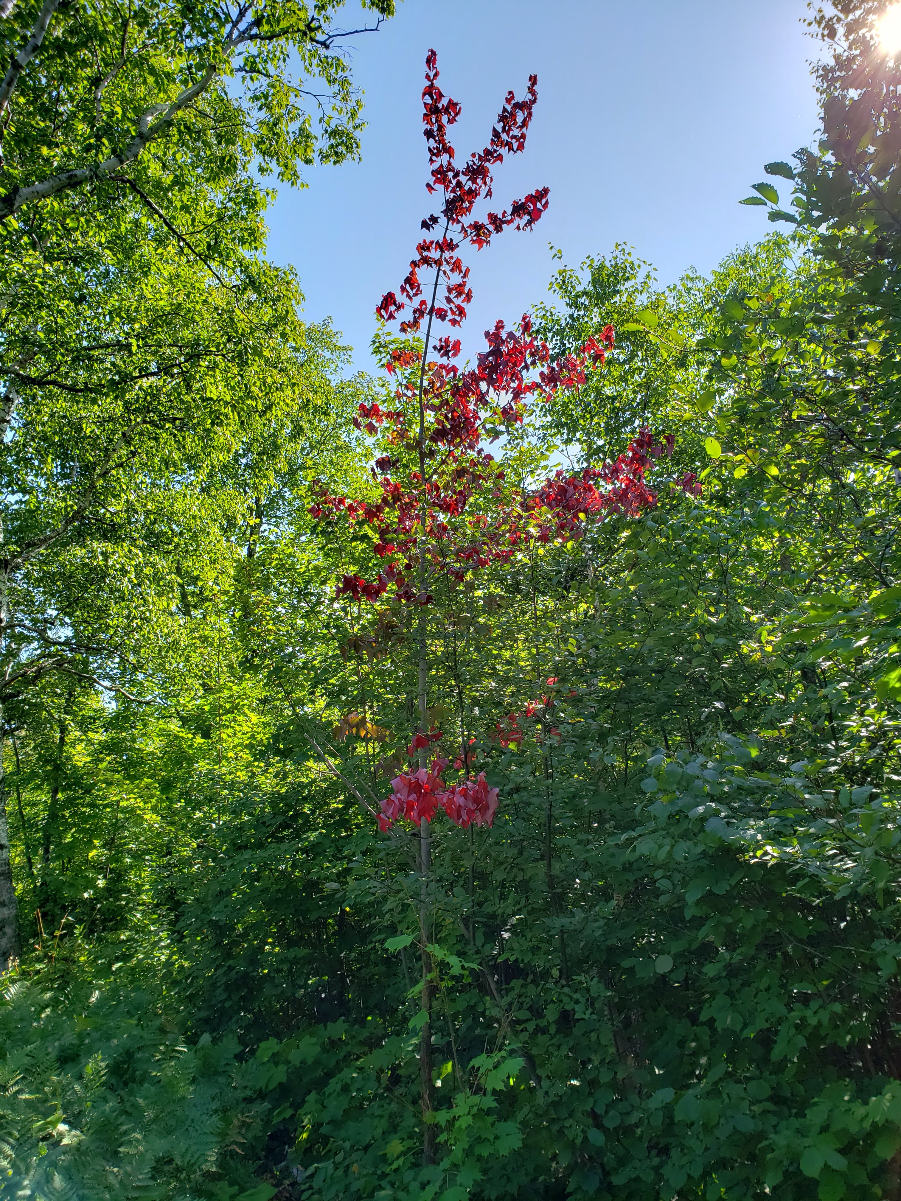
While hiking along the trail, I heard a rustling up ahead. I was in front of Leah and I stopped as soon as I saw that it was a moose about 100 feet ahead on the trail. I think it was startled by us, and just as soon as I had stopped, it started to trot away on the trail. All I got to see was its butt as it ran away. I was glad that we actually saw a moose, but also a little disappointed that the moment was so fleeting and I didn’t have a chance to enjoy it or photograph the moose.
We kept hiking along the trail. Parts of it were pretty overgrown and it felt like we were walking in a field of plants. Here’s Leah standing in the trail.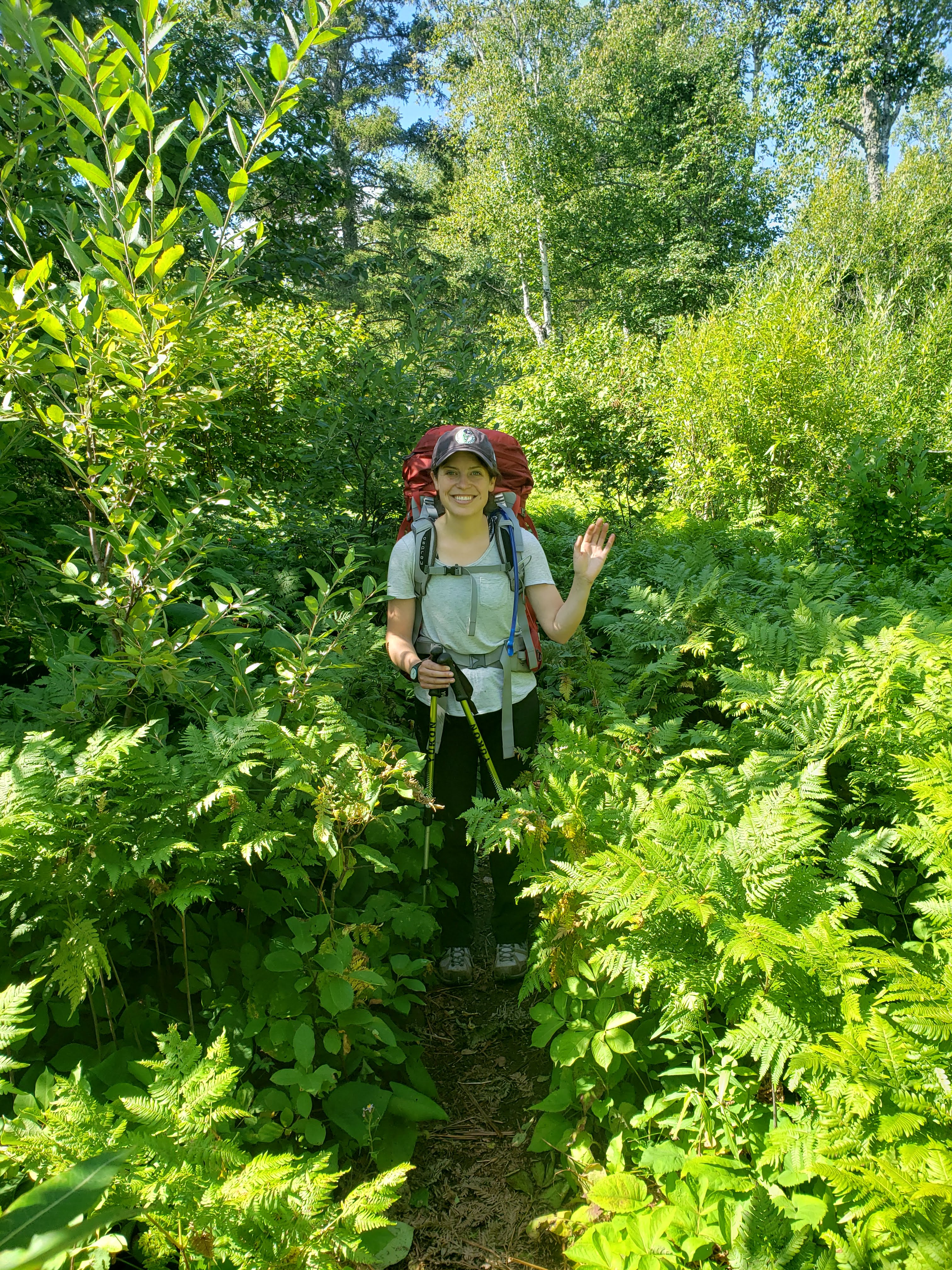
We managed to take a decent selfie on top of the ridge.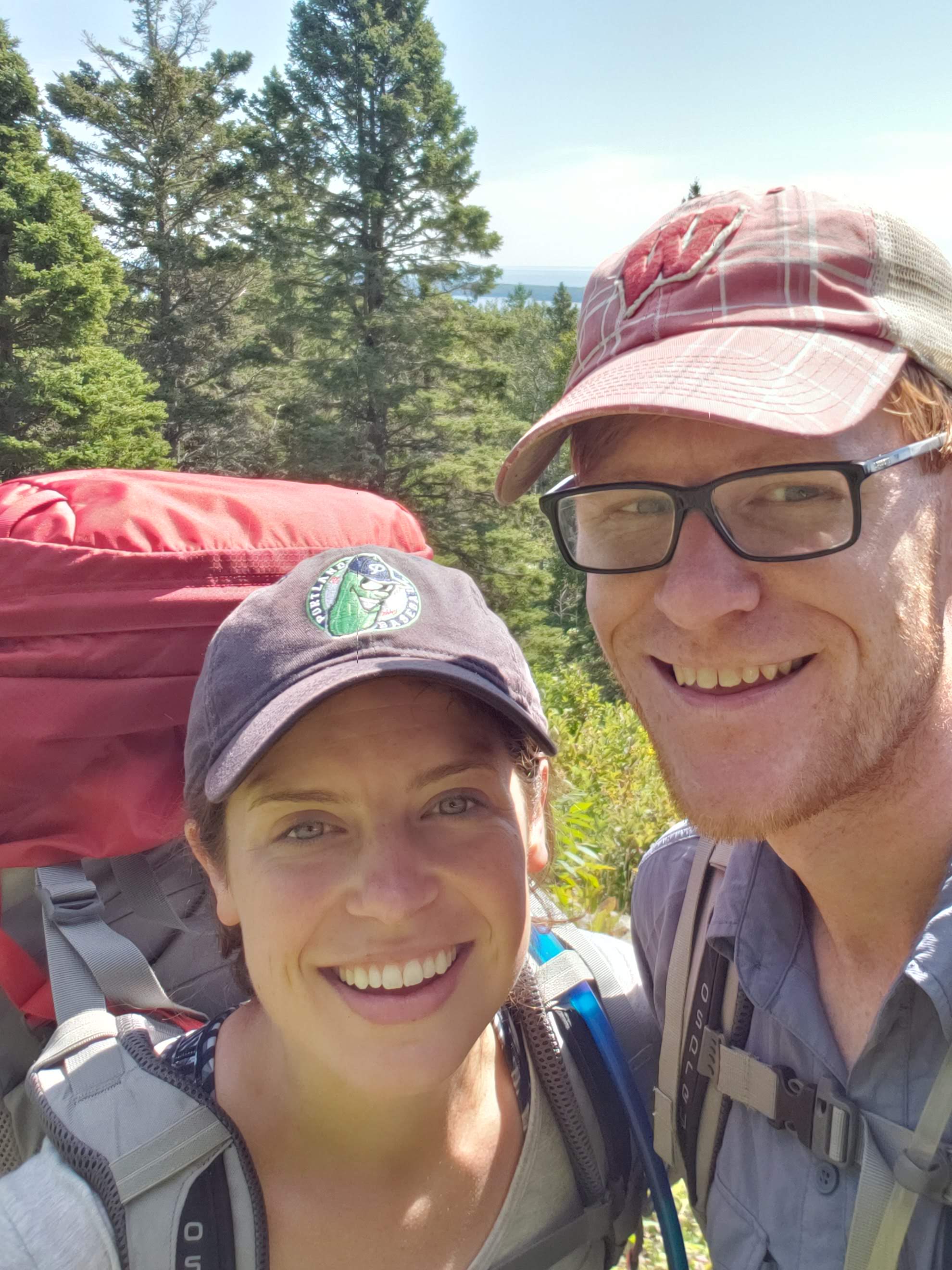
Here’s a photo of Leah looking out onto the wilderness below and Lake Superior beyond.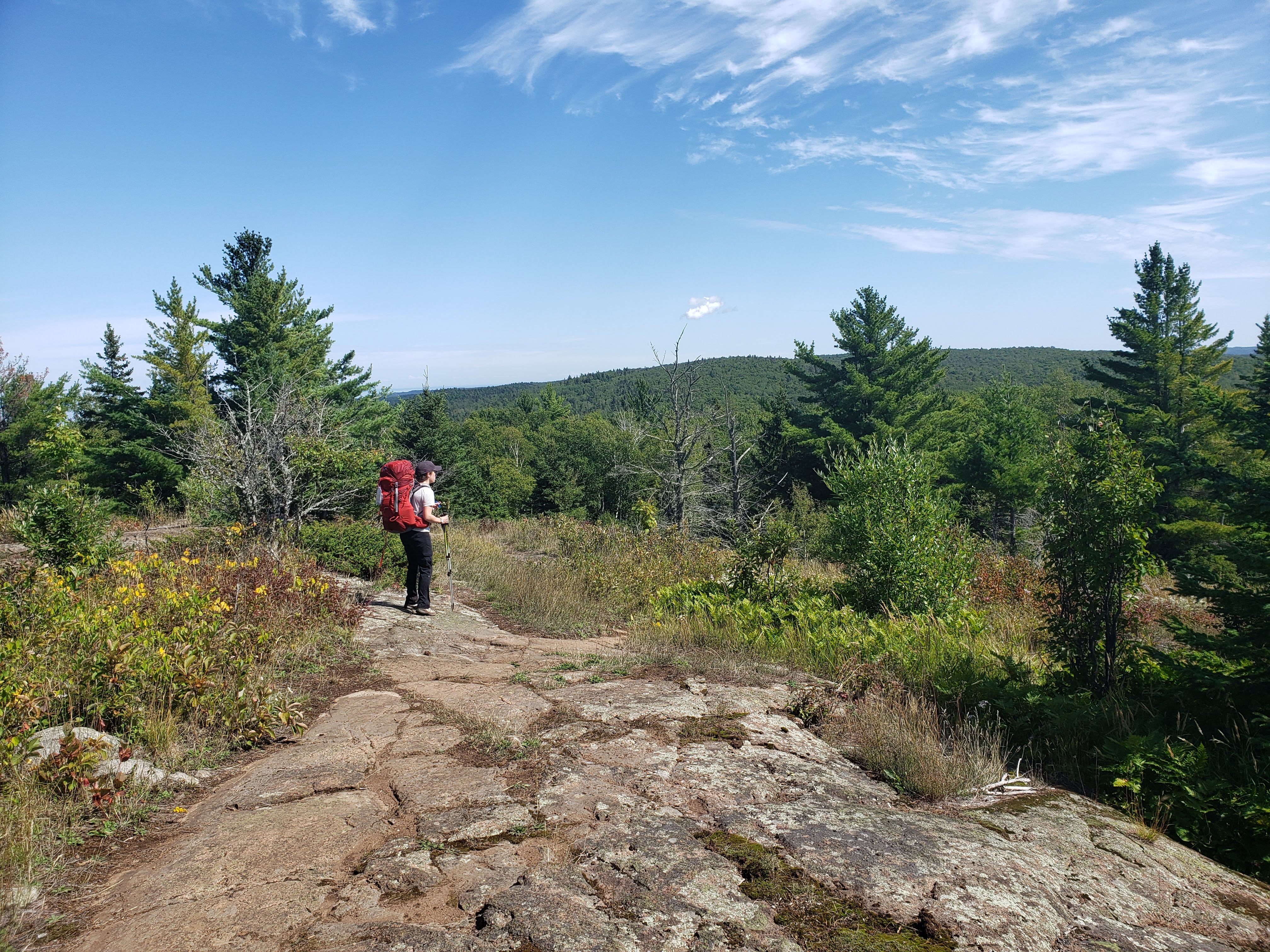
We decided to stop at Hatchet Lake for lunch. It was the last reliable water source before making it to our campsite and we thought it would make a nice place to stop and take a break. Here’s Leah navigating the trail down to the lake.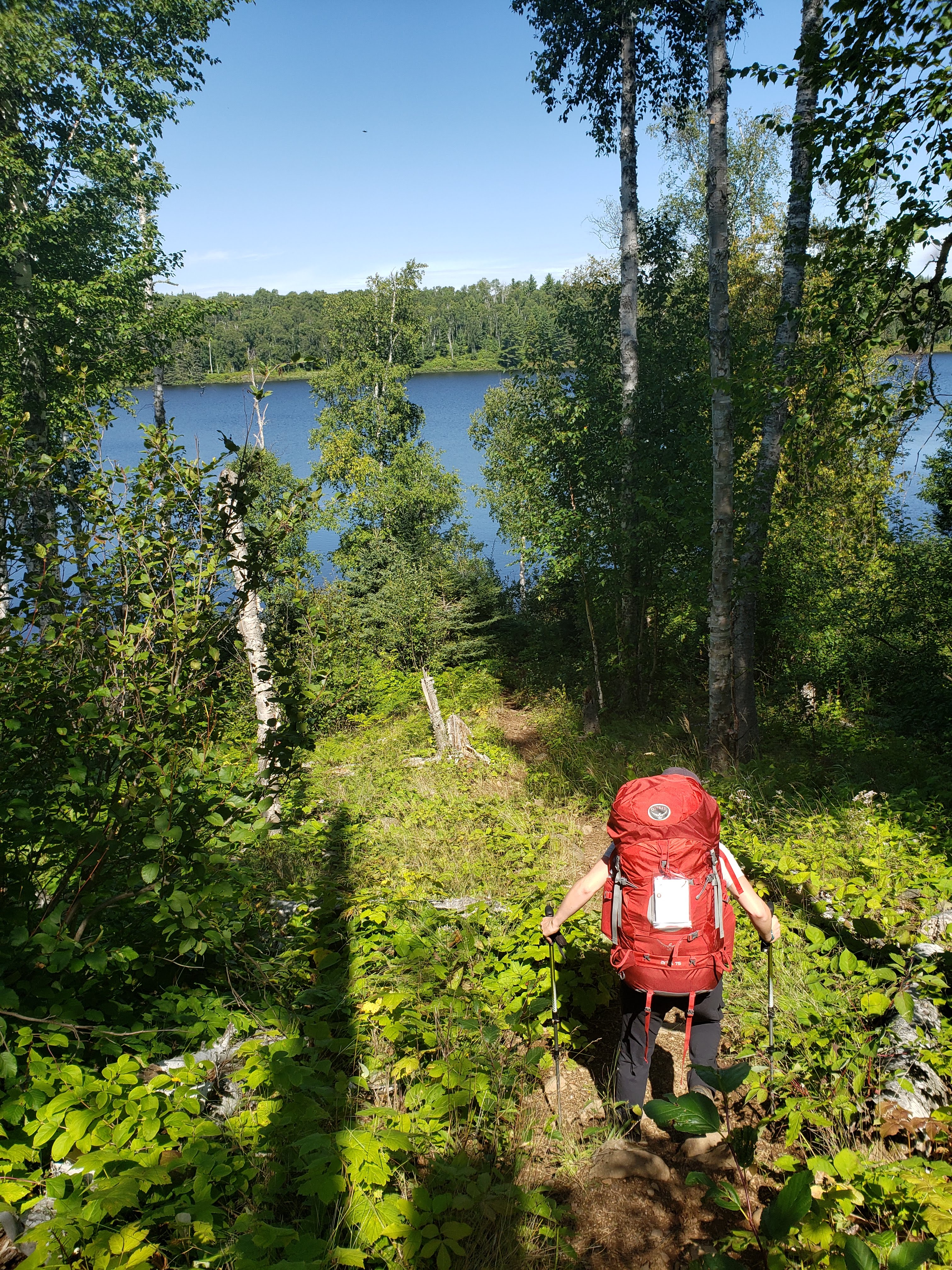
Here’s a photo of Leah enjoying our little break by the water.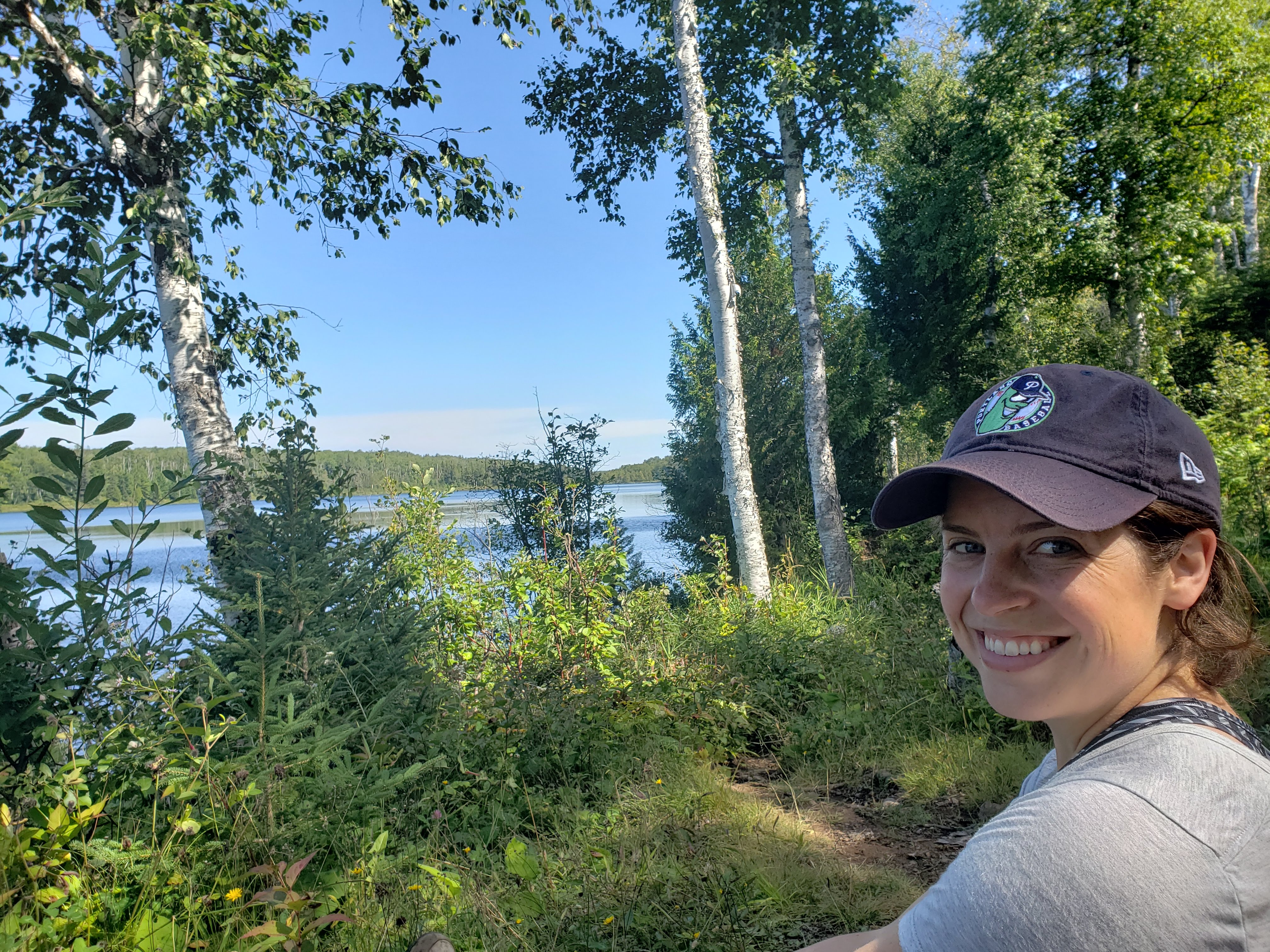
We also saw these insects flying around by the lake. I’m not sure if they’re butterflies or moths or whatever (I’m not a professional insect identifier yet). I just thought they were really pretty.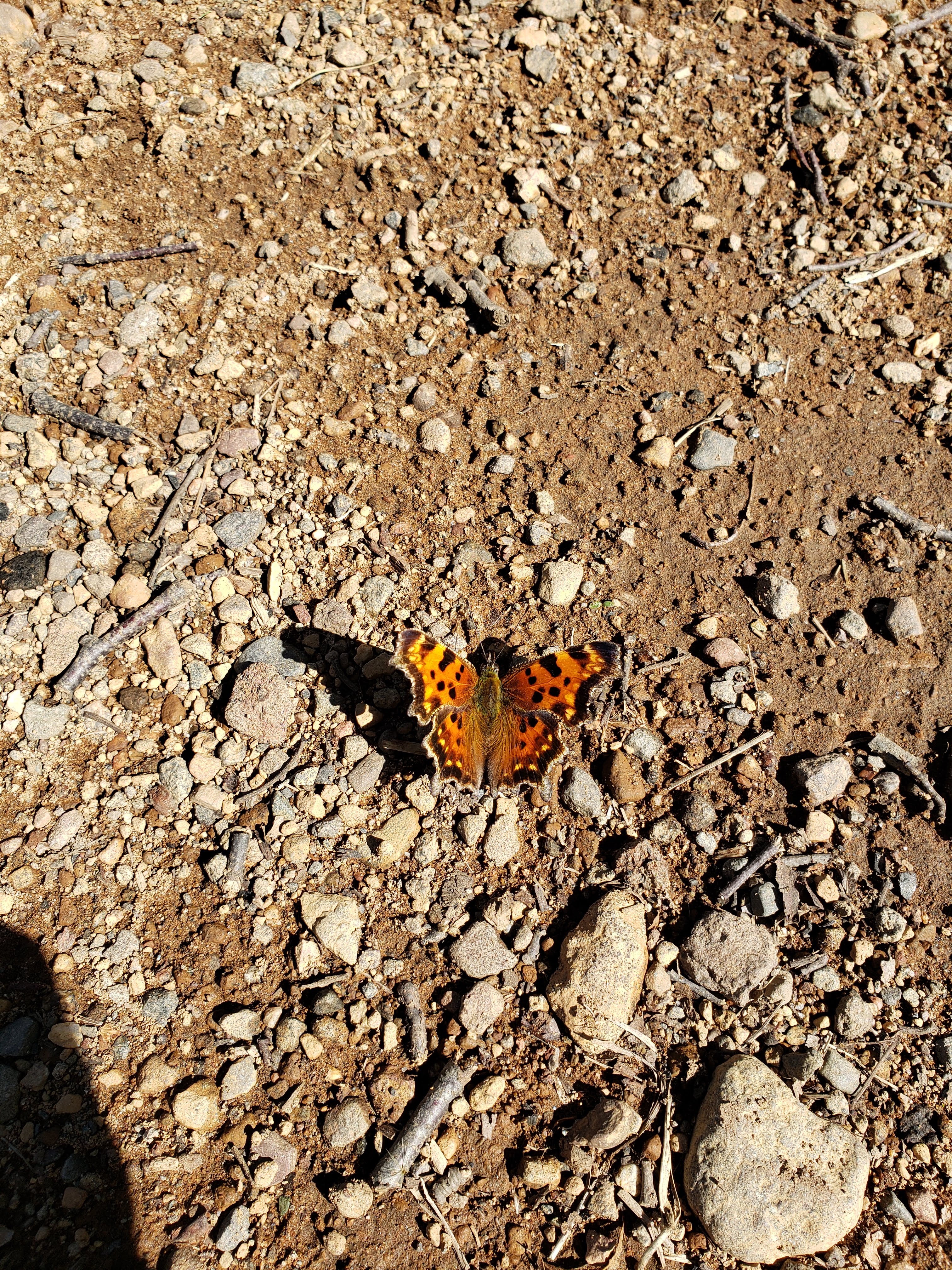
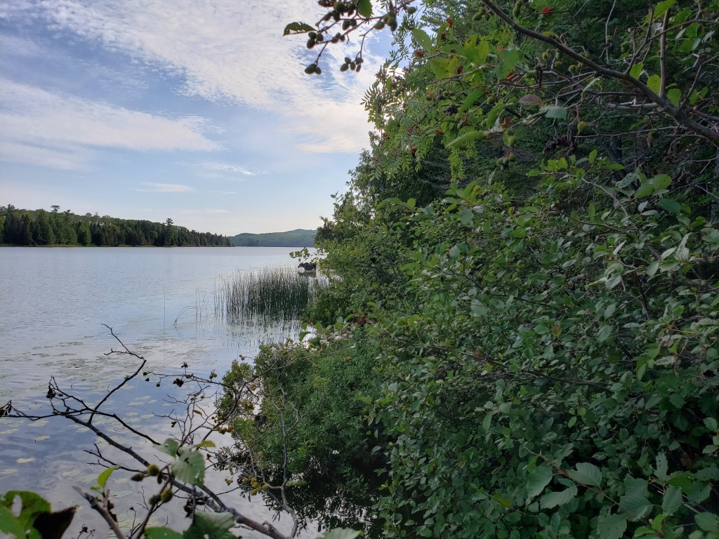
We hiked back up onto the ridge trail and continued on our way. One of the interesting things about hiking on Isle Royale was that if you couldn’t see Lake Superior or didn’t have a view, you kind of had to remind yourself that you were hiking on a really big island in a really big lake. Here’s another photo of the trail picking its way through a different grove of trees.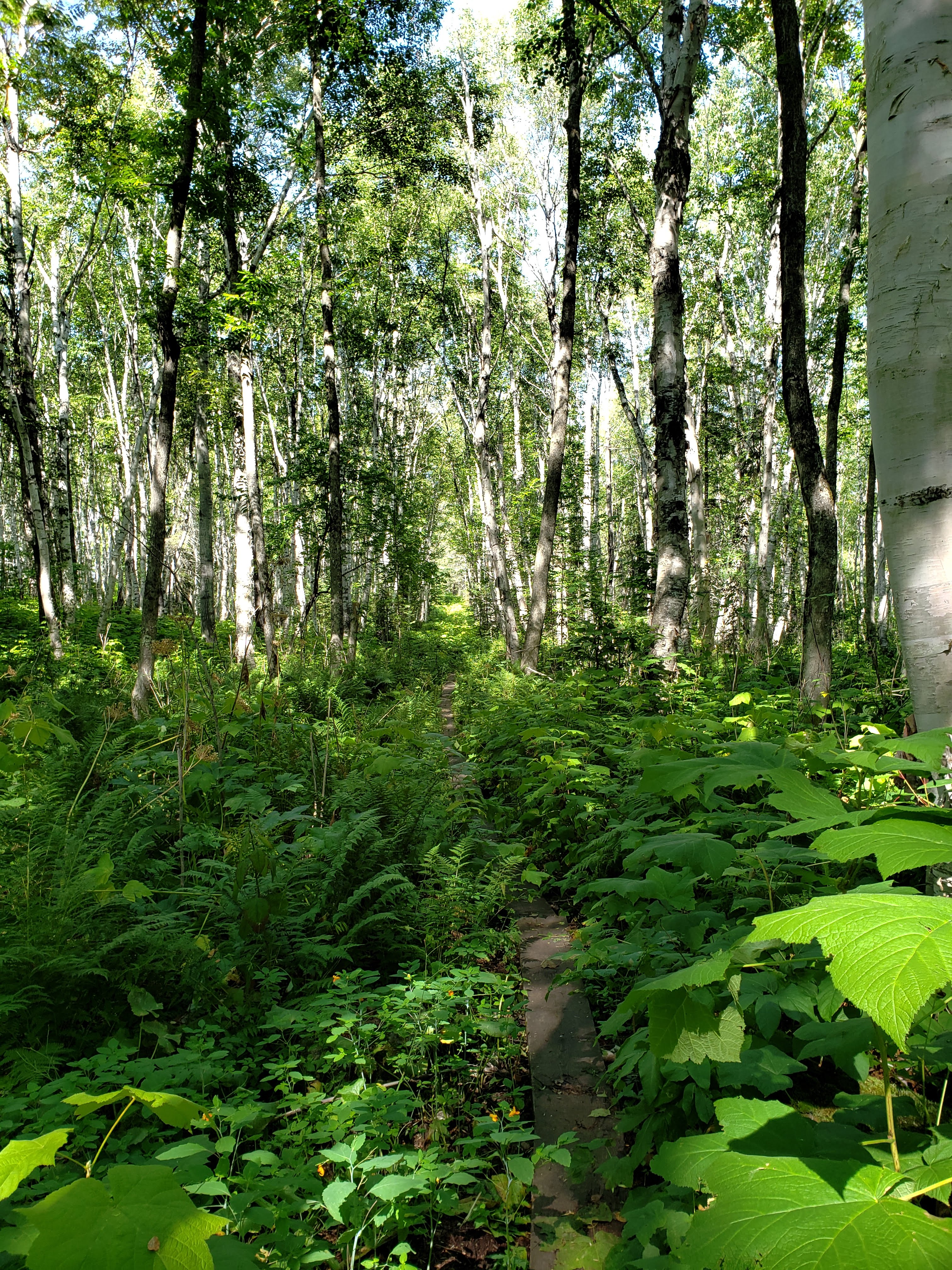
Here’s a photo Leah took of me on top of the ridge.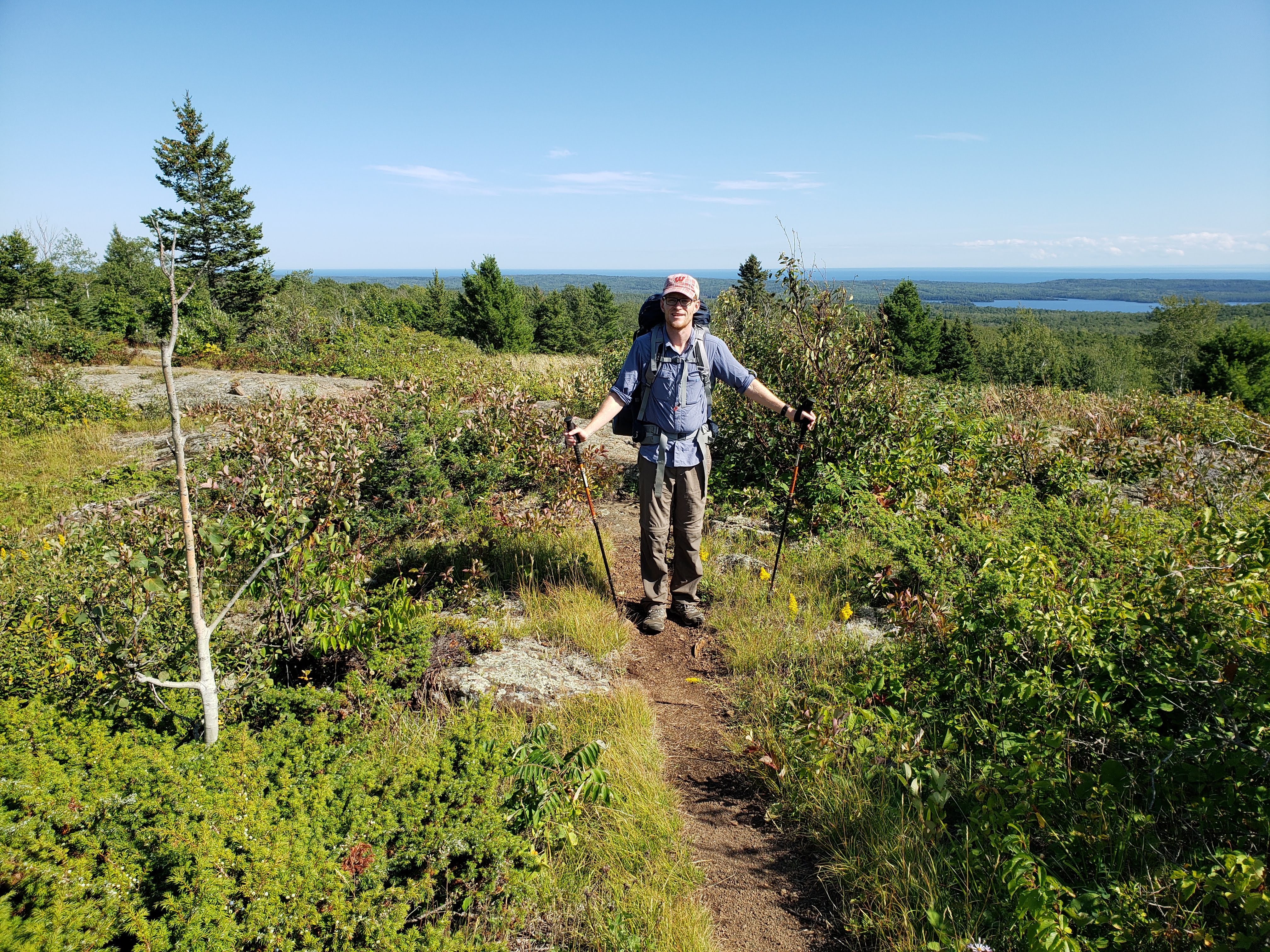
Later in the day we passed a group of about five people—probably the largest group we saw while hiking on the island. We chatted briefly about how we had seen a moose earlier in the day heading in their direction on the trail and were wondering if maybe they had seen it. They said that they had been on Isle Royale for seven days and hadn’t seen even one moose. I felt a little selfish for wanting a better moose encounter than what we had just experienced. Maybe I should be lucky that I even saw one at all, I thought.
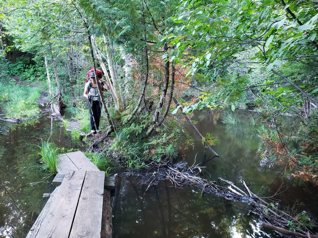
Closer to the campground we crossed a water feature courtesy of Mr. and Mrs. Beaver. There were some boards put out to help cross but they were not enough.
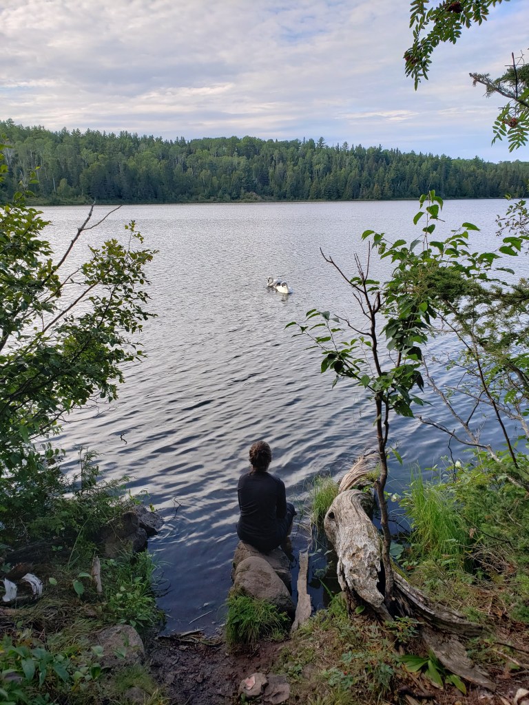
We finally made it to our campsite at West Chickenbone Lake. It was a long day of hiking and our feet were sore. We headed down to the lake to relax. Here’s a photo of Leah enjoying the trumpeter swans.
We ate dinner and headed to bed. We were planning another long day the next day.
Hiking: South Lake Desor campground to West Chickenbone Lake campground – 15.6 miles
Day 3
We woke up in the morning and made breakfast. We were just minding our own business and then all of a sudden there was a crashing sound coming down the trail. We looked up from our oatmeal to see a moose just chilling in the lake next to our campsite. We very quickly and quietly stopped what we were doing and got into a better position to see the moose. Here’s a photo of the moose taken from our campsite. This is the best photo I was able to take.

The moose just spent its time munching on lily pads and looking around. Leah attempted to move to a better vantage point and the sound seemed to startle to moose and it took off along the lake shore. I climbed down to the edge of the lake and was able to take another photo of the moose. You can see it just off in the distance.
We were thrilled to have an amazing moment seeing a moose up close and for such a long time. I was glad that I got the moose experience I was hoping for—much better than briefly seeing a moose run away. I felt satisfied. And lucky. A couple passed our campsite on the trail and we warned them about the moose. They ended up setting up camp further down the trail and when we passed them again they said that they had good views of the moose as well.
We eventually packed up our gear and climbed back up towards the ridge. Once at the top, I took a photo looking back over the inland lake.
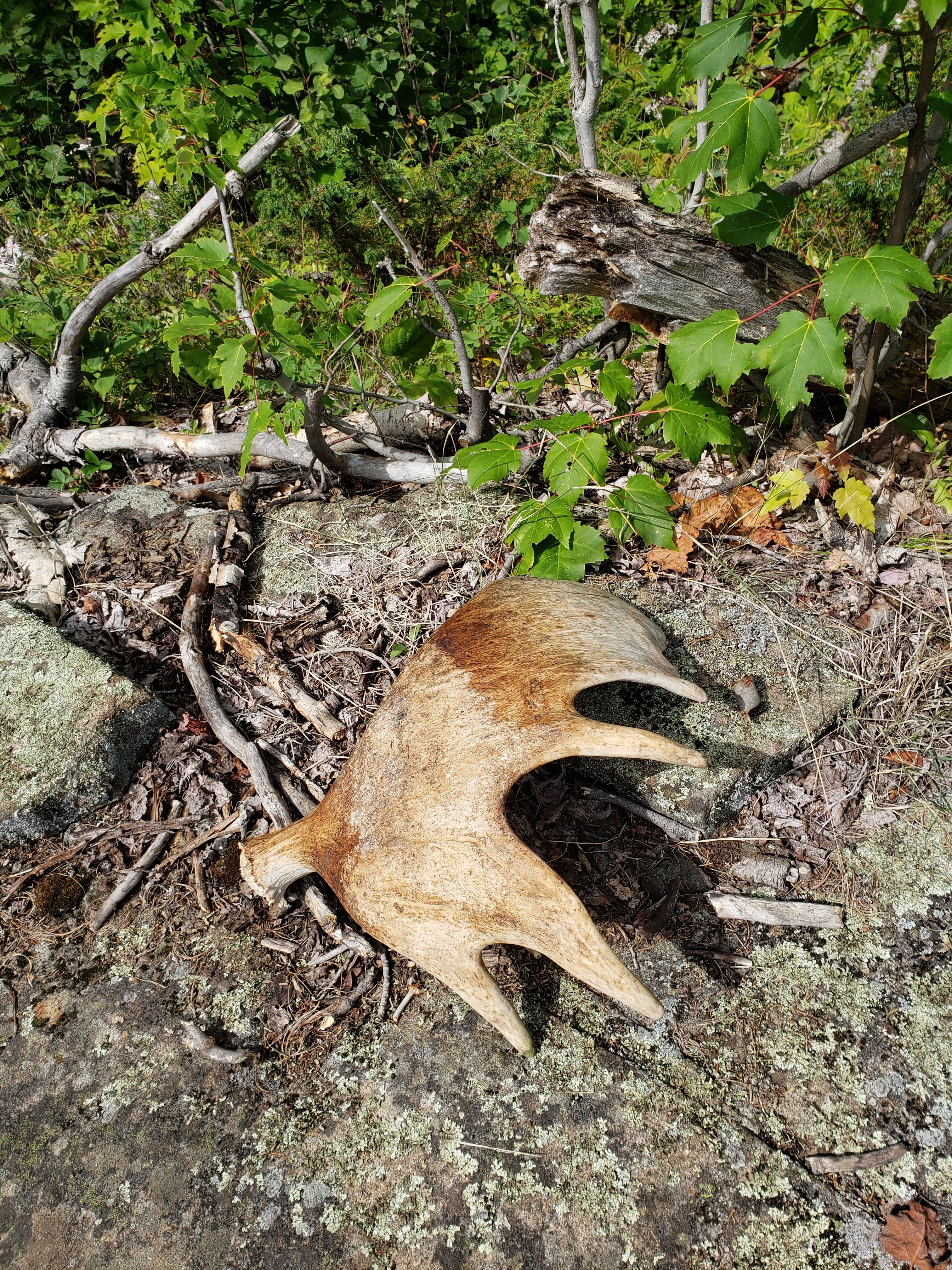
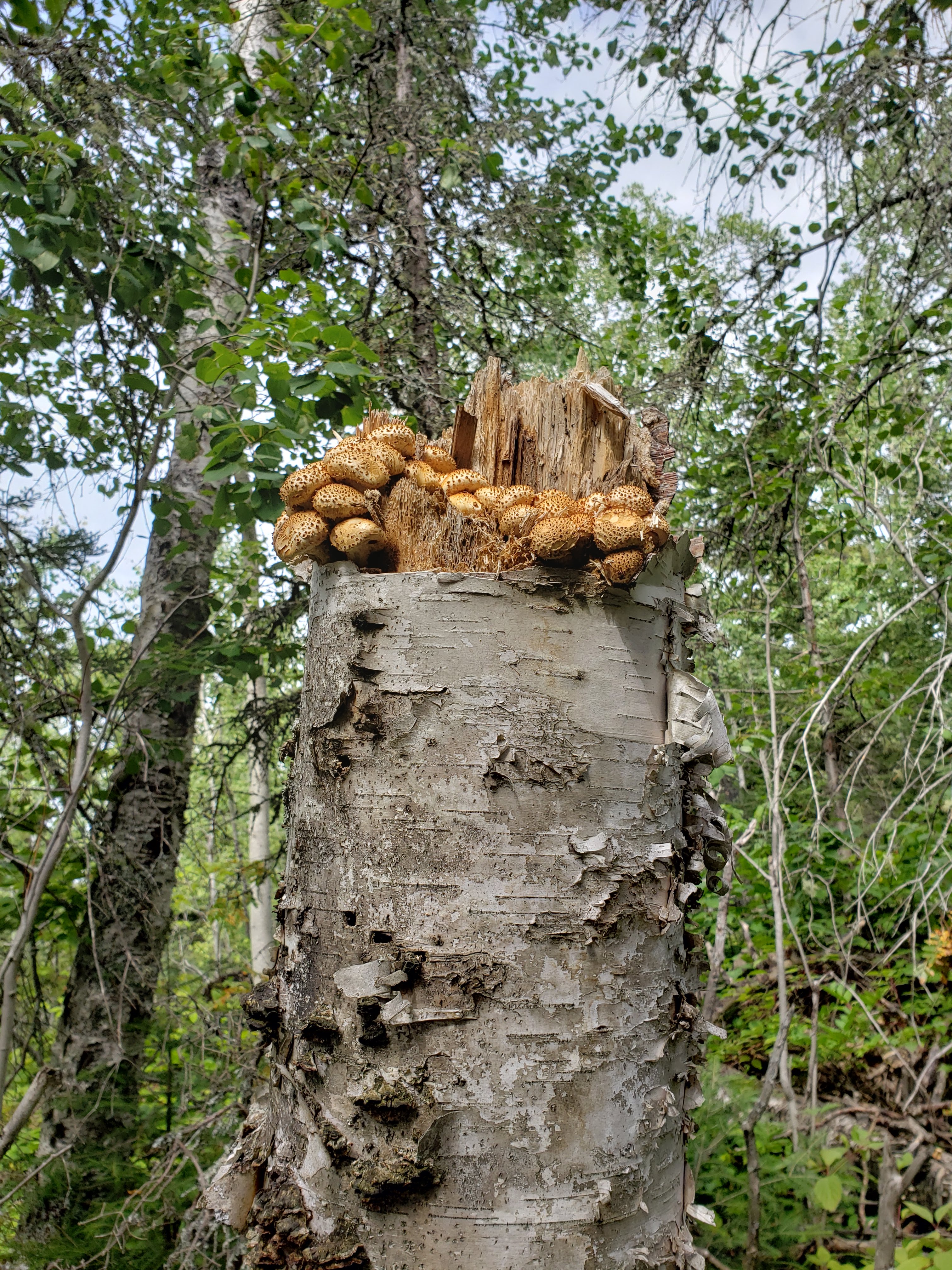
It was another beautiful day and we were preparing to hike our last long day of the trip. Here are a couple photos from the day; the first of moose antlers (they shed them annually) and the other of a cool mushroom formation.
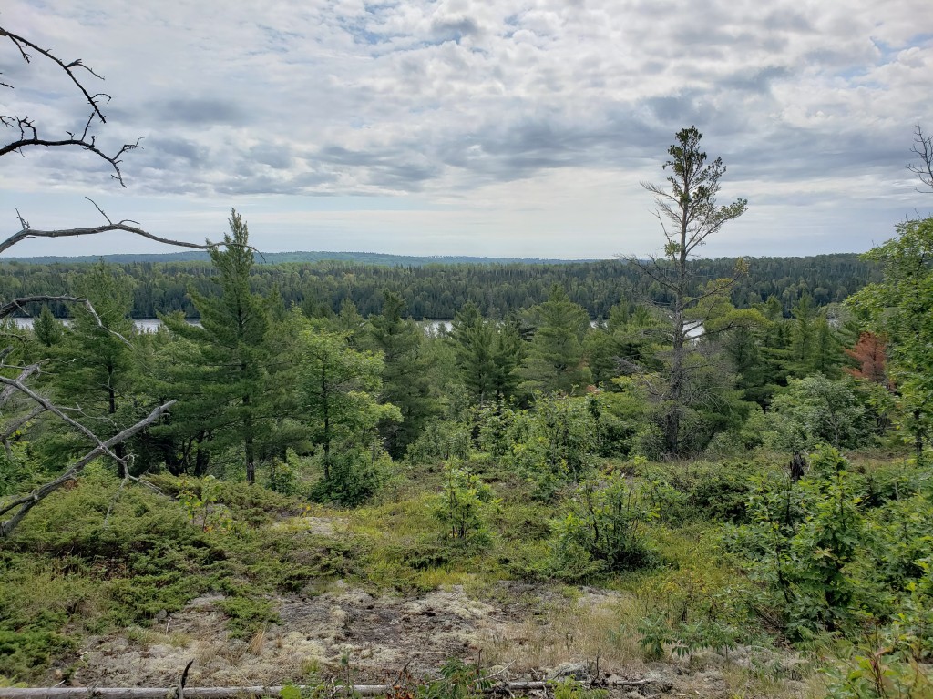
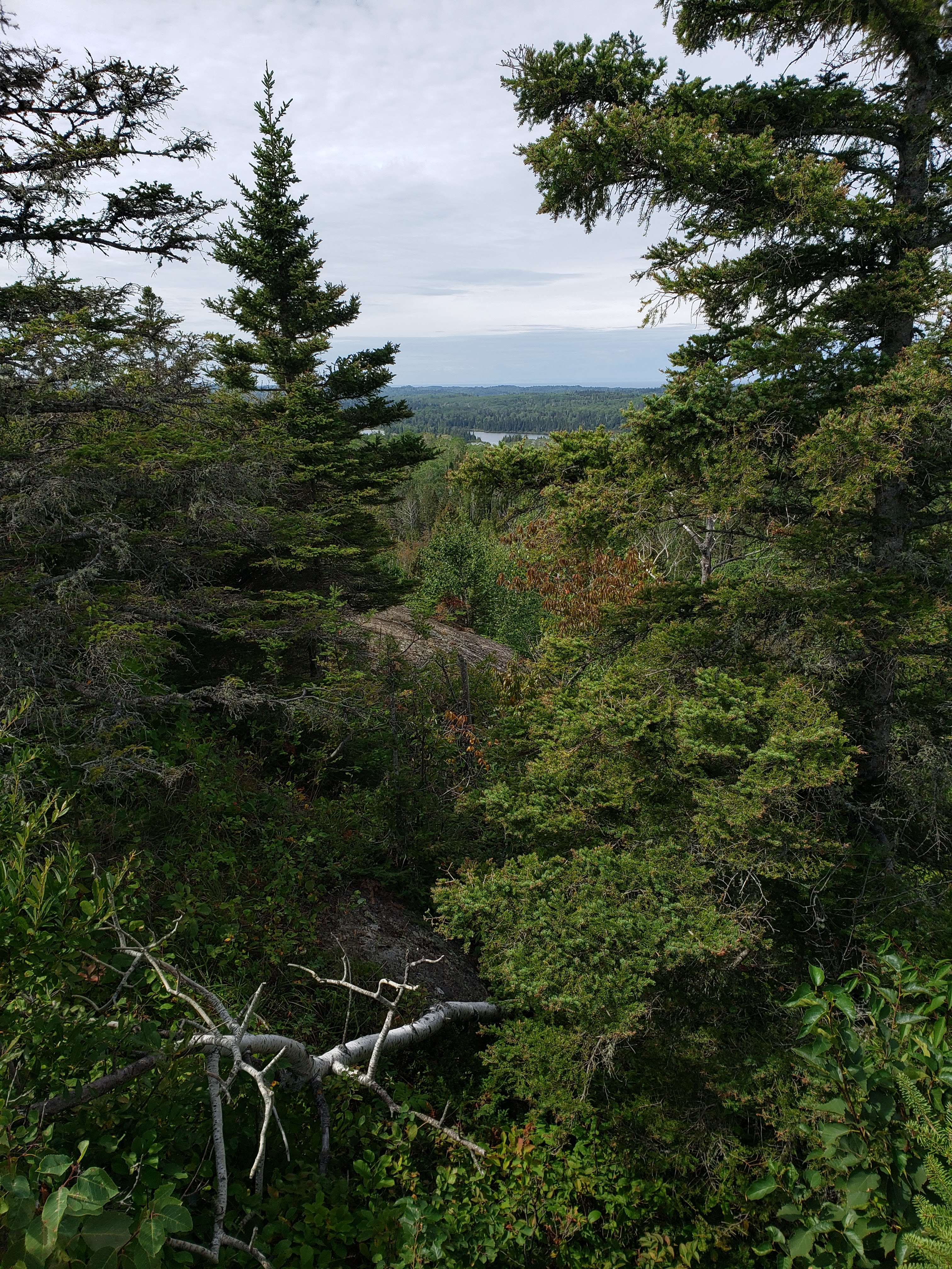
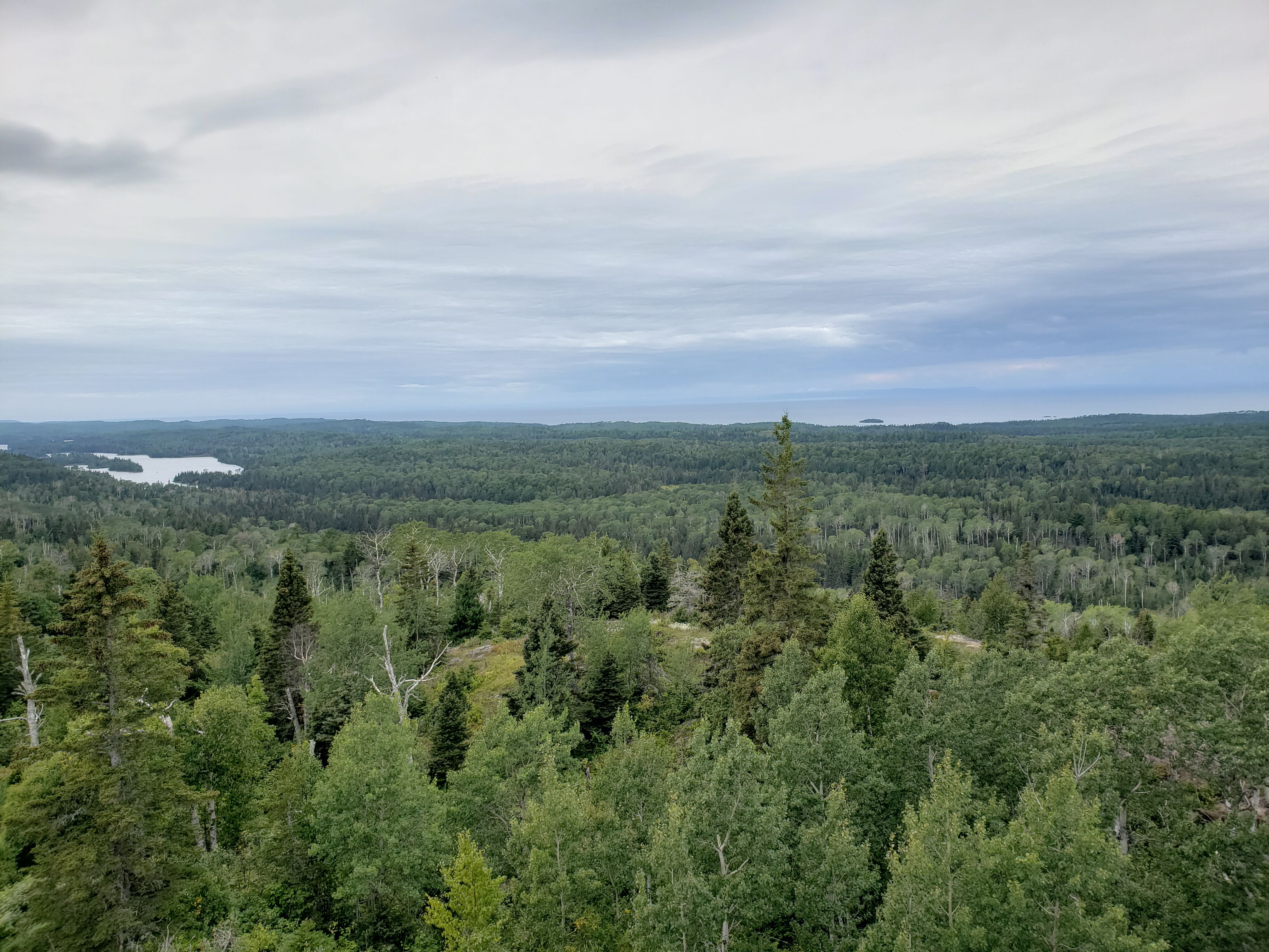
There was a couple that was hiking roughly the same direction and pace as us that we leapfrogged a few times during the day. I couldn’t tell if they were romantically connected, friends, or just strangers who had recently met and decided to go on a hike together. Here are a few of my favorite landscape photos from the day.
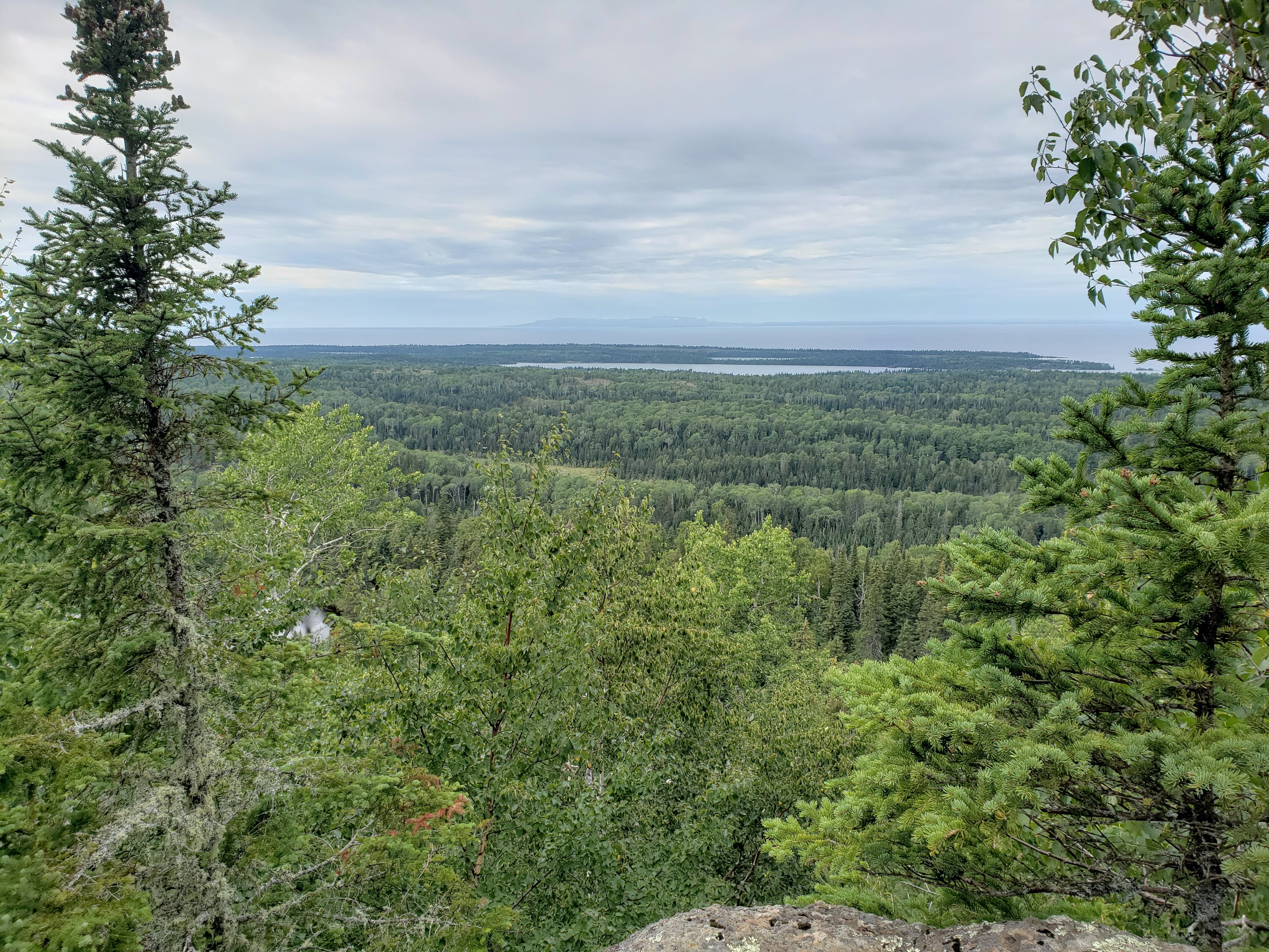
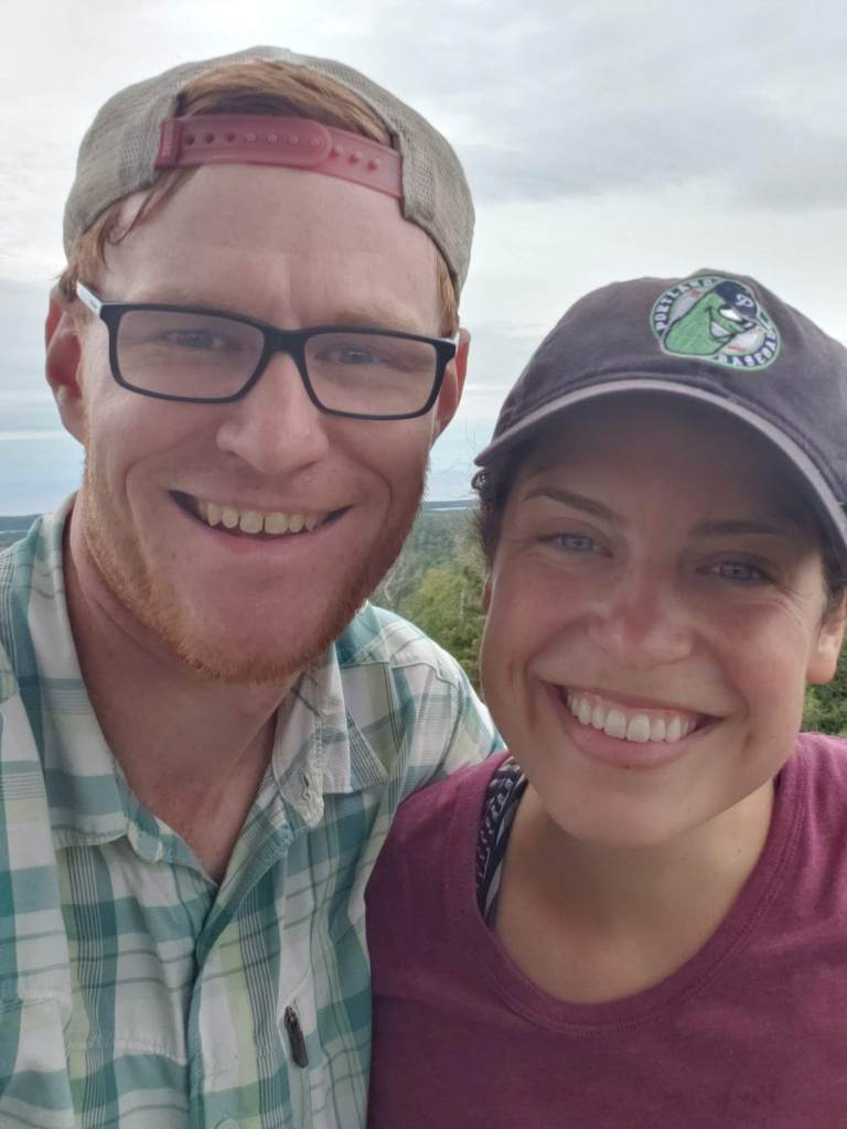
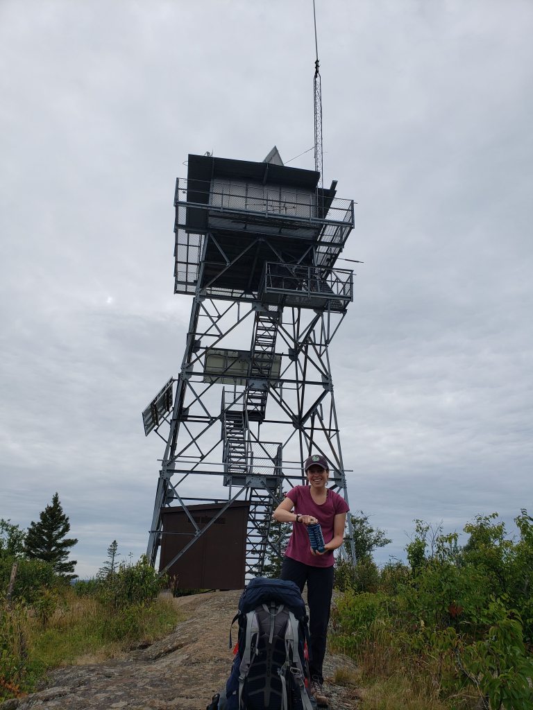
About halfway through the hike we stopped for lunch at Mount Ojibway which also has a lookout tower (but this one you could kind of climb). We took a quick selfie after shedding our heavy packs.
I also saw a familiar face on top of Mount Ojibway. At first I wasn’t sure but then I got a closer look and knew who it was. It was a guy named Victor that was in my study abroad program in China back in 2009. We were friendly during the program, but I didn’t really click with any of the people in the program so I hadn’t spoken to him in about ten years. If you know me, you know that I didn’t say anything and pretended like I didn’t know him. And we can only imagine what he remembered about me. If you’re keeping track, that’s the second person we knew that we randomly ran into while on a big island in a big lake. Victor, if you’re reading this I’m sorry that I didn’t say hello.
Here’s a photo from as high as you could climb on the lookout tower (the platform was covered by a gate and locked, but you could still get pretty high). The views from this spot were great.
Here’s a photo of Leah with the lookout tower in the background for scale.
We had a choice of staying on the ridge or dropping down to the shore of Lake Superior to finish the rest of the hike. We opted to stay on the ridge so that we could continue to get great views. We hiked along until Mount Franklin and then followed the Mount Franklin Trail (go figure) as we dropped down to the shore of Lake Superior and towards our campground.
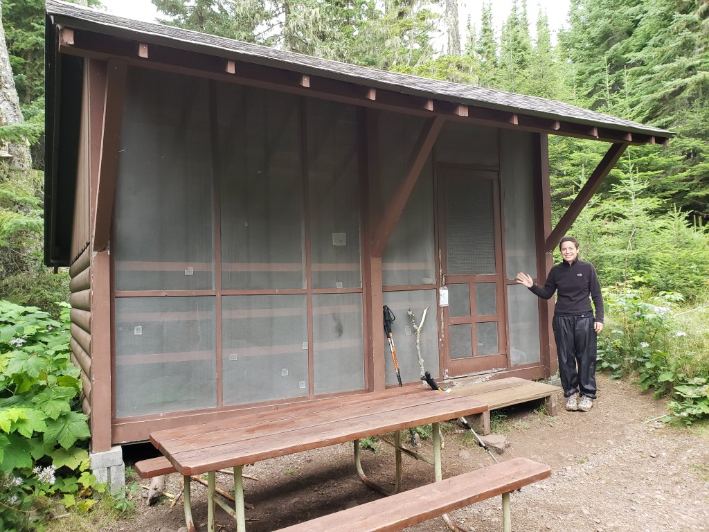
We were headed to a campground called Threemile which I think got its name because it’s three miles from Rock Harbor. There was a chance of rain in the overnight forecast so we were hoping to get a shelter. Some of the campgrounds (pretty much just the ones along the shores of Lake Superior) had four-walled shelters—one of which was screened—that seemed like real plush digs after being on the trail for days. We were leapfrogging a different couple on the hike into the campground and we ended up getting in just before them. We also ended up getting the last of the shelters (and one of the last open campsites in general). Sometimes it pays to be a little competitive. Here’s a photo of the shelter from the outside. Notice Leah’s rain pants—prepping for the chance of rain.
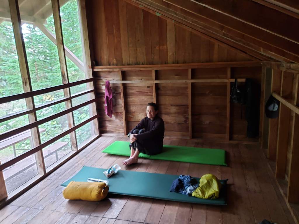
The shelters were quite roomy inside, especially for just the two of us. We were hoping that nobody would show up at our site desperately looking for a place to stay and asking if we would share the shelter with them. Thankfully, nobody did and we had it all to ourselves. Here’s a photo of our setup on the inside. No tent needed. Just sleeping pads and sleeping bags. We also had plenty of room to air out our dirty clothes.
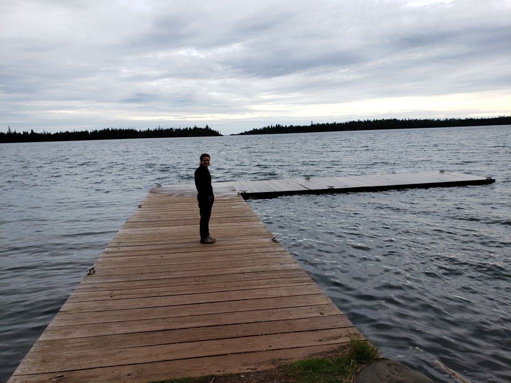
After settling in to the campsite, we strolled down to the dock to relax next to Lake Superior. The water was pretty chilly. We filled the reservoir for our water filter. The water from Lake superior was cold and clear and tasted great. Here’s Leah out on the dock.
We headed back to the shelter and had dinner. It did start to rain so we were glad that we had a roof over our heads. The majority of our hiking was behind us so the next couple of days would be pretty relaxed. I was glad that we were able to get so many more miles in during the first couple of days because it allowed us to take advantage of the nice weather early in the trip. Also, we didn’t have to worry about rushing at the end in order to catch the ferry in Rock Harbor.
Hiking: West Chickenbone Lake campground to Threemile campground – 15.6 miles
Day 4
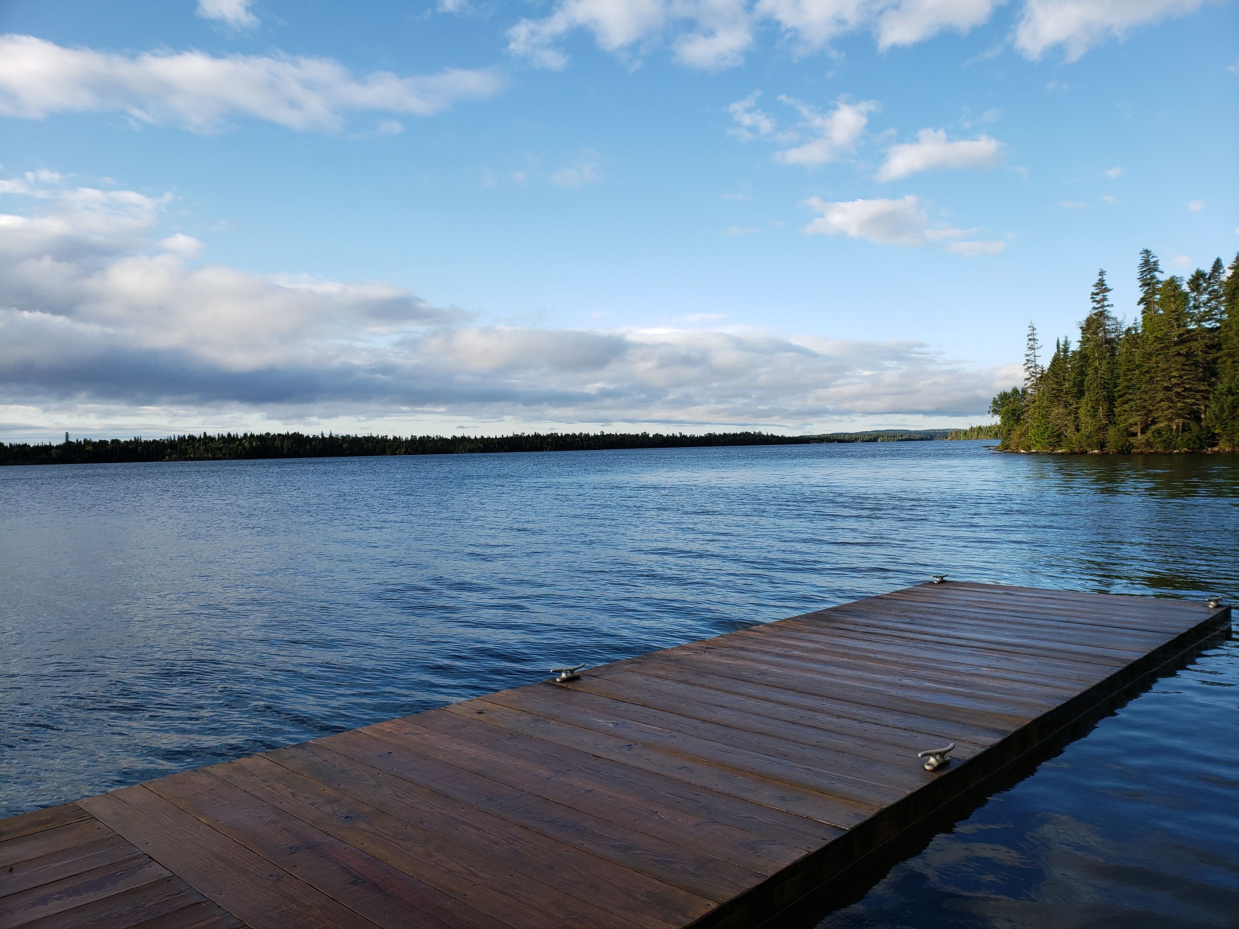
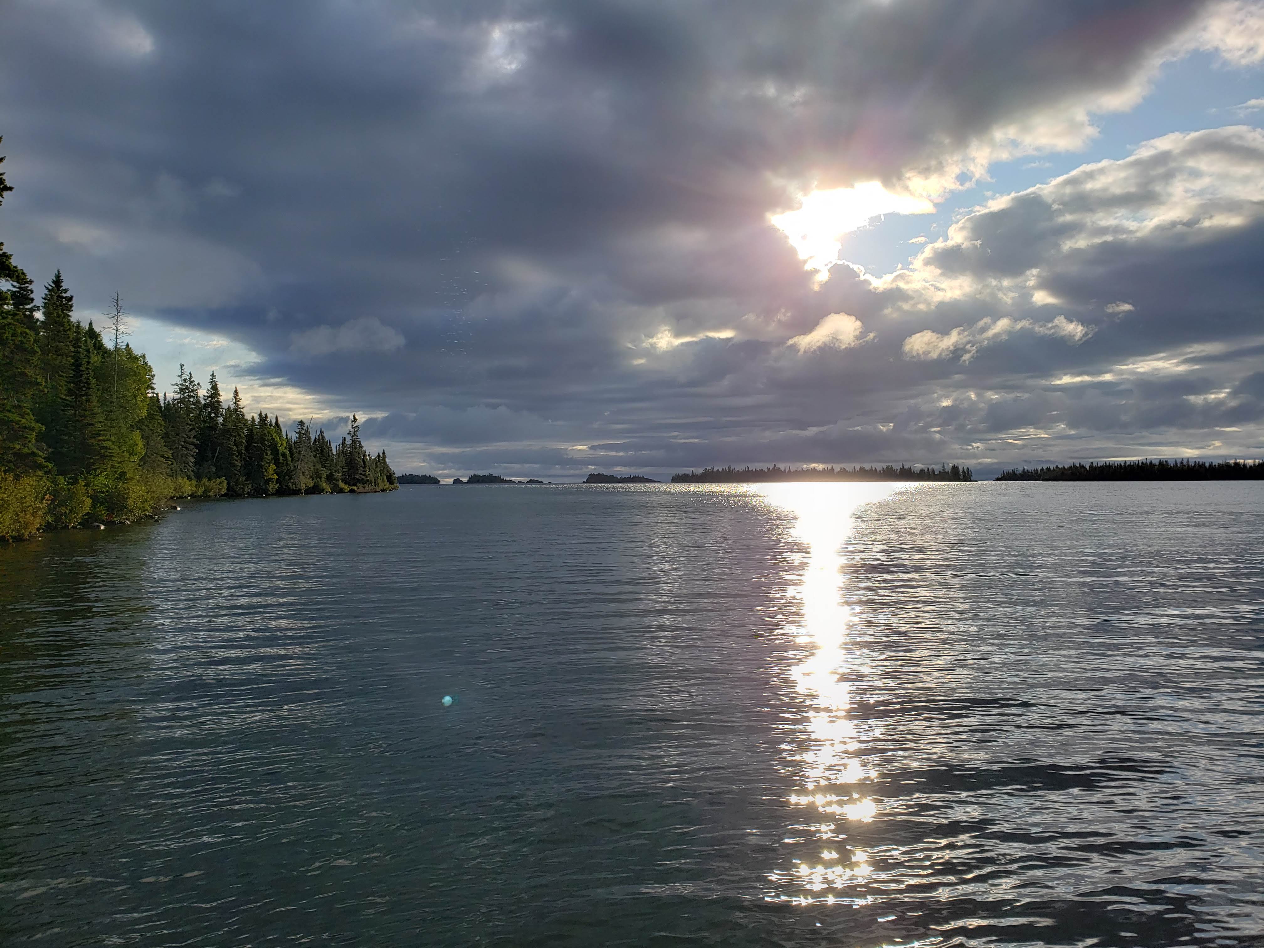
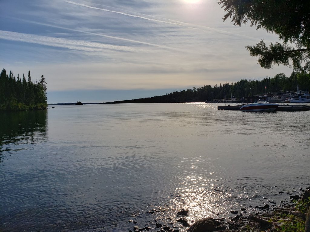
In the morning I walked down to the dock again to get water to filter. The lake looked so calm and beautiful. And the sunshine was reflecting off the lake through a gap in the clouds.
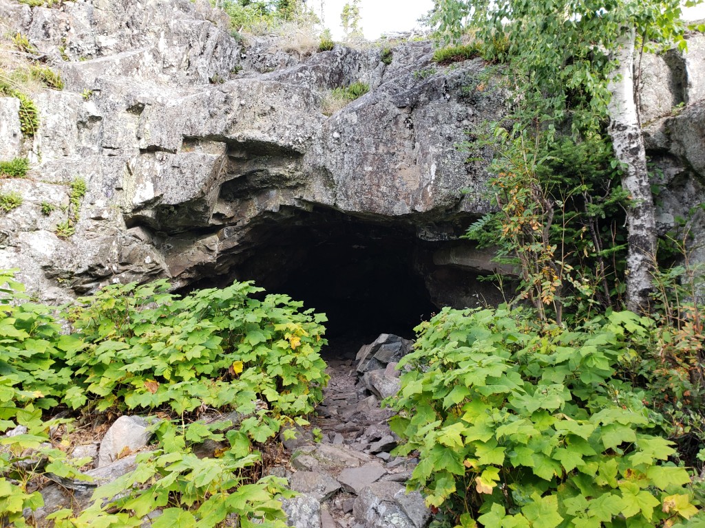
We had breakfast and packed up to leave. We only had three miles to go to get to Rock Harbor which was our next camping destination so it was going to be an easier day. The National Geographic map that I brought along with us (and I would highly recommend a detailed map if you plan to hike or camp on Isle Royale) showed a marker on the map simply labeled “Cave”. We stopped to check it out and sure enough it was a cave.
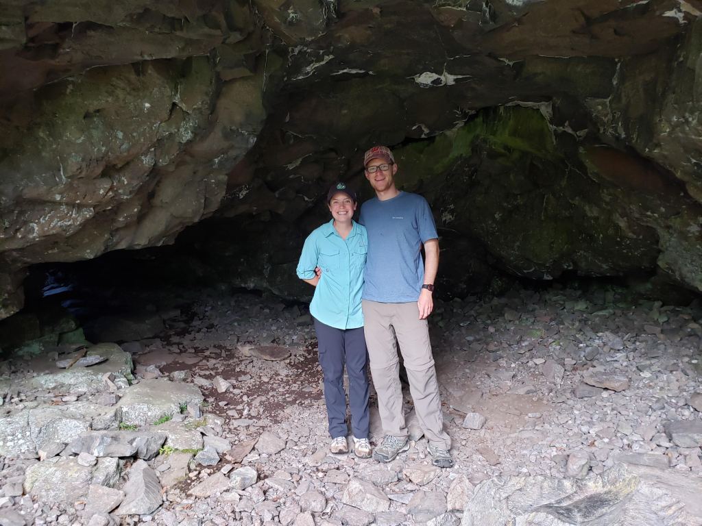
While hiking to the cave we ran into a couple that was staying at the lodge in Rock Harbor. They were older and seemed like they were past their years of roughing it. They also told us that they arrived on the island via seaplane. We saw a few seaplanes take off and land while we were on the island, but they were the only people that we met who had flown in on one. They took this photo of us in the cave.
We got back on the trail and continued hiking towards Rock Harbor. Here’s a cool tree growing on a boulder that we stopped to look at.
We eventually made it to the Rock Harbor campground. It was only about 10 AM but already there were slim pickings for the shelters. We grabbed what appeared to be the last shelter available. There were some that were along the shores of Lake Superior that looked magical, but unfortunately those were occupied. Since there was more rain in the overnight forecast we were glad to have a shelter again. We dropped our gear at the shelter and headed into Rock Harbor. Here’s a photo of the harbor with its rocky beach.
Our first stop was the restaurant. Actually, scratch that. My first stop was the restroom facility to enjoy the first flush toilets and running water that we had seen in days. Then we headed to the restaurant. We were both craving something other than freeze dried and trail mix. There was some confusion about their breakfast vs lunch menu and which part of the restaurant was open for which meal. Eventually we were seated and we both got a burger and beer.

The burger was decently fulfilling, but not the type of euphoric meal that I was expecting. The beer was also underwhelming. It was from Keweenaw Brewing Company in Michigan’s UP. It tasted very carbonated and I don’t know if it was the beer or the method of storage and delivery of the beer. Either way, the beer was a letdown.
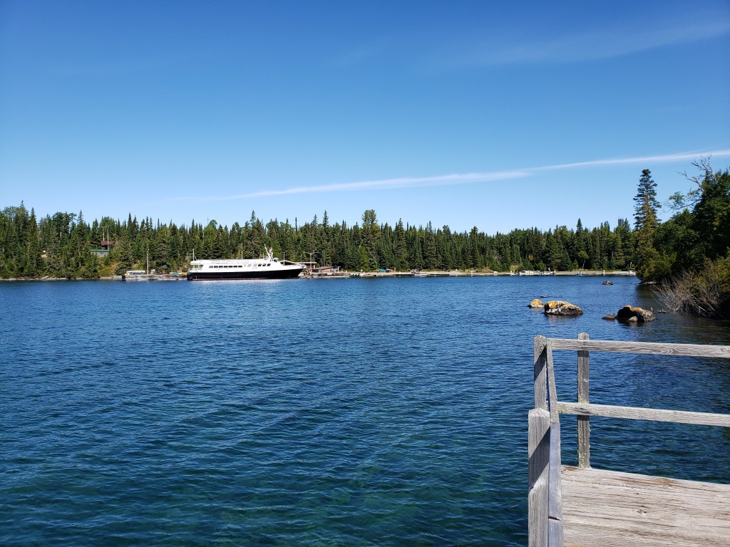
After lunch we did some hiking around the Rock Harbor area since we had an entire afternoon to explore. First we walked out to a dock on the other side of the harbor from the visitor center. You can see the Isle Royale Queen IV docked in the harbor.
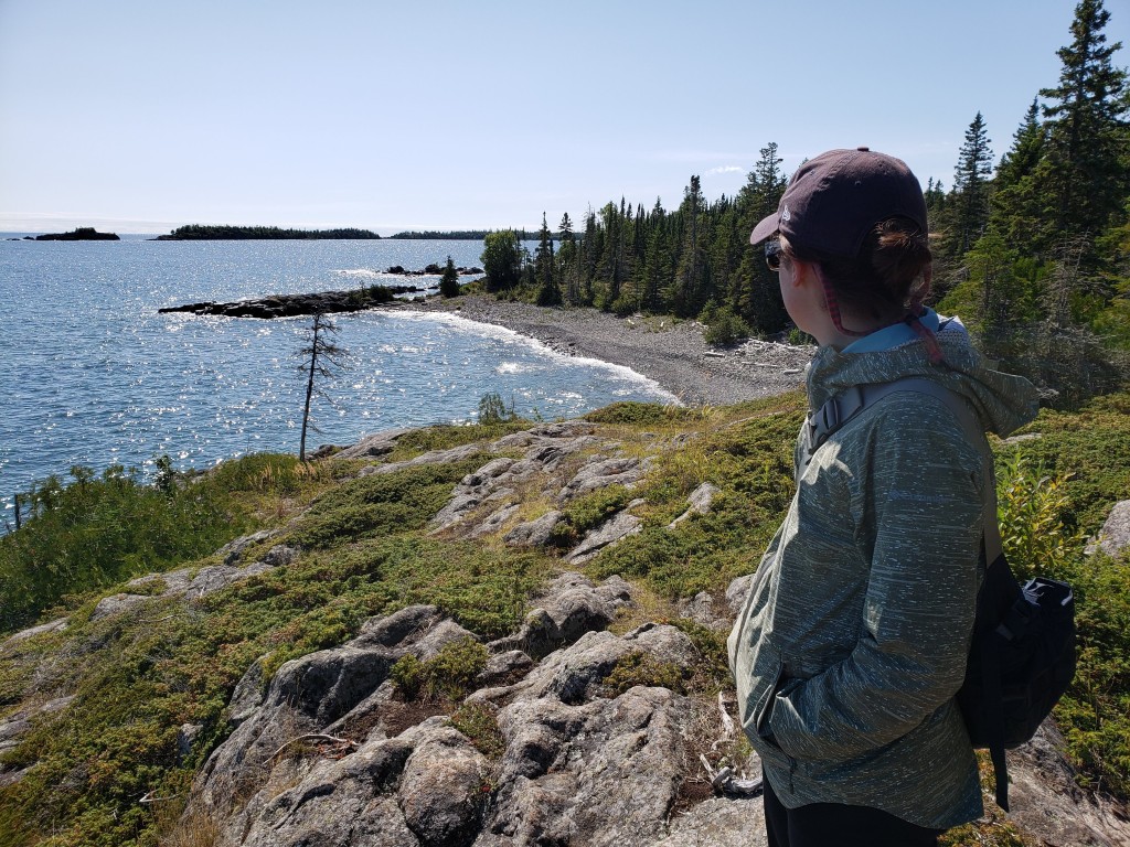
We thought about doing one of the guided boat excursions that left from Rock Harbor. One went out to the Passage Island Lighthouse and sounded cool. We decided instead to go on a short hike. Maybe next time we go to IRNP we’ll go on a boat tour. We headed out on the Stoll Trail to Scoville Point. Here’s a photo of Leah enjoying the beautiful shoreline during the hike.
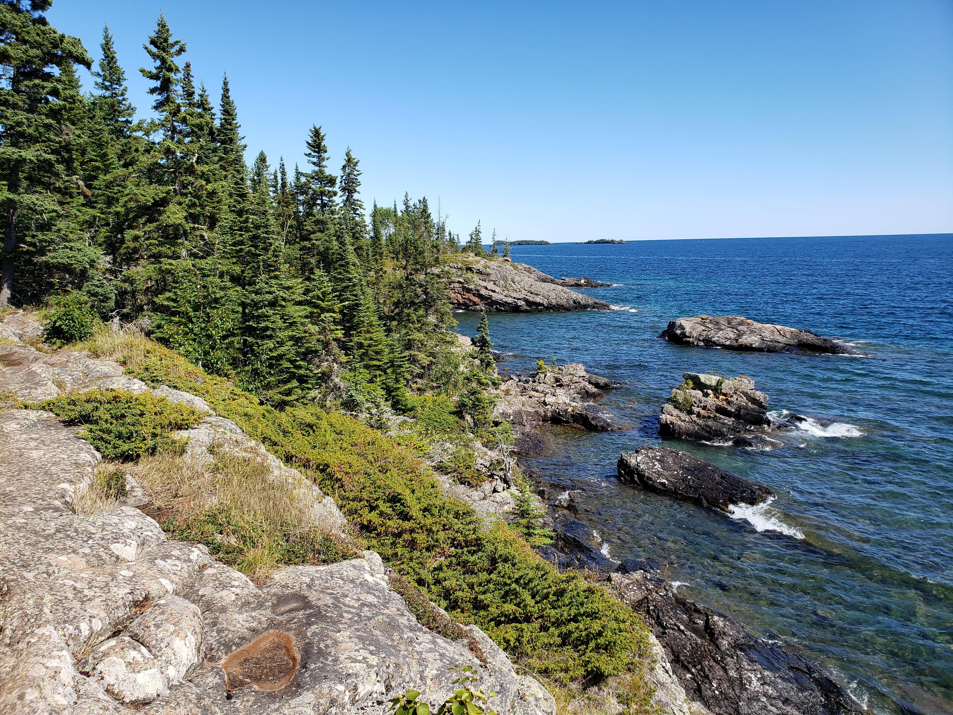
Here are a couple more photos that I took on the hike. The first one is of the rugged shoreline and the second one is a small section of tide pools.
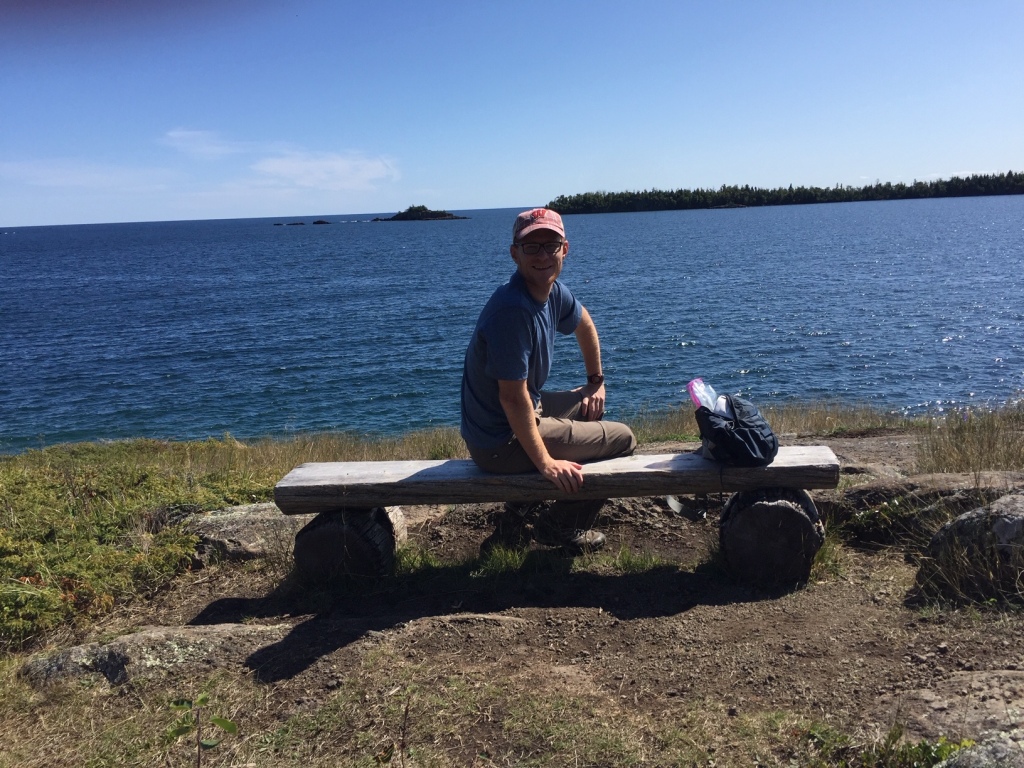
Leah managed to snap a candid shot of me taking a load off on a bench.
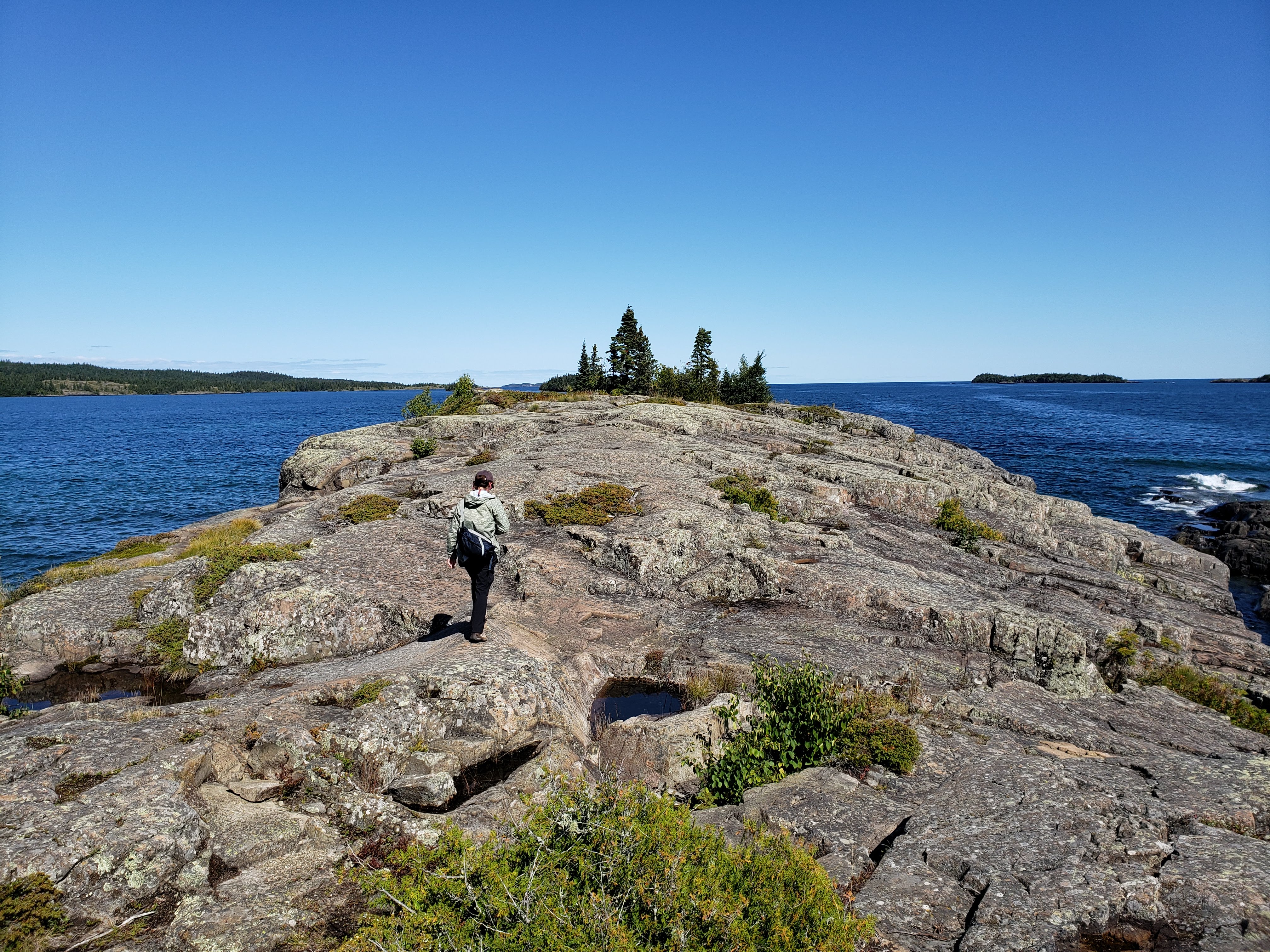
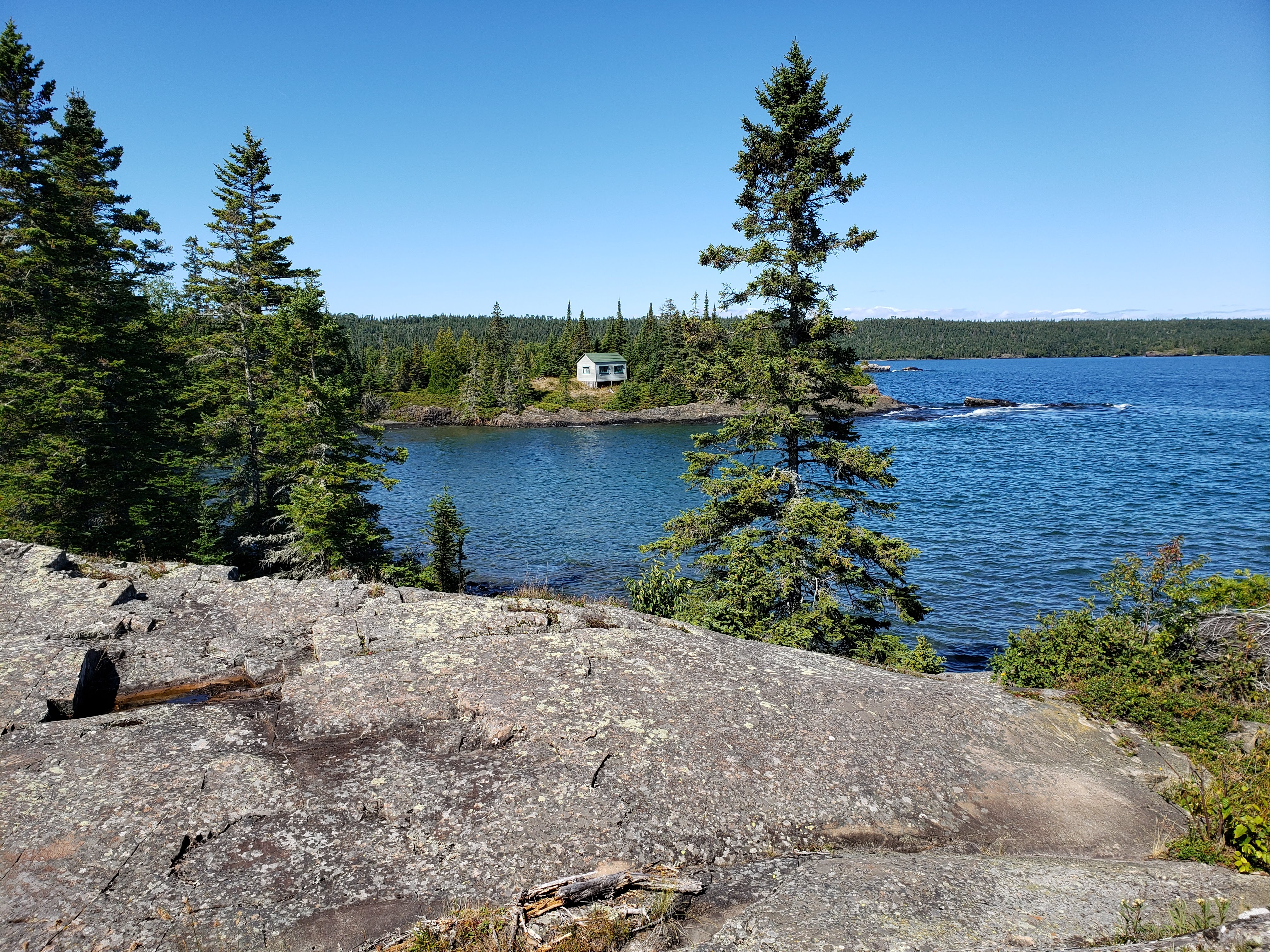
Here are a couple more photos that I took near the end of Scoville Point. The first one is Leah walking out towards the point and the second one is a private building that is on National Park property. We learned a little bit about how some of the people that had property on the island when it was made into a national park were allowed—or rather grandfathered in—to keep their property on a temporary lease with the government. There weren’t many buildings left that were still privately owned at this point.
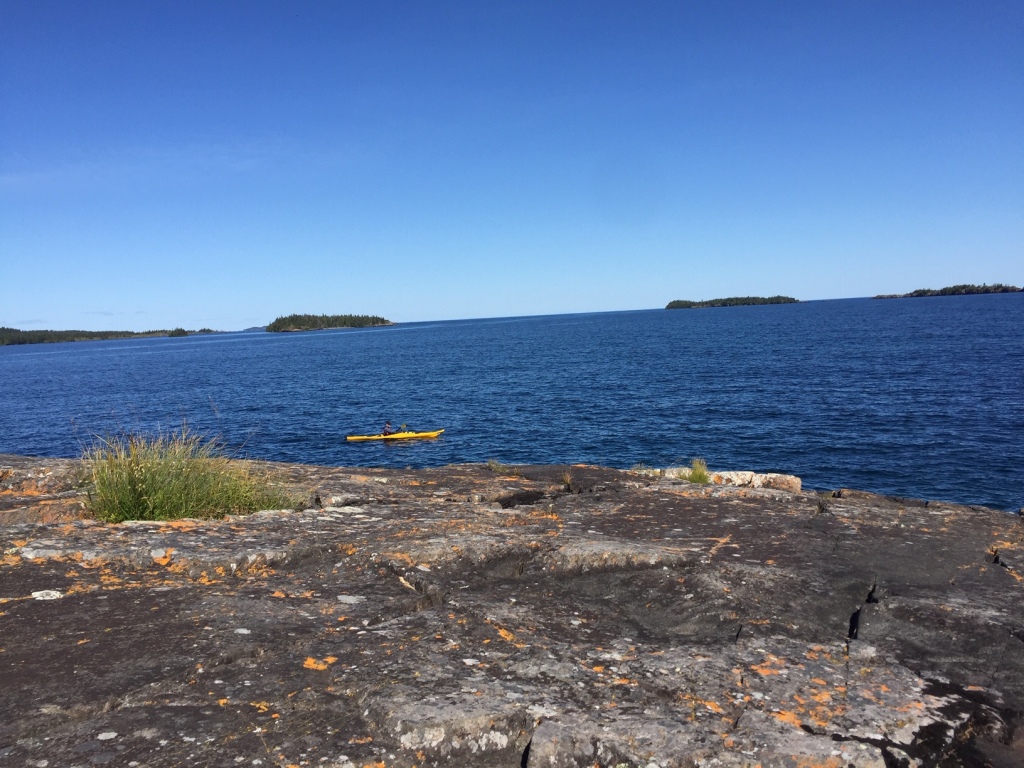
Leah captured a kayaker out in the open water. It seemed like a great day to paddle.
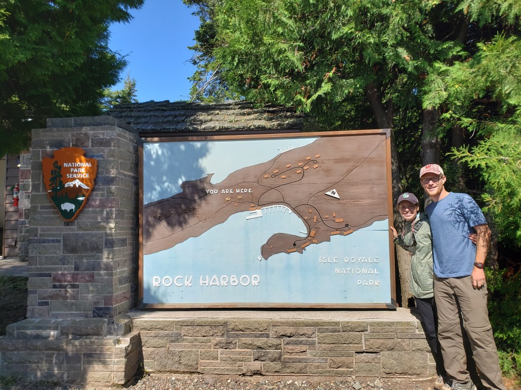
We finished the loop back from Scoville Point. The trail was well maintained and easy to hike on. Tobin Harbor is on the other side of the point and is the location that seaplanes land for service to Rock Harbor. We got to see a few planes take off and land while we were hiking. We finished the hike and headed to the visitor center to take our national park sign photo.
We got some snacks from the general store including beer (better than the stuff on tap at the restaurant), boxed wine, a Doritos knock off, and candy. We ate dinner—which included a freeze dried meal—on a bench next to the harbor.

The harbor was beautiful. And it wasn’t very busy, either. I kind of thought we’d see more people at Rock Harbor.
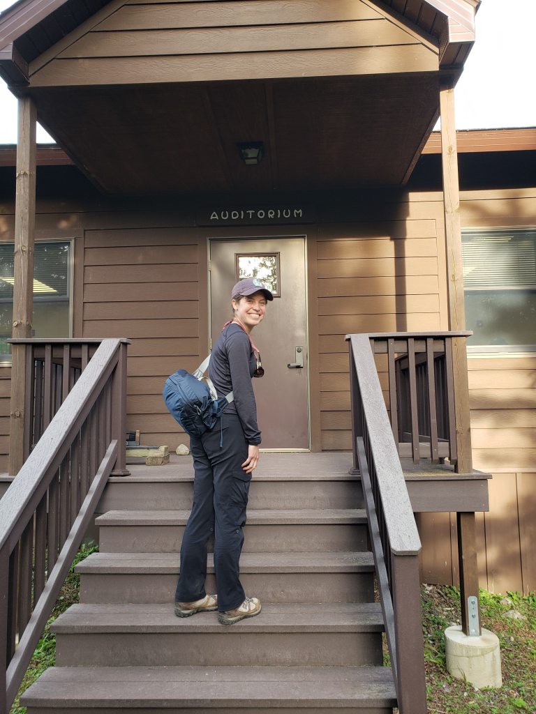
After dinner we headed to the ranger program. Here’s Leah on her way in to the auditorium.
The ranger program was about the history of Isle Royale. Like many stories about U.S. history it began with the original inhabitants of the land being kicked out so that white settlers could mine/log/harvest the resources of the Island. There was a big copper rush in the upper Michigan area decades ago and that was the main resource that was sought after on the island.
The program was very interesting. That is until the ranger really went in on Minnesotans. He pulled out some article from the Star Tribune that was asking why Isle Royale is part of Michigan and not Minnesota (since it’s quite a bit closer to Minnesota than it is to Michigan). He claimed that he would very clearly answer that question, and I feel like he didn’t. There was something about how the geologic formations that made the island were more closely related to the geologic formations that created the upper peninsula of Michigan. And there might have been some story about land rights or disputes or whatever. Either way, I didn’t appreciate how this guy really disparaged Minnesota.
After the ranger program, we headed back to the shelter and fell asleep. We had to make sure we got up early in the morning so that we didn’t miss the ferry going back to Grand Portage. We also got a weather update from the ranger station that there was some stormy weather on the way that was going to be creating some big waves on Lake Superior. We were a little worried that we wouldn’t be able to get back safely, but there was nothing we could do at that point.
Hiking: Threemile campground to Rock Harbor and the hike out to Scoville Point – 8 miles
Day 5
We woke up to a cold and stormy morning. Our ferry ride back to the mainland was waiting for us at the dock. Here’s the Voyageur II.

All of the ferry riders were gathering around the boat. There weren’t many of us. We met a couple that was doing a bike tour from Grand Portage, MN to Copper Harbor, MI. They were using the ferry as a “fun” method of transportation so that they didn’t have to do an out-and-back loop. We asked a park ranger what the chances were that the ferry would make it back to Grand Portage that day. The ranger told us that the Voyageur II had been in the same family for years and that if anyone knew how to navigate these waters safely it was them. We also got word that another ferry, the Ranger III, had already canceled its service to and from the island. And the seaplanes were temporarily grounded (watered?)
We loaded the boat and left at the regularly scheduled time which was 8 AM. At first the ride wasn’t so bad. This was mostly due to us still being in the protected waters of Rock Harbor. There was a string of barrier islands that sheltered the shore (and the ferry) for the first part of the trip. We made our first stop at Daisy Farm and picked up a few passengers. Next we headed out into open water. The waves immediately started to pick up. One of the passengers that we picked up at Daisy Farm headed straight to the back of the ferry to vomit into the cold waters of Lake Superior. The waves were big. The deckhand said that the waves were probably 12 to 15 feet high.
After about fifteen minutes of trying to navigate the rolling waves—and without saying anything—the captain whipped the boat around. We knew we were headed back. We were about an hour into a six hour journey, and it was all for nothing. I can’t say that I was that disappointed. I was really feeling sick and there was no sign of conditions improving. I felt like if we had kept going either the boat was going to sink or I was going to puke. Or both.
The captain dropped us back off at Rock Harbor and told us to meet him back there at 2 PM and maybe they’d give it another go once the waves had calmed down. We didn’t know what to do. Should we go get a campsite again? Should we eat? We ended up heading to the restaurant and getting breakfast. It seemed like all of the other ferry passengers were doing the same thing.
We then needed a way to contact the mainland to let them know that we were okay but that we wouldn’t be back when we had planned. The lodge wouldn’t give out their WiFi password and Leah was not pleased. An older couple that we had befriended (and that were staying at the lodge) gave us the password and we emailed our family and coworkers to let them know that we’d be delayed. Here’s Leah posing cheerfully in the crappy weather.
We hung out (with pretty much all of the other ferry passengers) in the lodge guest lobby which was open to the public. There was a small fire going in the fireplace and everyone was damp and unhappy. At 2 PM we all headed back to the ferry and loaded everything back on again. We left for attempt #2. Again the first part was easy. Once we hit open water, the boat was rocking again. This time the waves weren’t as bad but it was by no means a pleasant ride.
The ferry continued on and made a couple more stops where we picked more people up (who knows what they were thinking this entire time). I managed the wavy ride by simply putting my head between my legs and closing my eyes. The key word is managed. Neither Leah nor I puked during the ride. The same woman that was puking before was puking again. What was even left for her to puke?
The deckhand was a rugged looking man who looked like he’d seen some shit in his life. He was bearded and scraggly, and kept bounding around the boat giving people advice about seasickness and telling stories. He seemed to really be enjoying the wavy ride.
The ferry made its last stop on the island at Windigo where we picked up a large number of people. The ferry, which before was mostly empty, was now full. And one of those new people was our friend Kate. We knew that she was going to be on Isle Royale at the same time as us but we didn’t know that she’d be on our ferry or if we’d even see her. If you’re keeping track that’s the third person we saw on the island that we knew. We took advantage of being stopped and not slowly rocking from side to side as an opportunity to eat some food and drink water. We were pretty hungry and dehydrated.
The ride from Windigo to Grand Portage was pretty calm. There was a slight rock to the boat but nothing too bad. We even had a few more snacks. By the time we got back to Grand Portage it was almost 10 PM. We looked for places to stay in Grand Marais but since it was so late we decided to just head back to the Grand Portage Casino for another night. We were both exhausted, hungry, and a little sick so any amount of time in a car seemed miserable.
When we checked in to the hotel, the desk attendant made some joke about all of their rooms being full. Not very funny. They also commented about how we had just stayed there. Yes, we love casinos. They also had the same promotion going on, a five dollar casino voucher for each adult staying in the hotel. We declined again. Instead, we unloaded our crap in the hotel room, ordered pizza and cheese curds from the hot food station in the casino, and got drinks from the bar to take back to the room (I got a PBR tallboy and Leah got a large wine pour in a plastic cup). We showered for the first time in days and devoured the hot, greasy food.
Day 6
We got up and packed the car for the drive home. We stopped in Grand Marais for breakfast. Then we stopped for wild rice burgers and beer at Fitger’s in Duluth (a tradition of ours). We arrived home later than planned and had to take an extra day of vacation. But overall it was an amazing trip and I’d definitely go back to Isle Royale National Park again.

Thank you, Brian and Leah for sharing your adventure. You are both optimistic and rugged people! Being from the U.P. I was very interested in reading your blog. Hopefully , you are now dry and back into a less nomadic life! MaryAlice and Bill Farrell—Ilion, N.Y. Bob’s aunt and uncle
LikeLike
Hi MaryAlice and Bill! Thank you so much for reading and I hope you enjoyed the post. Yes, Leah and I are back in Minneapolis where we live, thinking about new adventures. It’s so nice to hear from you, I hope you’re both doing well. I never really know who reads these things so it’s great to hear from you!
– Brian
LikeLike
I don’t know what the logistical fuss is all about, you’re on island time baby!
LikeLiked by 1 person