Leah and I decided to go on a bigger Labor Day trip this time around. It was the fall of 2020 and many of our travel plans seemed up in the air due to the global pandemic. Neither of us had ever spent any time in Utah and “The Big 5” (Arches, Canyonlands, Zion, Bryce Canyon, and Capitol Reef) were on our bucket list. We lucked into a lull in COVID-19 cases which, along with the relative safety of camping and hiking, made the trip seem reasonable. I’ve split the trip into three blog posts. Part 1 covers the first six days which included driving out to Utah, Arches National Park, Canyonlands National Park, and Natural Bridges National Monument. Part 2 covers the next 5 days which included Monument Valley, Zion National Park, and Cedar Breaks National Monument. Part 3 covers the next six days which included Bryce Canyon National Park, Capitol Reef National Park, and the drive back to Minnesota.
Planning
I spent a lot of time researching this trip. Having never been out to Utah before, I was excited to see so much of it. I was really hopeful that we’d have enough time to see and enjoy all five of the National Parks in Utah while we were out there. They’re all relatively close to each other and the idea of going to just a few seemed like a missed opportunity. Leah and I had gone back and forth on how much time we should spend out there. I was pushing for a full two week vacation considering the fact that we were planning to drive to Utah which would take about four days—two out and two coming back—on its own.
We decided to take two weeks off work—leaving on a Friday afternoon and returning on a Sunday two weeks later. We also chose to go in early September which aligned with our Labor Day vacation tradition but also seemed like it would provide decent weather throughout the different desert climates. I then began looking into park details and potential driving routes. All of the parks had reopened since shutting down earlier in the year due to COVID-19, but certain things remained closed. A few notables were the final chain section of Angels Landing and the Narrows at Zion National Park (though the Narrows was closed due to a toxic bacteria in the water) and the Fiery Furnace at Arches National Park.
It was hard to tell how busy the parks would be. With outdoor activities being some of the safer things to do during the pandemic, parks across the country had seen increased use. I had a very difficult time booking campsites for the trip. We both enjoy camping in National Parks but so does everyone else. Also, trying to book things just a few weeks before arriving is not recommended. Many people book campgrounds at the Utah National Parks (especially Arches and Zion) a year in advance. My strategy was to constantly check the reservation site for cancellations. When I say constantly, I mean that I was checking about once an hour for days in a row.
I started off booking certain nights as placeholders while also looking into alternative campgrounds like on BLM (Bureau of Land Management) land or private campgrounds. At a few parks I was unable to initially get the same site for consecutive nights so we would have to coordinate a move in the morning. Luckily, after lots of searching and lots of reservations made (and some non-refundable deposits lost), the itinerary for the trip was completed. We would spend the first two nights on the road in hotels out of convenience—the same for the last night on the way home. For the rest of the nights (other than one night where we were booked at a KOA because the campground at Natural Bridges National Monument was closed) we would be camping at either a National Park or National Monument. I was really proud of myself for having all of the dates and plans line up as well as they did. It took a lot of patience, persistence, and luck to book the campgrounds and plan out how much time to spend at each place.
I purchased the annual park pass ahead of time for $80. It got us access to over 2,000 recreation sites—7 of which we were planning to visit on this trip. The individual entrance fees for each of the parks we were planning to visit ranged from $20-$35. The annual pass made sense financially and it also meant that we didn’t have to stop and purchase a new pass at every park we visited. Another positive was that we would get access to National Parks for a year from the purchase date. This meant that any National Park trips in the coming year (which there probably will be at least one) would also be covered.
We would leave on a Friday and drive to Lincoln, Nebraska that night. Then we’d drive to Moab, Utah the next day. Then two nights at Arches National Park, one night in the Needles district of Canyonlands National Park, and then a night a at KOA in Monument Valley after stopping at Natural Bridges National Monument. The next day we’d drive to Zion and spend three nights there, then two nights at Cedar Breaks National Monument, two nights at Bryce Canyon National Park, and two nights at Capitol Reef National Park before driving home and stopping for one night in an undetermined city (probably in Nebraska).
Day 1 – Driving
We took off a little early after work on a Friday which also happened to be Leah’s birthday. The car was packed full of all of our camping and hiking gear as well as clothes for two weeks and most of the food we’d be eating. It was also our first real trip with a new Yeti cooler—to the hot desert no less—so it would definitely be tested. The drive was mostly uneventful. We stopped at a Culver’s just outside Des Moines for dinner. Leah was craving Culver’s (she gets the grilled cheese kids meal) and it sounded good to me, too. I also had coupons to Culver’s which I obviously forgot at home. There appeared to be a lot of old people enjoying a Friday night custard treat—masks optional.
The rest of the drive that night was straight west on I-80. It was also dark. There were some ominous flashing reds lights on the side of the freeway which we determined to be coming from wind turbines. We tried to avoid driving too much at night but in order to make it to Moab in less than two days it was necessary. Finally we arrived at our hotel just off the interstate in Lincoln, Nebraska. You could see the capitol building from the freeway—a destination for another trip. It took around six hours of driving to get to Lincoln and I did all of the driving that day. When we walked into the hotel there was a sign out front that said “mask required” but the employee working there wasn’t wearing one. This would end up being a theme throughout the trip. The hotel room was fine other than the freeway noise. We settled in for bed with an even longer day of driving ahead of us and not really knowing what the breakfast situation would be.
Day 2 – Some more driving
We woke up and headed down to grab our “to-go” breakfast. It was basically all individually wrapped items from a standard free hotel breakfast. The waffle maker was still on which didn’t seem to lend itself to COVID safety, nor was is very “to-go” friendly. There was also some sign about waiting for the hotel staff to serve you your food. With no staff in sight we thought it best to just grab some food items and go. We ate in the car.
Nebraska is long and flat. I was again doing the driving on this leg. Not much to see as far as scenery. Every once in a while there would be a huge cattle farm or some agricultural smell. We drove without stopping until we got to Sterling, Colorado. At this point we had veered onto I-76 towards Denver. We saw a lot of signs warning of limited services on this stretch of freeway and Sterling was one of the only “big” cities (population ~15,000) for a while. The scenery was getting hilly but it was also incredibly dry and hot. The temperature was about 100 degrees Fahrenheit. On a side note, the extended forecast for that area called for over a foot of snow the following night. Some crazy weather when you get closer to the mountains.
We briefly looked for a Quiznos to stop at for lunch in Colorado. This stemmed from a conversation about how the last time I can remember having Quiznos was at the Denver airport. I figured Colorado must be the last stronghold of Quiznos restaurants since it doesn’t seem like I see them very often anymore. Unfortunately, the nearest Quiznos was a little too far away for a reasonable lunch time and we needed to stop for gas anyways so in Sterling we stopped at a Jimmy John’s. Mask usage was again questionable. We called it the “wild west”. While eating our sandwiches at a table outside the restaurant we saw a car back into a parking spot, two people exit the car and enter Jimmy John’s for less than five minutes, and return without any food items. Leah said they were there to get the free smells.
After lunch Leah took over driving duties. Once we got to Denver we hit a bunch of traffic heading into the mountains. It was a Saturday afternoon so we thought we’d miss the weekend mountain rush but apparently not. At this point we had merged onto I-70. Once we had cleared most of the traffic we stopped again for gas and made another driver switch. Leah isn’t a big fan of driving through mountain passes at freeway speeds. The mountains were beautiful and still luscious and green. Somewhere along the way we started listening to a book on tape—Wild by Cheryl Strayed.
Our next stop was in Parachute, CO for another gas break and dinner. Right before getting to the Parachute exit the low oil light turned on in the car. I was a little worried. Leah said that it had happened before and that we just needed to add some more oil to the engine. Luckily for us there was a full service gas station in Parachute. And by that I mean they sold engine oil and there was a Domino’s inside as well. We ordered some engine oil, pizza, and a salad and I poured the oil into the engine—I only spilled a little bit onto the engine block. We then enjoyed our dinner while sitting on a bench next to the car. It was a very eventful break in the drive that put some fear of car troubles into me. I chalked it up to the Volvo not being as experienced with mountains and thus burning through some extra oil. We also only used about half of the bottle of oil in order to get the dipstick back to the proper oil level reading, so if it happened again we’d be ready.
The drive from Parachute to Grand Junction was very pretty—winding canyon roads and river views all around. Due to the prolonged dinner stop and the traffic, we hit nighttime right before the Utah border. I had hoped that we’d make it to Moab in daylight, but at least we weren’t too far away. The Utah border crossing at night was very uneventful. We got into Moab and I was blown away at how built up it was. The town—on a holiday weekend Saturday night—was busy. Pandemic be damned. The main road through the downtown area was crawling with people and the hotels, bars, and restaurants appeared to be packed. I didn’t know what to expect since I had never been to Moab before, but it seemed like a real madhouse.
We checked into our hotel which we had booked in order to avoid having to set up camp late at night after a long day of driving and to hopefully help us get an early start the next morning. The hotel provided free truffles—a real treat if you ask me. We both took our last shower for what would be a few days at least. I was reading some info on the Arches National Park website that mentioned that the park entrance was closed to vehicle traffic at 9:20 AM that day (the Saturday of our arrival into town). This was due in part to the popularity and high visitation numbers for Arches National Park—over 1.5 million people a year. But also the pandemic was forcing the National Park system to monitor their crowds more than they had in the past. We planned to get to the park around 7 AM so that we’d be able to go to the visitor center right away when it opened and hopefully beat the crowds. That meant a 6 AM wake up the next morning.
Day 3 – Arches National Park
We got up at 6 AM so we could be in line for breakfast when it started at 6:30 AM. As we lined up for breakfast it was obvious that we weren’t the only ones that had the idea of getting up early to beat the crowds. We ordered our “to-go” breakfast à la carte with no indication of a menu. The hotel staff stuffed it all into a brown paper bag and handed it to you. Not ideal but still better than the last place. We went back to our room to eat and get ready.
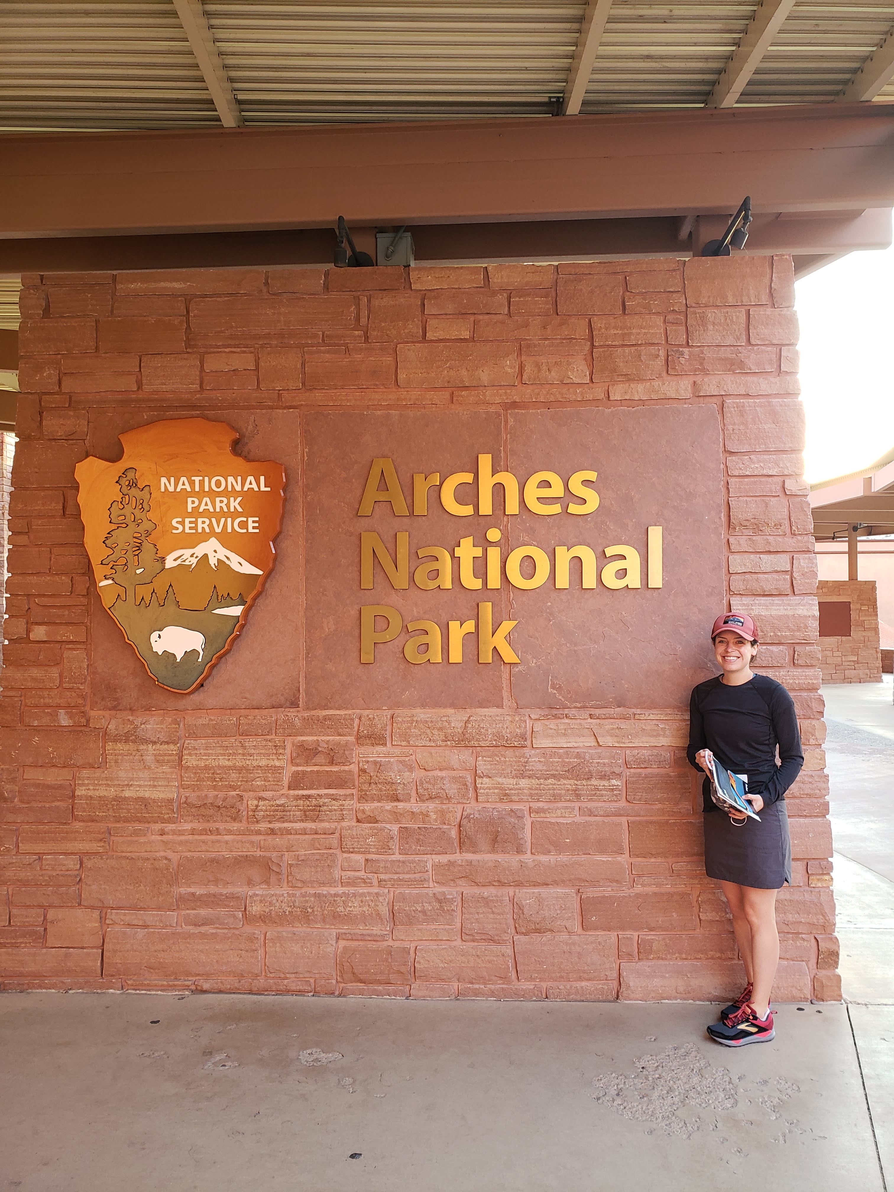
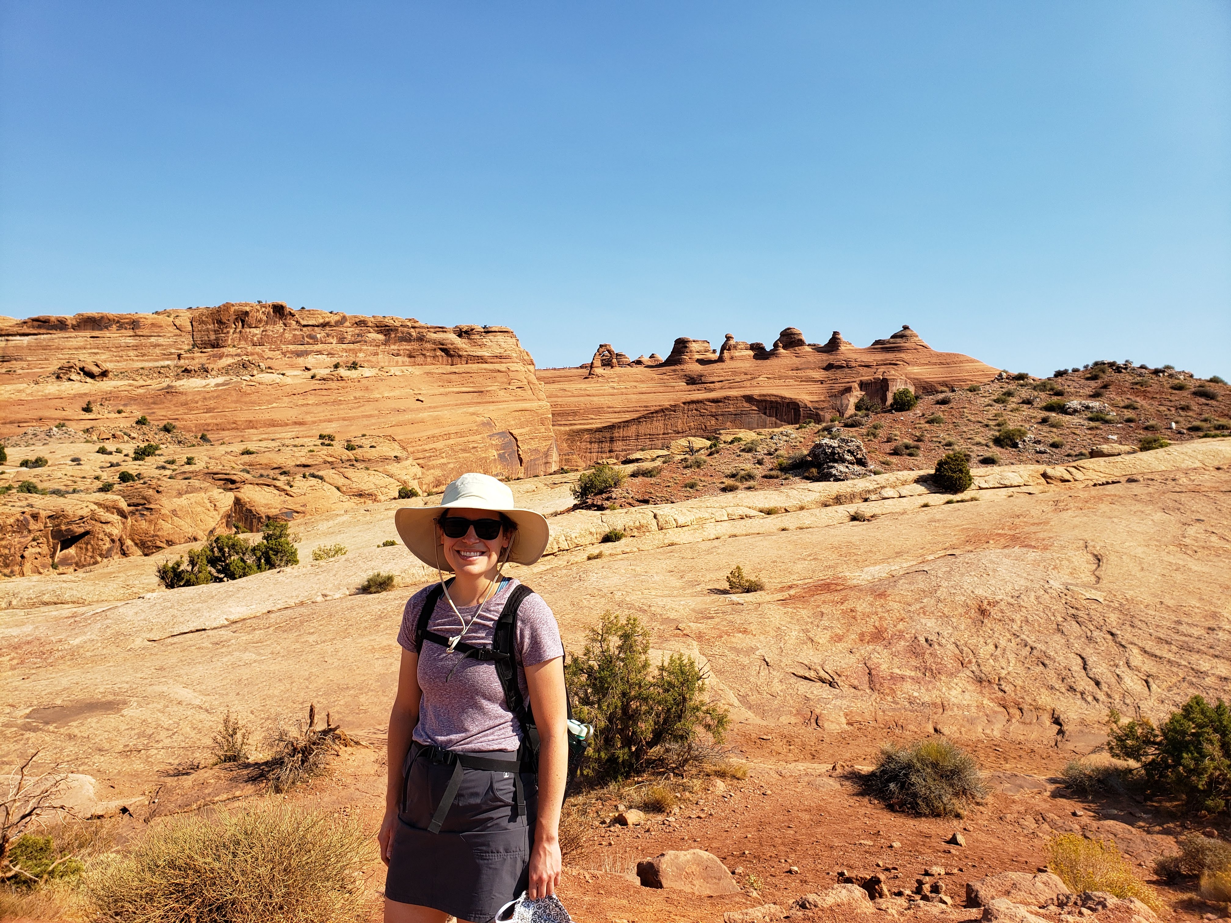
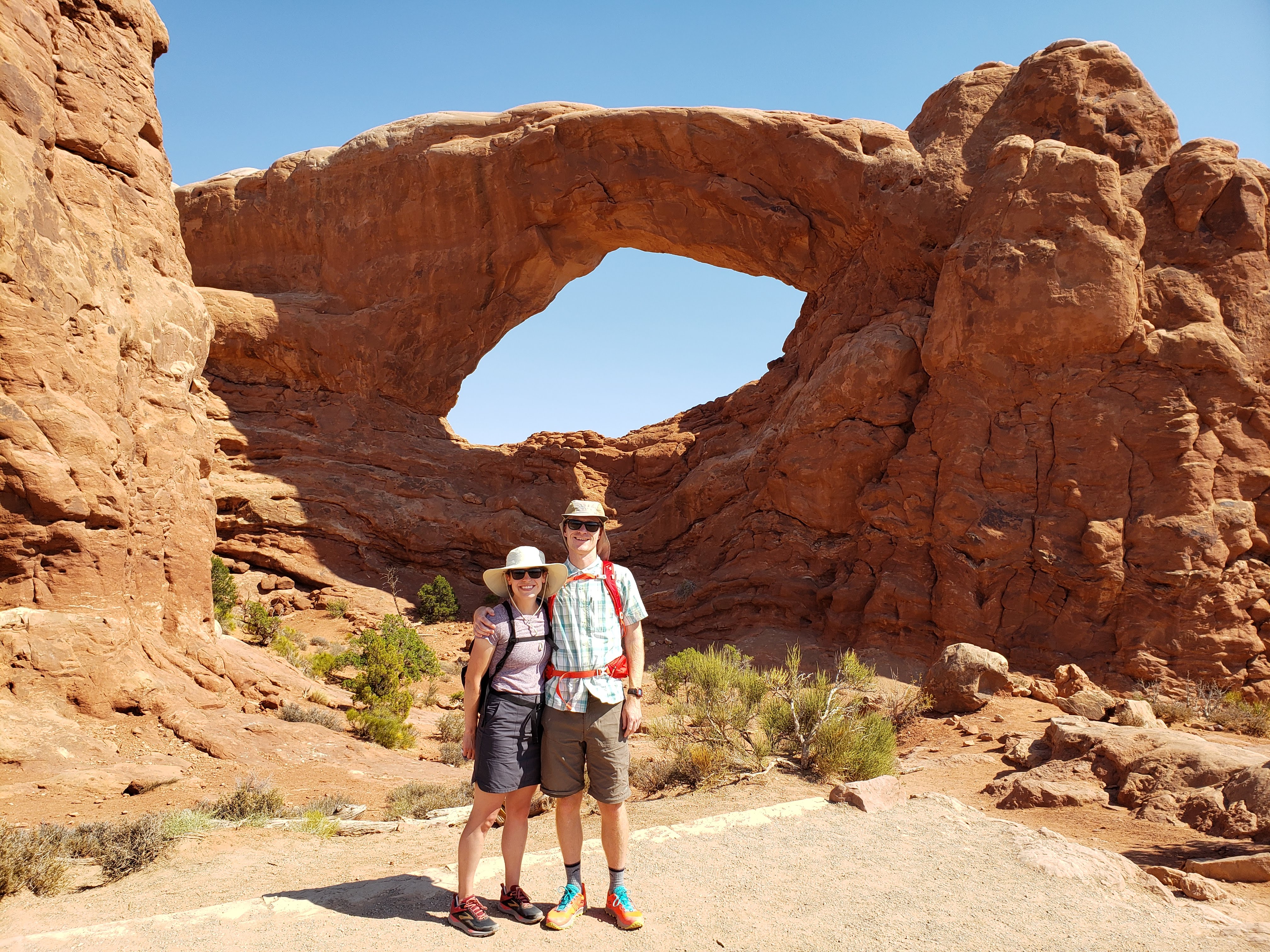
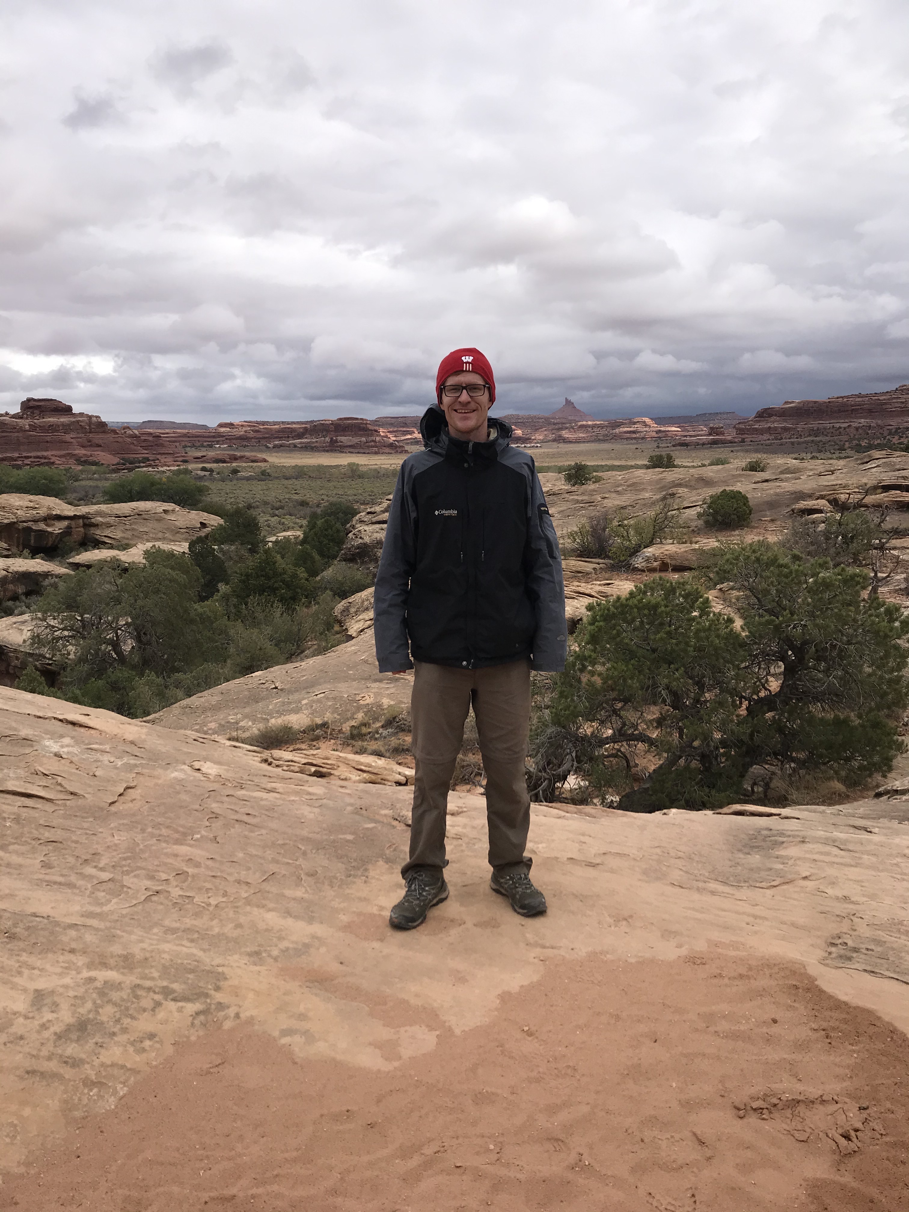
We loaded up into the car and drove the short distance (about 10 minutes from Moab to the park entrance) to Arches National Park. We arrived at the visitor center at approximately 7:15 AM. We wanted to talk to a ranger but once we arrived we saw signs that said the visitor center opened at 8. We didn’t want to wait that long so we headed off into the park and towards our first destination for the day, Delicate Arch. But first we took our National Park sign photos. Due to the pandemic we didn’t get a lot of photos of the two of us (phone sharing and common touch points didn’t seem all that safe) but rest assured we each got our own photos. For the sake of brevity—and my blog’s cloud storage limit—I’ll just alternate between each of us.
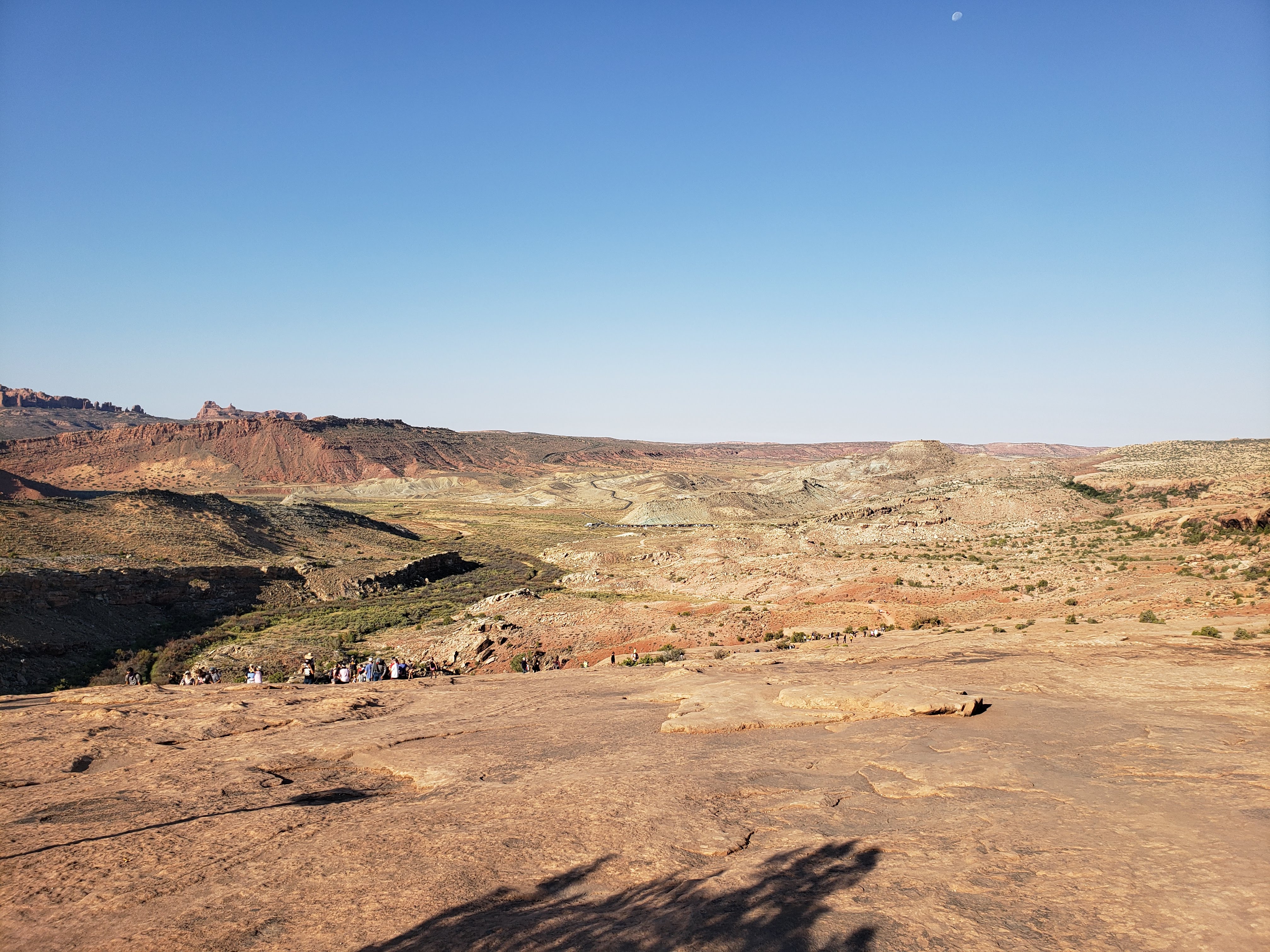
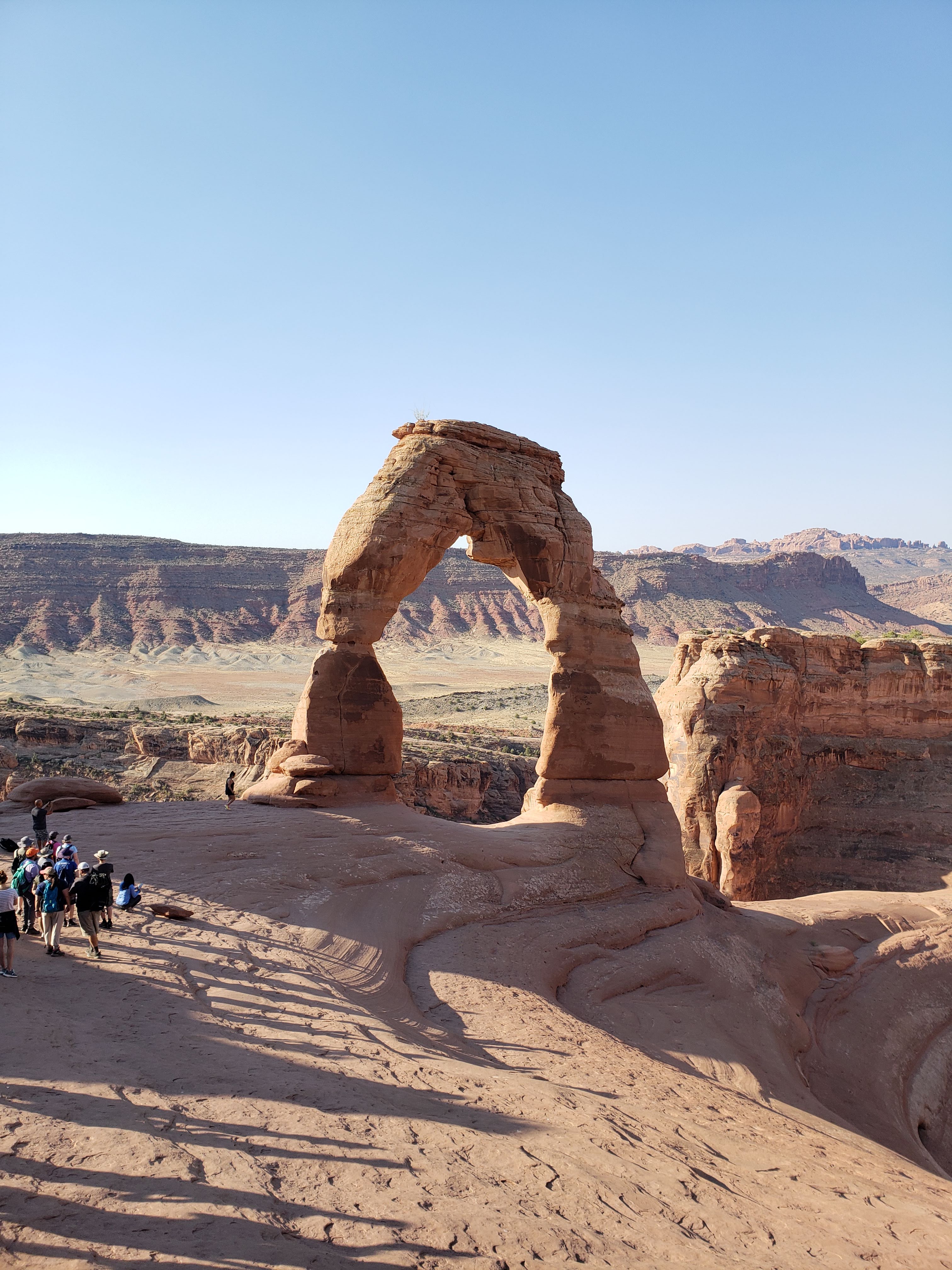
There were two parking lots for Delicate Arch, an upper one and a lower one. The lower parking lot was for the trailhead for the hike to the arch. The upper parking lot was where two short trails to viewpoints of Delicate Arch started. The lower parking lot was full when we got there and we were directed by a ranger to continue to the upper parking lot. We drove around the upper parking lot a couple times before we finally found a parking spot. It was about a one mile hike from the upper parking lot to the lower parking lot. We decided, like so many others we passed, to walk back to the lower parking lot along the park road so that we could hike out to the arch. This would add a couple extra miles of hiking and also eat away at some of the pleasant morning temperatures but we figured that we might as well do it.
We got to the Delicate Arch trailhead and started hiking. The trail was crowded. The Delicate Arch trail is three miles round trip and very popular. For those who don’t know, Delicate Arch appears on one of the common Utah license plates. It is also impressive to see in person. When you add together it being the most iconic hike in Arches National Park along with the fact that it’s only three miles long (granted 500 feet of elevation gain and no shade), you get a lot of people out on the trail.
The hike felt a little touristy, but it’s hard to be mad at the crowds when you factor in how beautiful it all was. As someone who loves to take advantage of all of the amazing outdoor adventures available through state and national park systems, I can’t be upset when other people do the same. As long as people are respectful and follow the rules then who am I to complain. Park overuse is a question that I’m not qualified to talk about but I hope those decisions are being made by the powers in charge. I think the ultimate goal should be to provide access to as many visitors (and especially those of different backgrounds that haven’t been provided access in the past) while still preserving what currently exists for generations to come. But I digress…
Leah read in the park brochure that the Delicate Arch hike was “expertly designed” such that you wouldn’t get any views of the arch until the very end. This proved to be true. I suppose the idea is that you won’t see it until it’s basically right in front of you. We finally saw it.
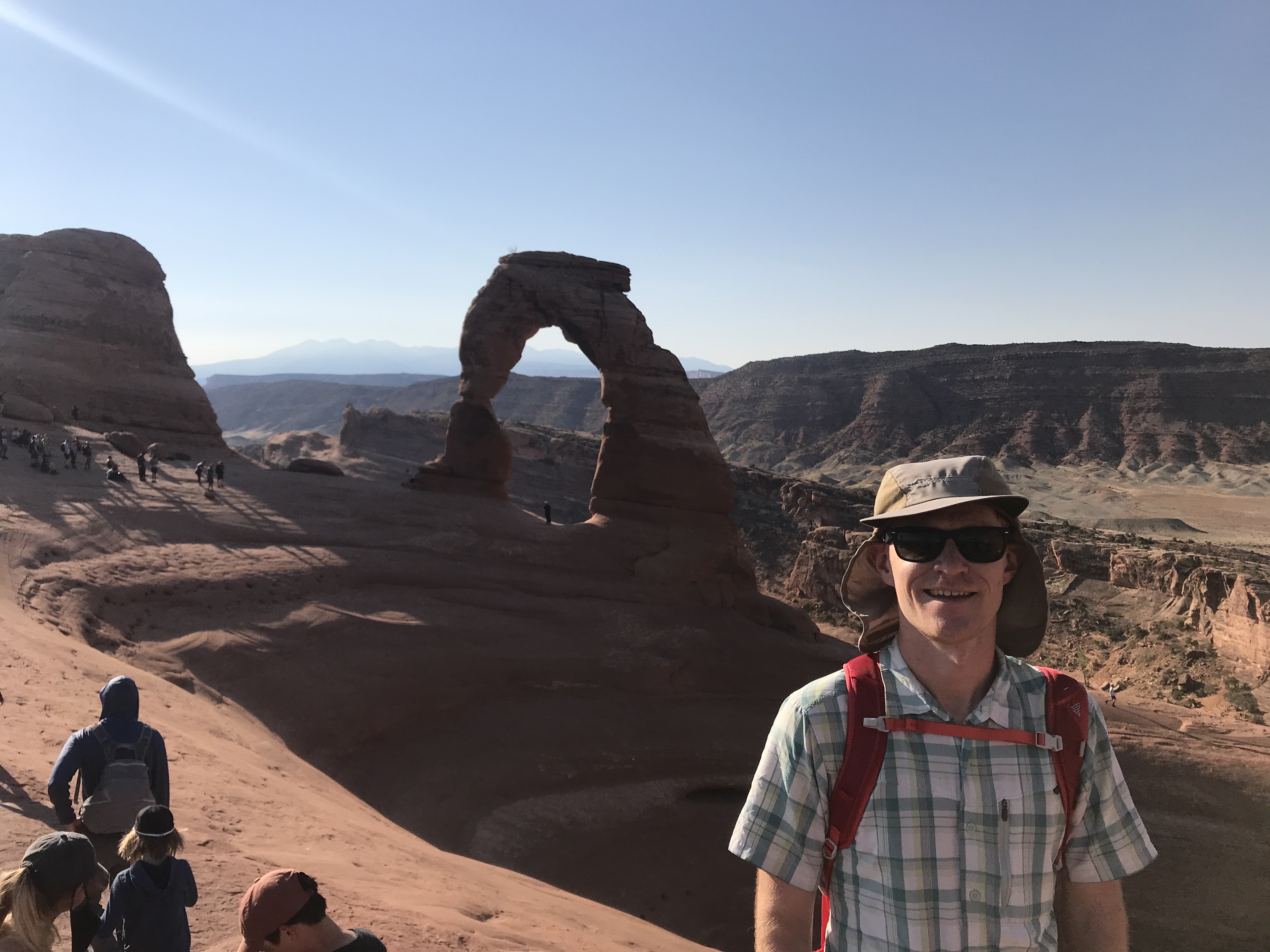
In the photo above and below you can see the line of people to the left of the arch that are waiting to take individual photos underneath it. We weren’t interested in waiting in line so instead we just took some photos from the perimeter.
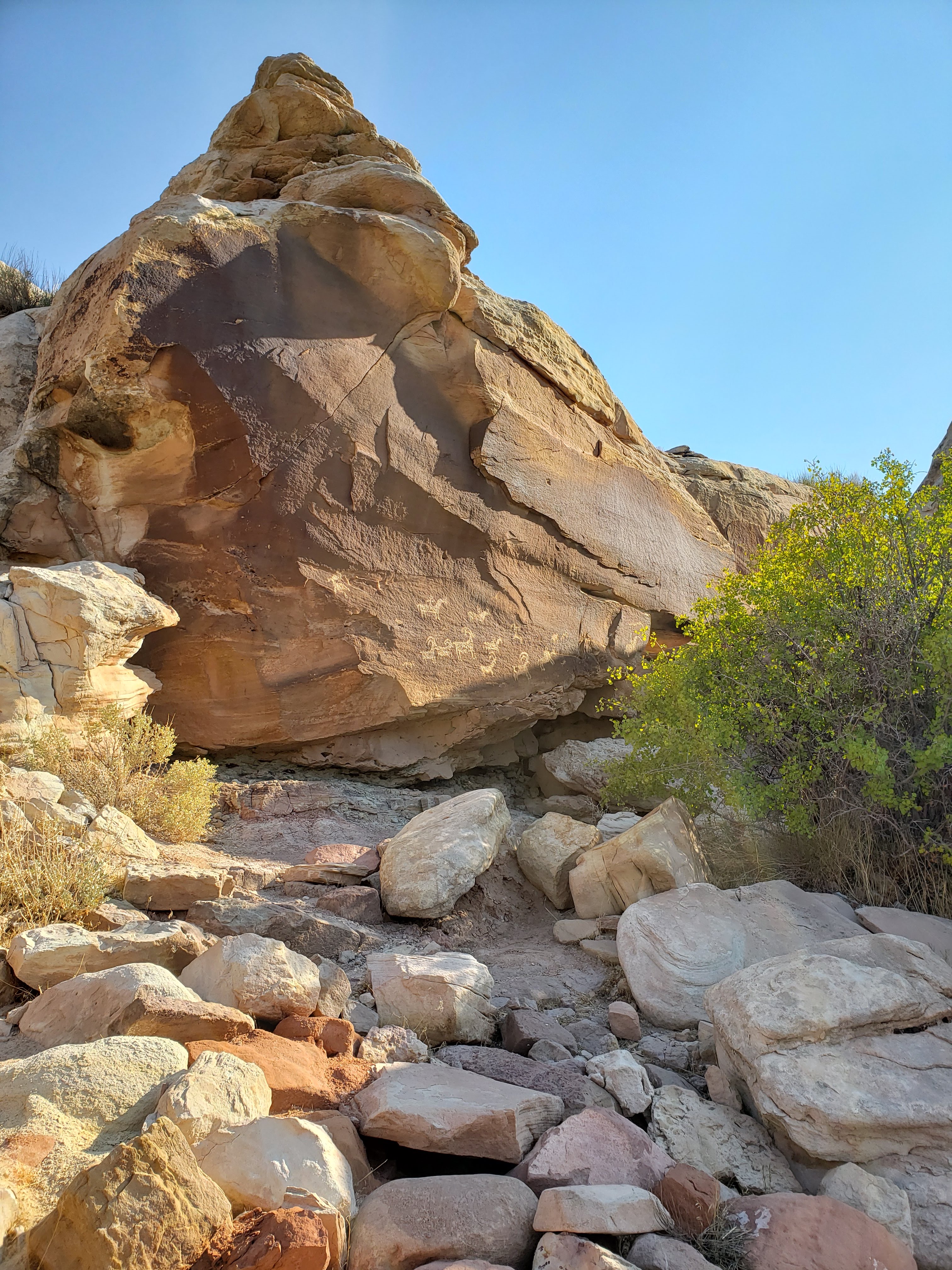
On our way back towards the parking lot we stopped by the Wolfe Ranch. It is an old settlement started in 1898 by a 69-year-old who left Ohio—and most of his family—to find a drier climate that would be easier on a leg injury suffered during the Civil War. There were also some cool petroglyphs which showed that the land had been inhabited long before any white people ever arrived.
When we finally got back to the lower parking lot many of the cars had cleared out. There must be an early morning rush to see Delicate Arch? We walked back to the upper parking lot and hiked the short spur trails to the upper and lower viewpoints for Delicate Arch which left from the upper parking lot. The viewpoints weren’t really anything special, mostly because we had already hiked out to the arch.
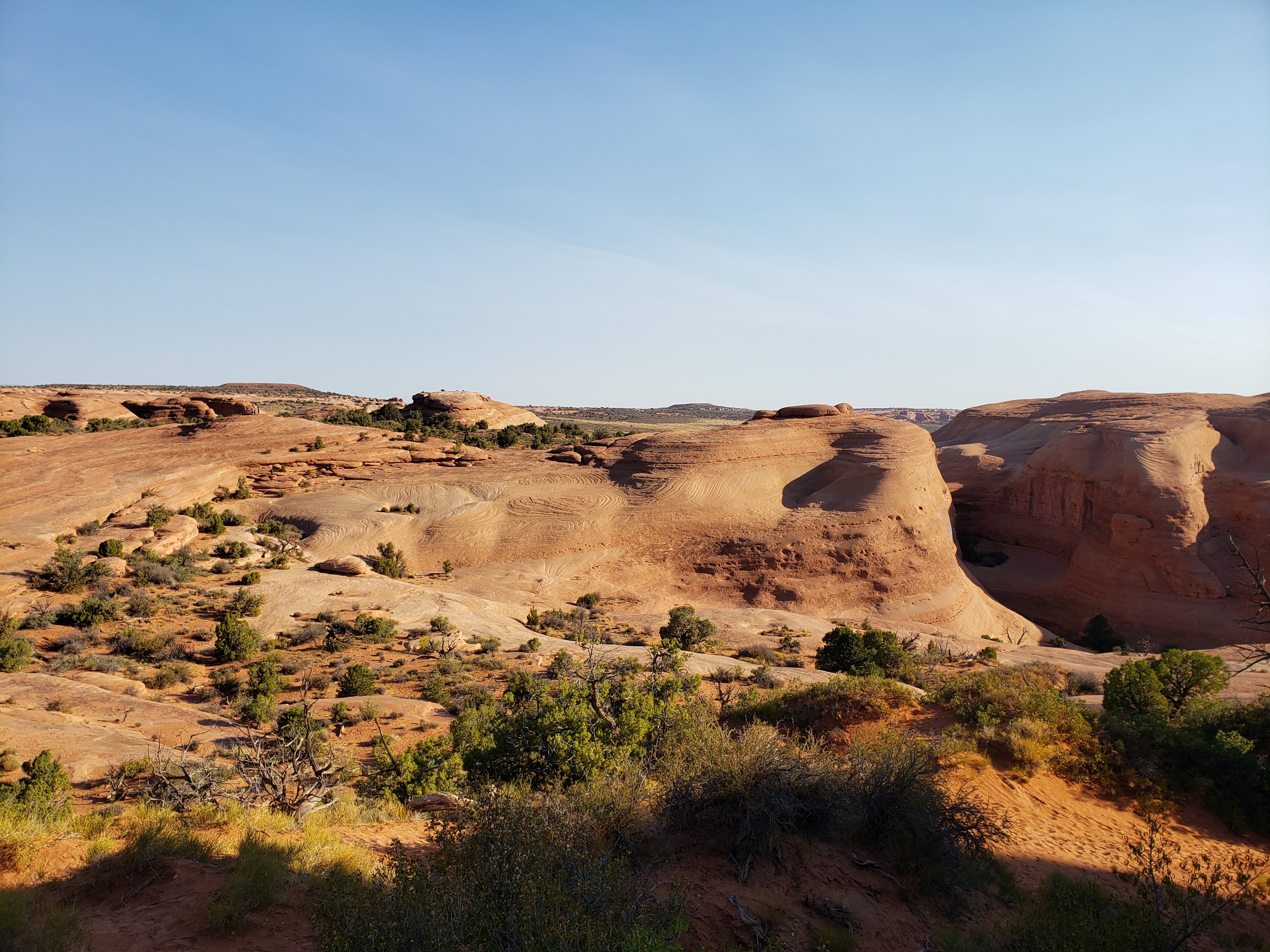
On that first day I was wearing my new trail running shoes as a test to see how they’d fare on some more strenuous hiking. Unfortunately, I got a blister on my left heal after hiking for only a few miles. I had theories about changing insoles or socks, but sadly I was back to wearing my old hiking boots the rest of the trip. We left Delicate Arch and made our way back towards the visitor center. We stopped at a few places along the way. Here’s a view from Panorama Point.
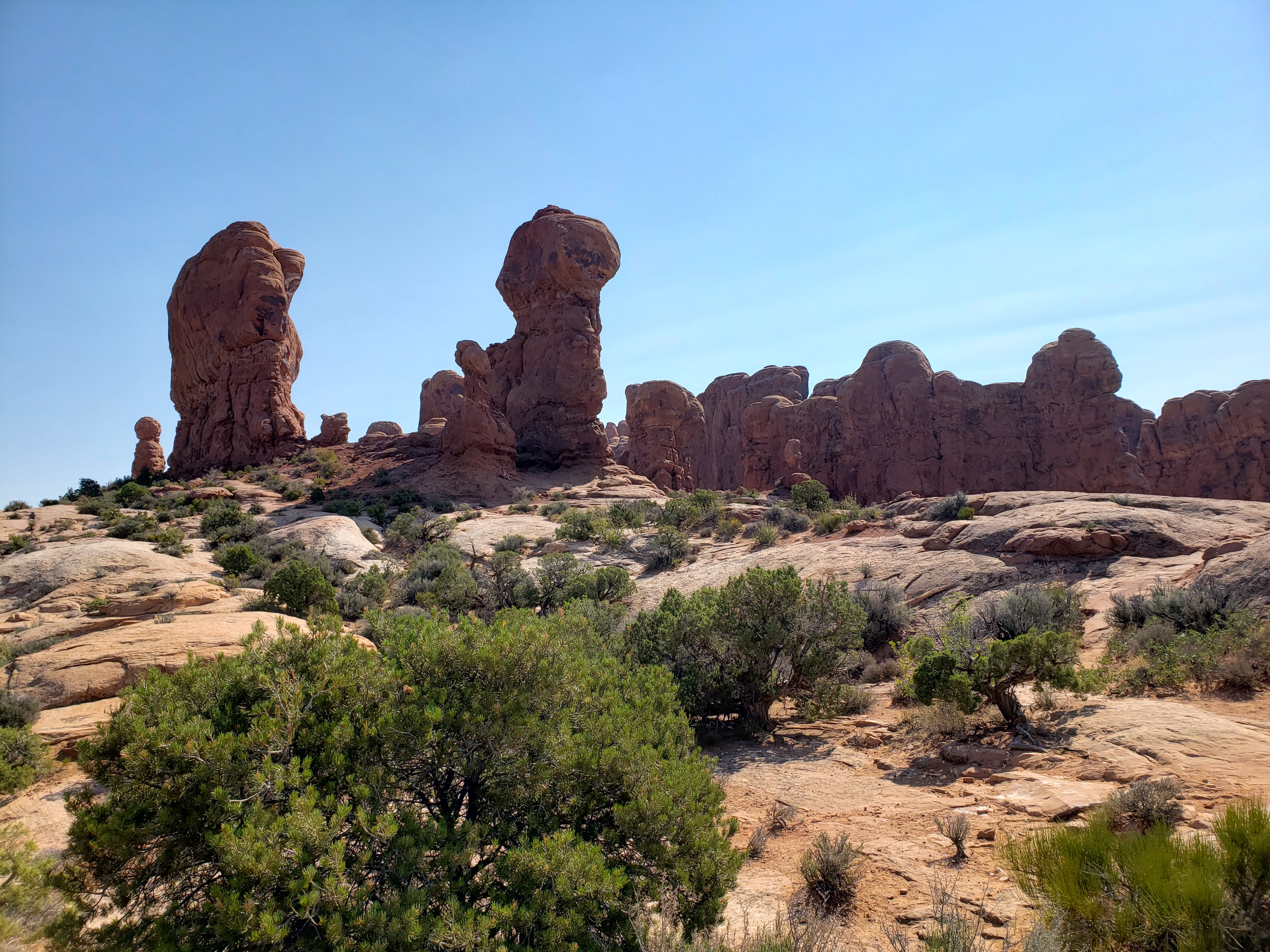
Our next stop was at the Garden of Eden, which was a collection of cool rock formations.
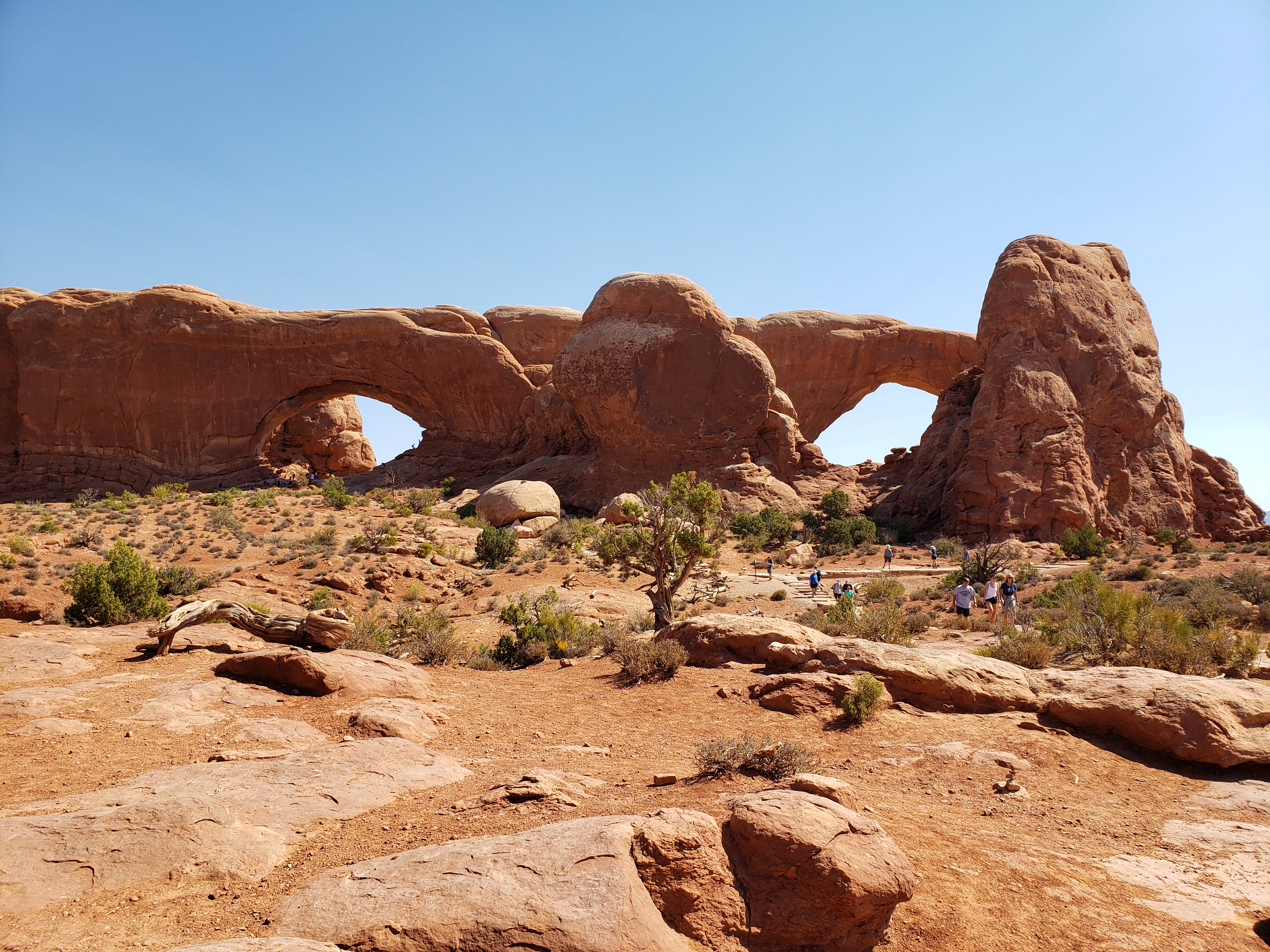
The Windows Section is another marquee stop at Arches National Park. There you’ll find some of the following formations.


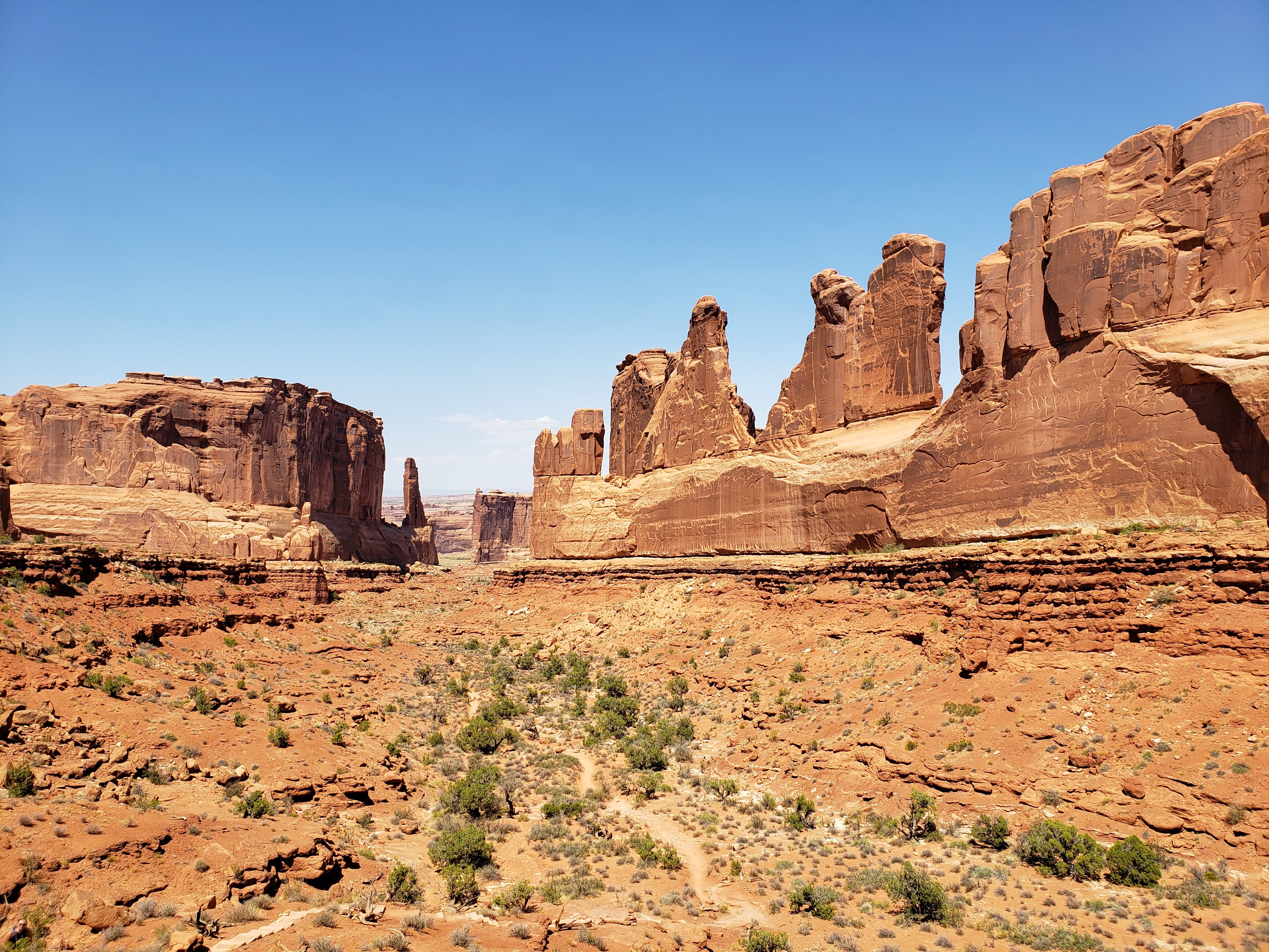
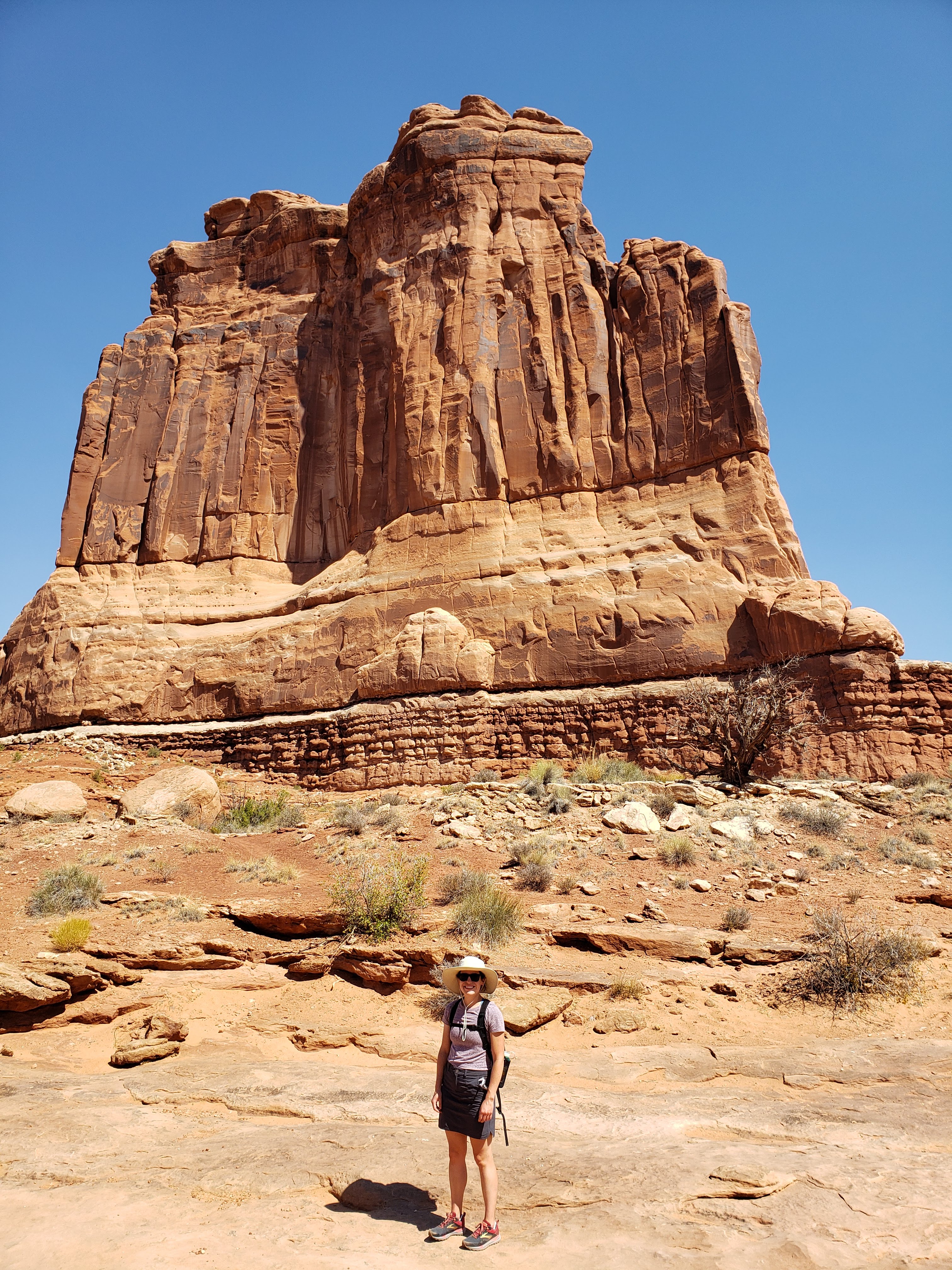
After all of that we finally headed back to the visitor center. I bought my National Park stickers and we ate lunch at a picnic table next to the parking lot. The picnic table had a covering so we weren’t in the direct sunlight, but it was already really heating up. The first half of the day we had done a bunch of hiking in the sun but for the most part hadn’t really felt the heat yet. After lunch, however, the heat started to seem unbearable. The high for that day was 105 degrees and at about two o’clock we felt like we hit a wall. Naturally we powered through (we’re not the type to take it easy). Our next stop was Park Avenue—named for how it felt like you were walking down a skyscraper canyon in New York City.

The Park Avenue Trail is an out and back that ends at the Courthouse Towers viewpoint. We barely saw anyone on the trail. The park seemed to clear out a little bit as the midday heat crept in.


We finally made it back to the car and chugged hot water. There were water filling stations at select locations in the park. It’s mostly trucked in from Moab and then sits in big storage tanks which must just bake in the sun all day because the water came out of the tap warm. Next we started heading towards the campground which is located at the very end of the park road. Along the way we stopped at a few more spots.

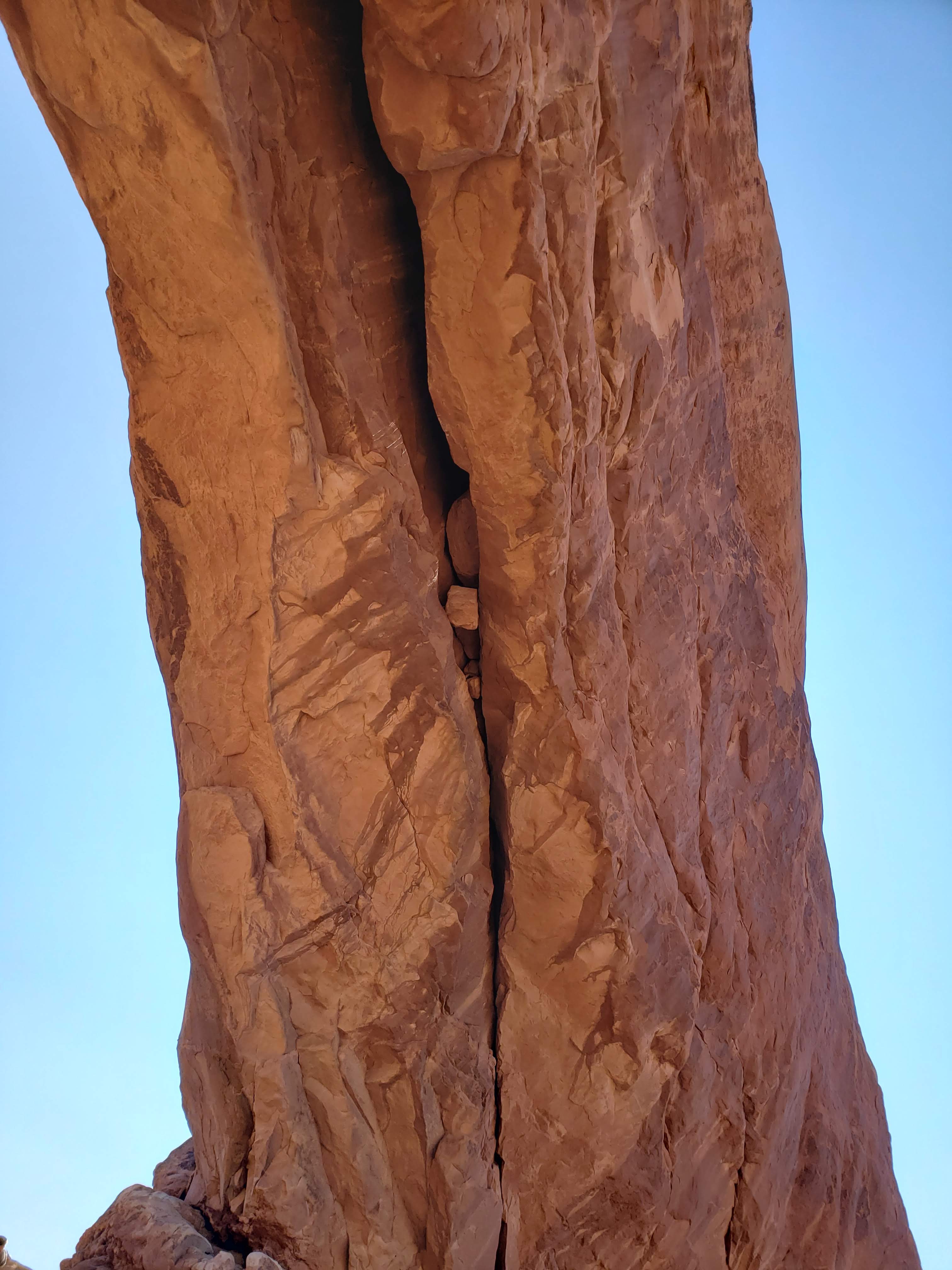
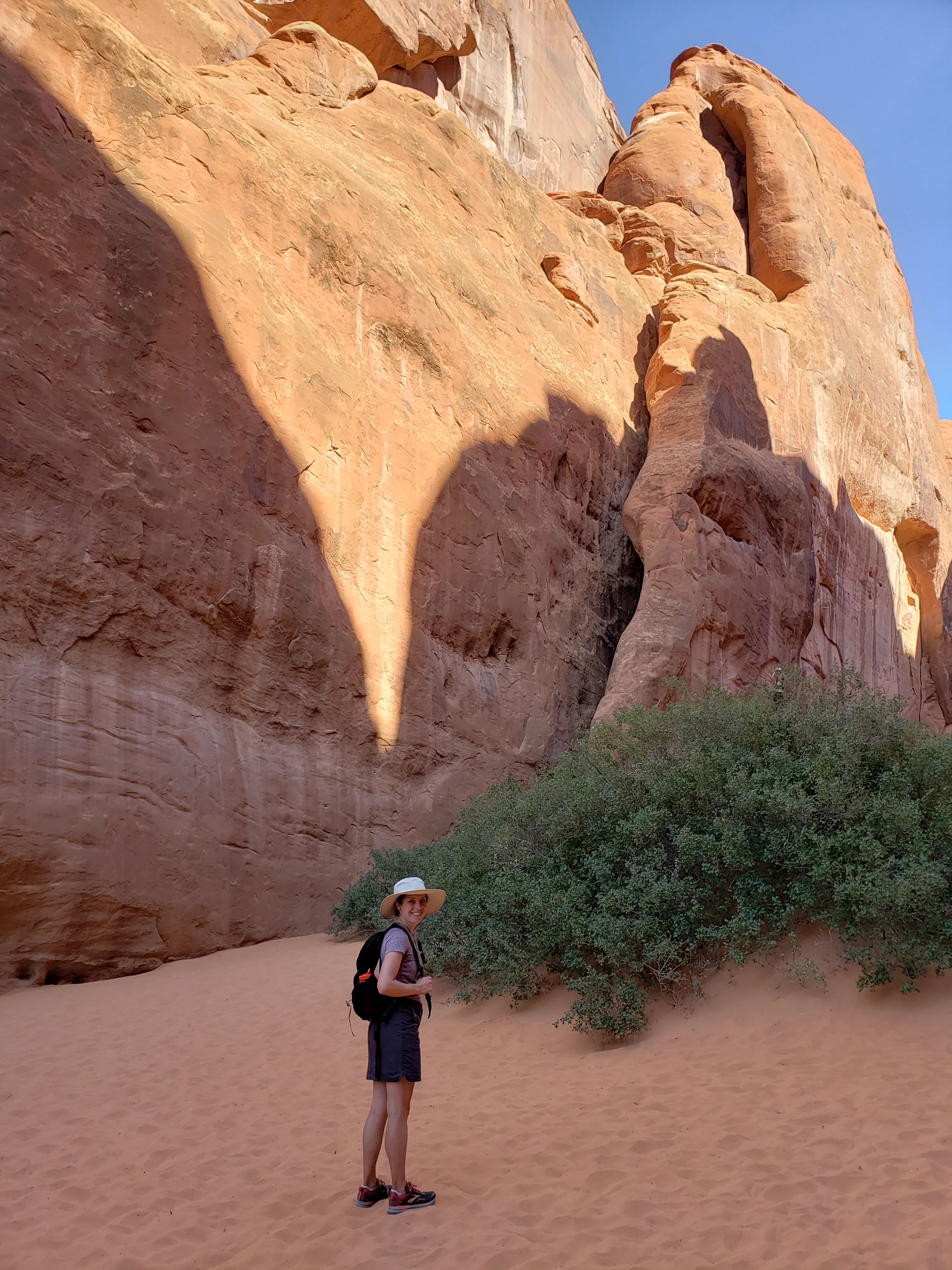
I was really hoping that we could hike in the Fiery Furnace. It’s another one of the main attractions at Arches National Park. Due to preservation and overcrowding (and danger, especially of getting lost) the area is permitted. Unfortunately, due to COVID the National Park Service was not issuing permits and was also not providing ranger led tours—the only two ways to enter the Fiery Furnace. This was a bummer, but something to look forward to if we ever return. Next we headed to Sand Dune Arch. They weren’t kidding around when they named this one. You walk through a crevasse between two rock fins and all of a sudden you’re on a sandy beach.


Next we hiked a little loop trail that connected a couple more arches. It also overlapped with the campground so we got to take a sneak peak at our site.
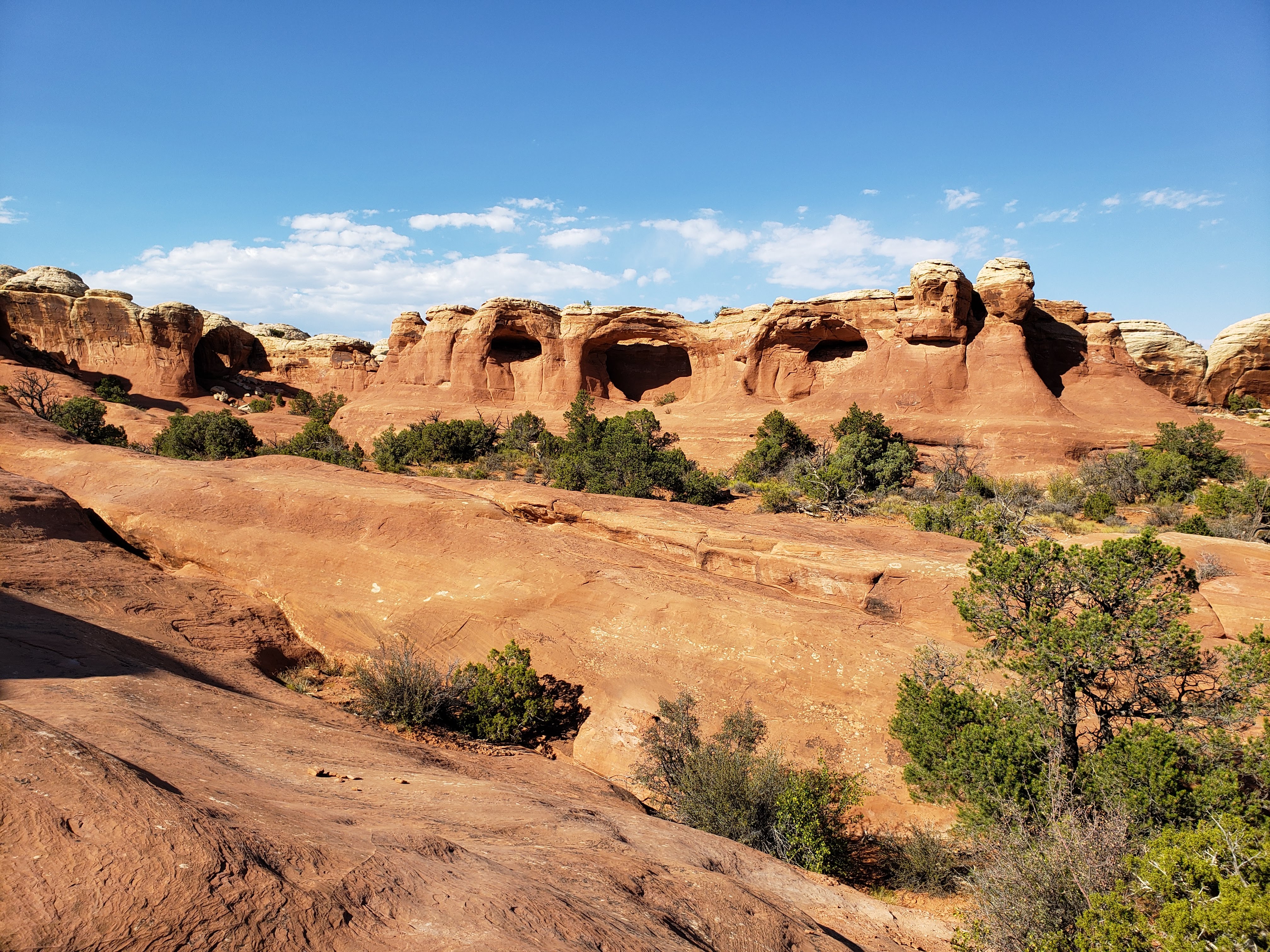
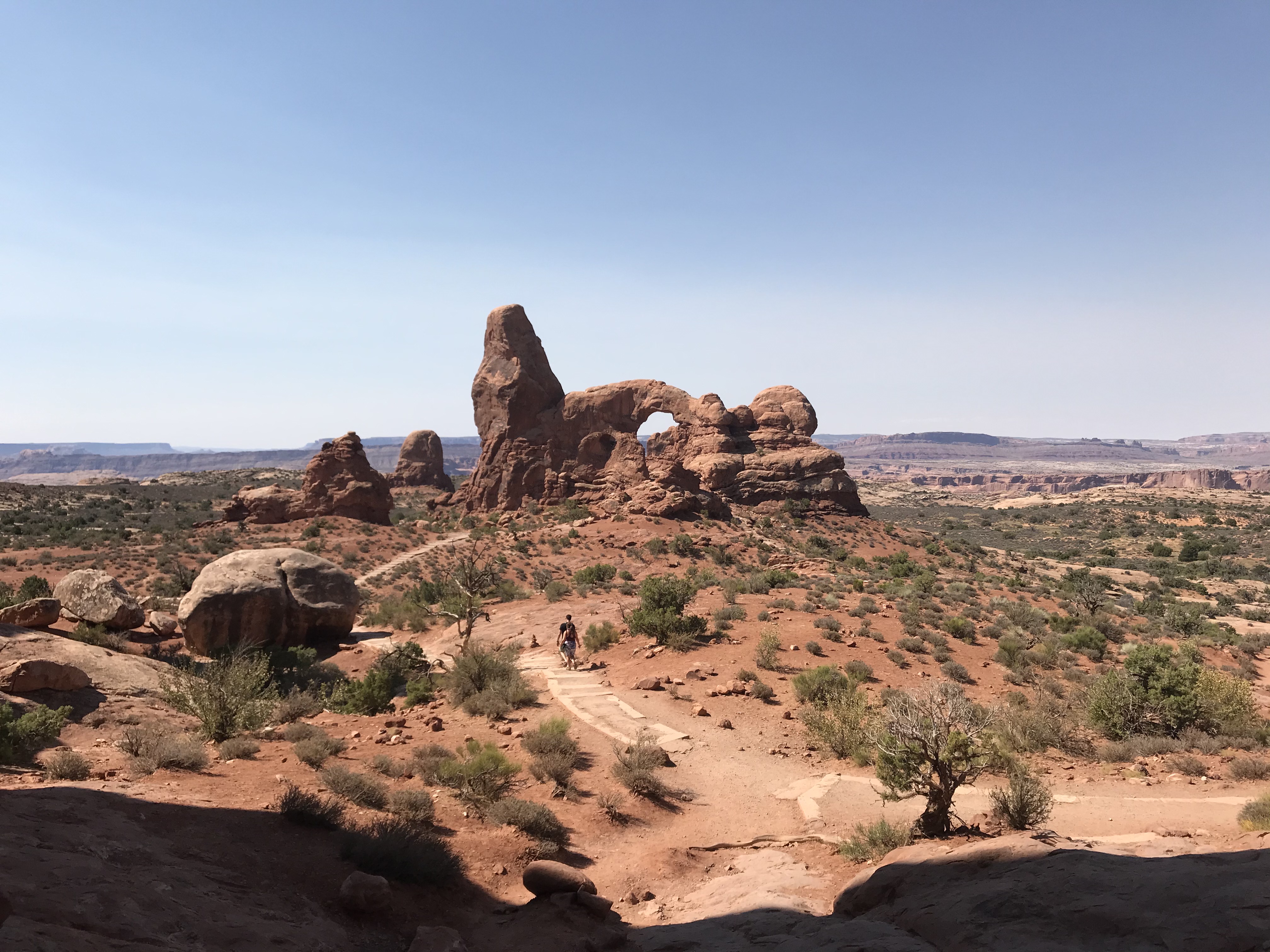
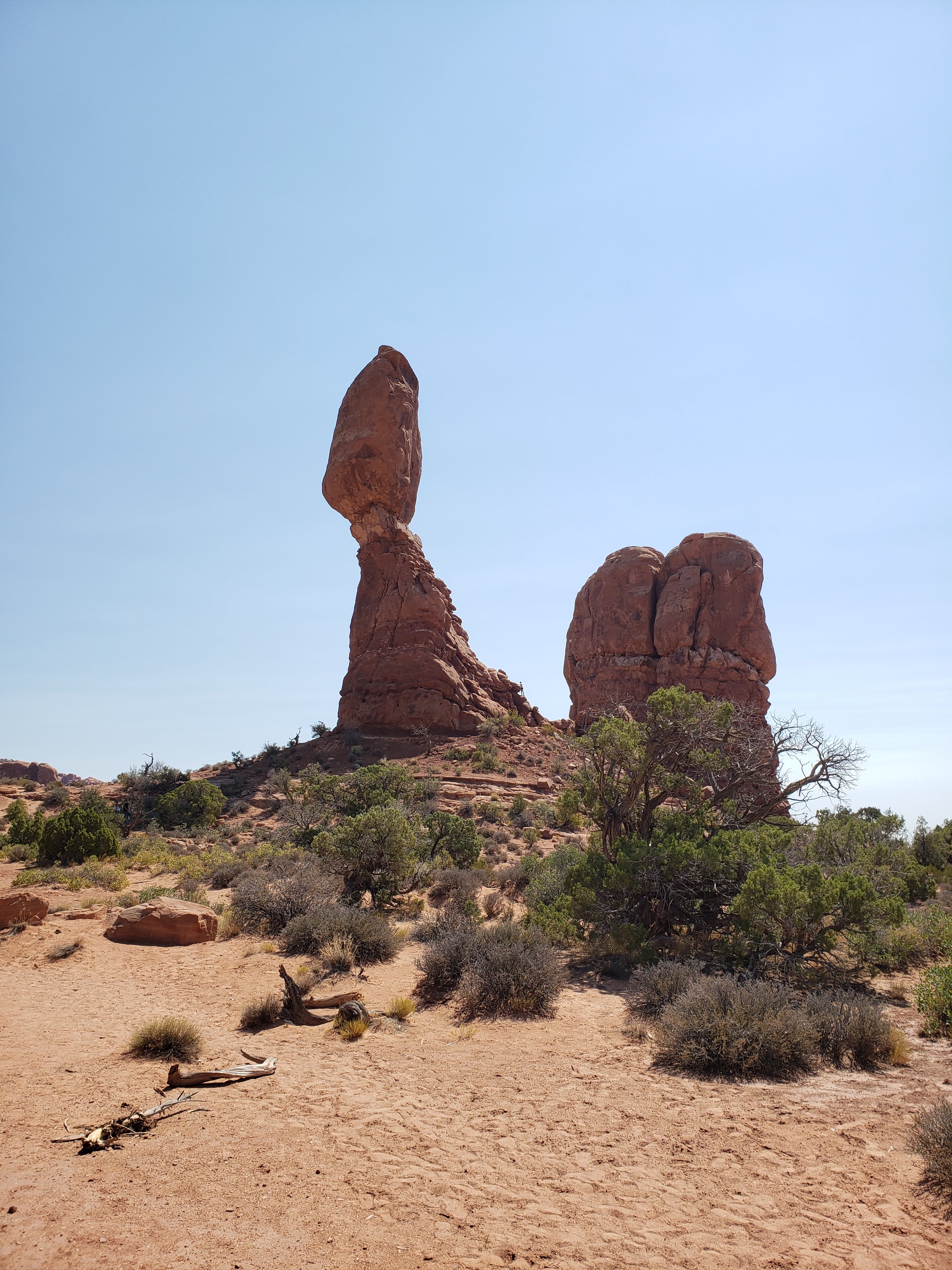
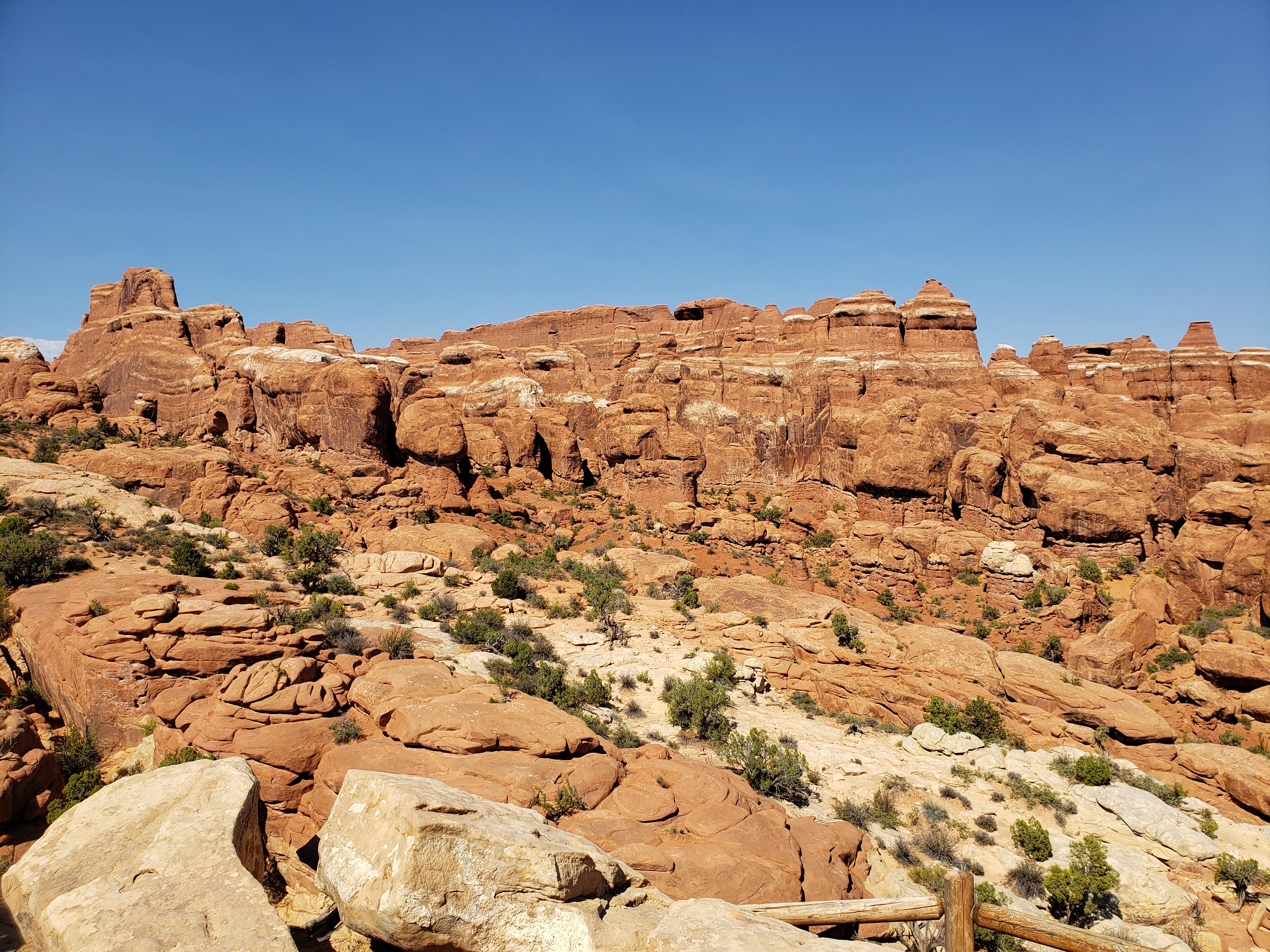
We got a little lost on the back side of the loop. It wasn’t so bad because without much vegetation we could pretty much see exactly where we needed to get to. Eventually we found the trail again and made it back to the car. Our next stop was Skyline Arch. In 1940 a big chunk of Skyline Arch fell off, instantly doubling the size of the opening. This brings up another point about Arches National Park. There are over 2000 documented arches, many of them smaller or less magnificent than the ones on the map. But that number is constantly changing as the elements that form arches—mostly water—also destroy them.
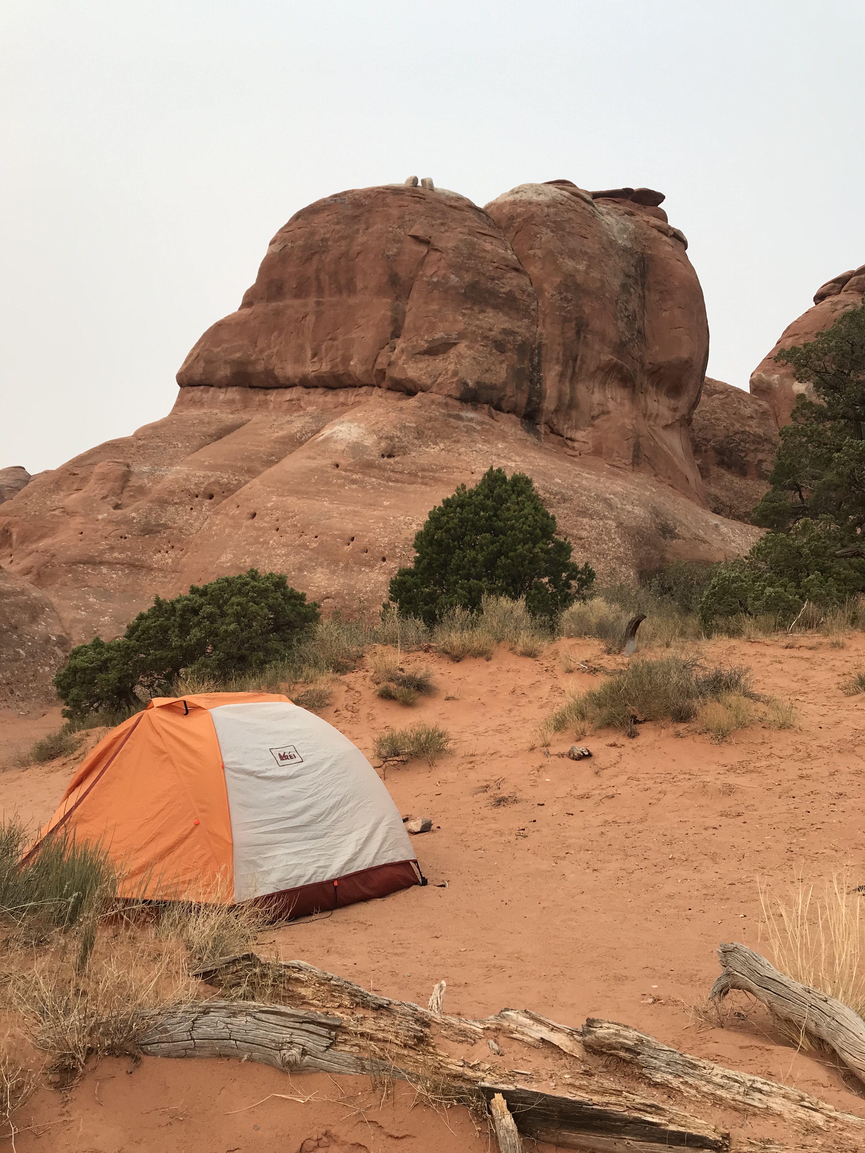
We were both feeling pretty beat and it was getting late so we headed to our campsite. There are 51 total sites at Arches National Park and they are all located in the Devils Garden Campground. It’s an incredibly hard place to book a campsite at if you’re not looking months ahead. As I mentioned above, I used persistence and luck to score a two night stay during a holiday weekend. And we just so happened to luck into a great site as well. It was a decent size and private on both sides. The site was also very sandy. Leah had been wearing her new trail running shoes as well. They had a mesh upper so after the last couple of hikes she had to stop and dump sand from her shoes.
We set up camp and drank beers—still cold thanks to our Yeti cooler, though a lot of the ice had already melted. We ate crackers and spinach artichoke dip as an appetizer. Dick, the campground host, chatted with us for a while. He was retired for 17 years and spent most of his time volunteering at National Parks. He was from Texas but told us about canoeing trips he took in Minnesota after learning that we were from there. He also mentioned that a 12-year-old girl had been helivaced (we had heard a helicopter but not known what it was for) from the Devils Garden section of the park (an area we hadn’t been to) just minutes ago. Apparently she was found unresponsive and with no other person nearby. Dick assumed it was heat related. Very strange circumstances but we hope she was okay. Dick also came back later to give us free firewood that he had collected as camp host.
For dinner we made quesadillas with vegetables from our garden. We cooked the quesadillas in a pan over the stove which actually worked pretty well. Next we got ready for bed. Our plan for the next day was to head to the Island in the Sky section of Canyonlands National Park.
We decided to put the rain fly on the tent because of blowing sand. Leah didn’t like being trapped in the heat. We got in bed around 9 PM but it didn’t cool off until about 10:30. I thought it was supposed to cool off immediately in the desert as soon as the sun set. Before falling asleep I took a look at the stars. I could see so many—and the Milky Way as well.
Total miles hiked: 11.5 Weather: Very hot and sunny, high of 105
Day 4 – Canyonlands National Park
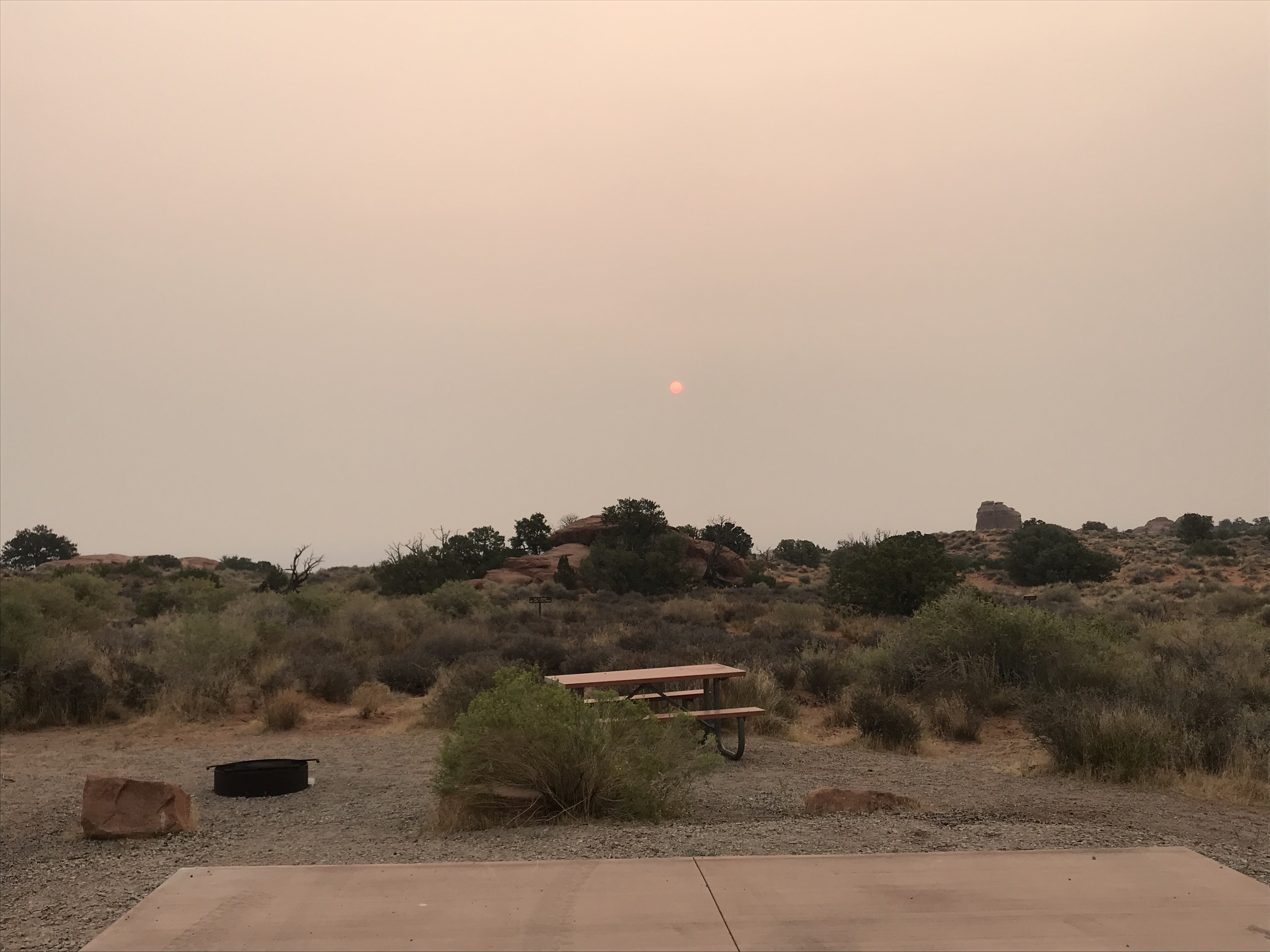
We set our alarm for 7 AM but ended up getting up at 6:45. We woke up to a hazy morning. The smoke came from forest fires near us (there were so many different wildfires that it was hard to know exactly which one the smoke was coming from).
We had a quick breakfast and then headed out towards Canyonlands National Park. Since the campground at Arches National Park was at the end of the park road it took about 30 minutes just to get back to the entrance to Arches National Park. We stopped at a gas station to fill up on gas and also restock our ice in the cooler. It felt wrong dumping out the melted ice water in the middle of a desert.
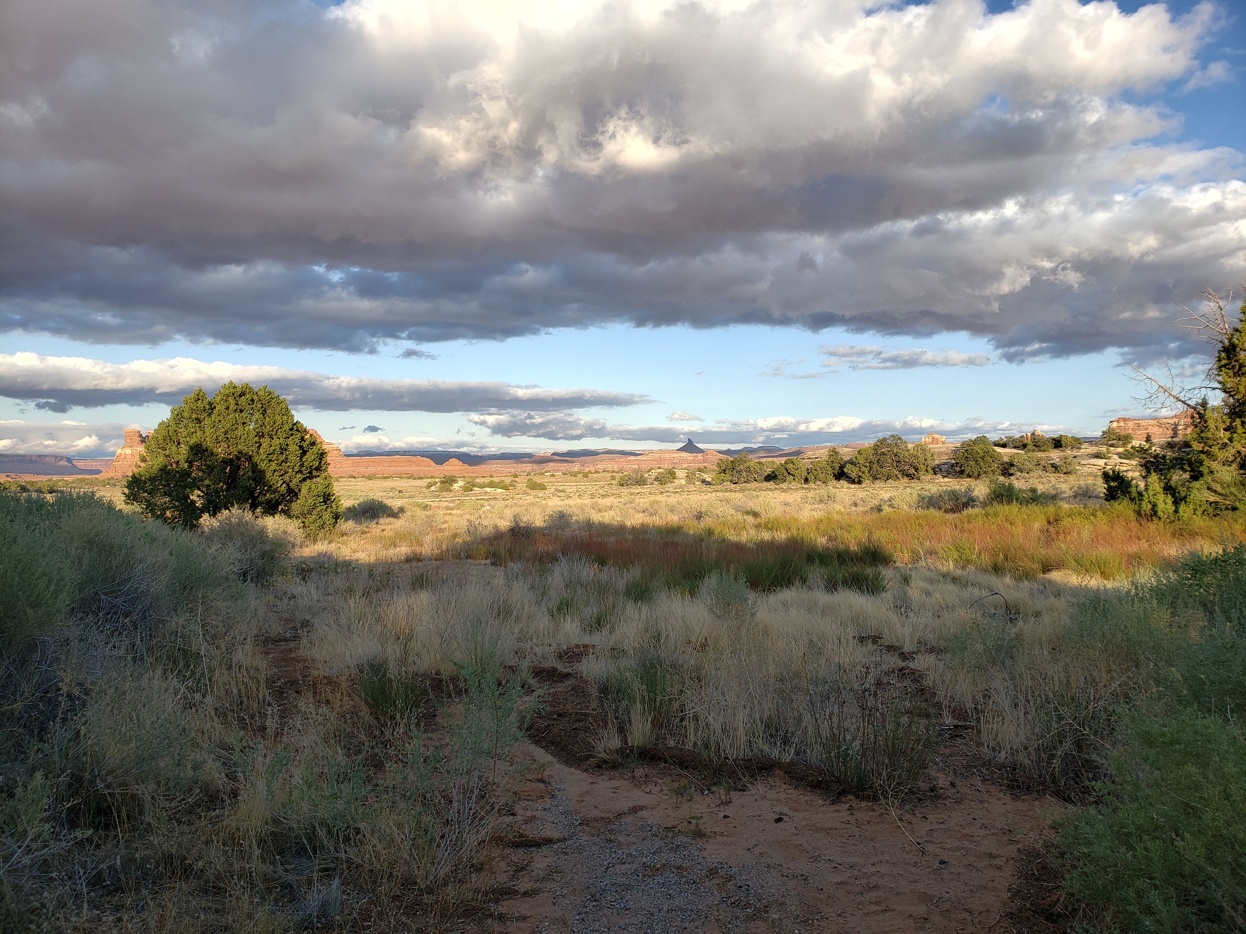
Canyonlands National Park is split up into four different sections; Island in the Sky, The Needles, The Maze, and Horseshoe Canyon. We were headed to the Island in the Sky section today and would be going to the Needles section the next day. The Maze is an incredibly remote section that is only accessible by hiking, off-road vehicle, or rafting the Green River or Colorado River. There were a lot of warning about the Maze due to how far it is from any services or help. It didn’t seem like a place that we needed to go to. Horseshoe Canyon is a much smaller section that is disconnected from the other three. Its main purpose is to protect pictographs on a section of the canyon. It was way out of the way and it didn’t make much sense for us to go there either.
We finally got to the Island in the Sky section of Canyonlands National Park but drove right past the National Park sign. We said we’d get it on the way out. We stopped at the visitor center to buy stickers and a postcard. We also asked a ranger about hikes and conveniently they had a list of recommended day hikes. Our first stop was Mesa Arch. It was a beautiful arch that was great for framing the canyon behind it.


In the parking lot we met some Minnesotans. They used to live fairly close to us in Minneapolis—near the Stone Arch Bridge. They had decided to take their lives on the road and live out of an RV. They worked during the week which meant that they had to stay in RV parks or campgrounds that had WiFi. Then they explored different parts of the country on weeknights and weekends. It was unclear if this plan was due to the pandemic and so many jobs going remote. They told us that they were planning to winter in southern California. And they also brought their pet cat with them so electric hookups were needed in order to run AC for their feline friend.
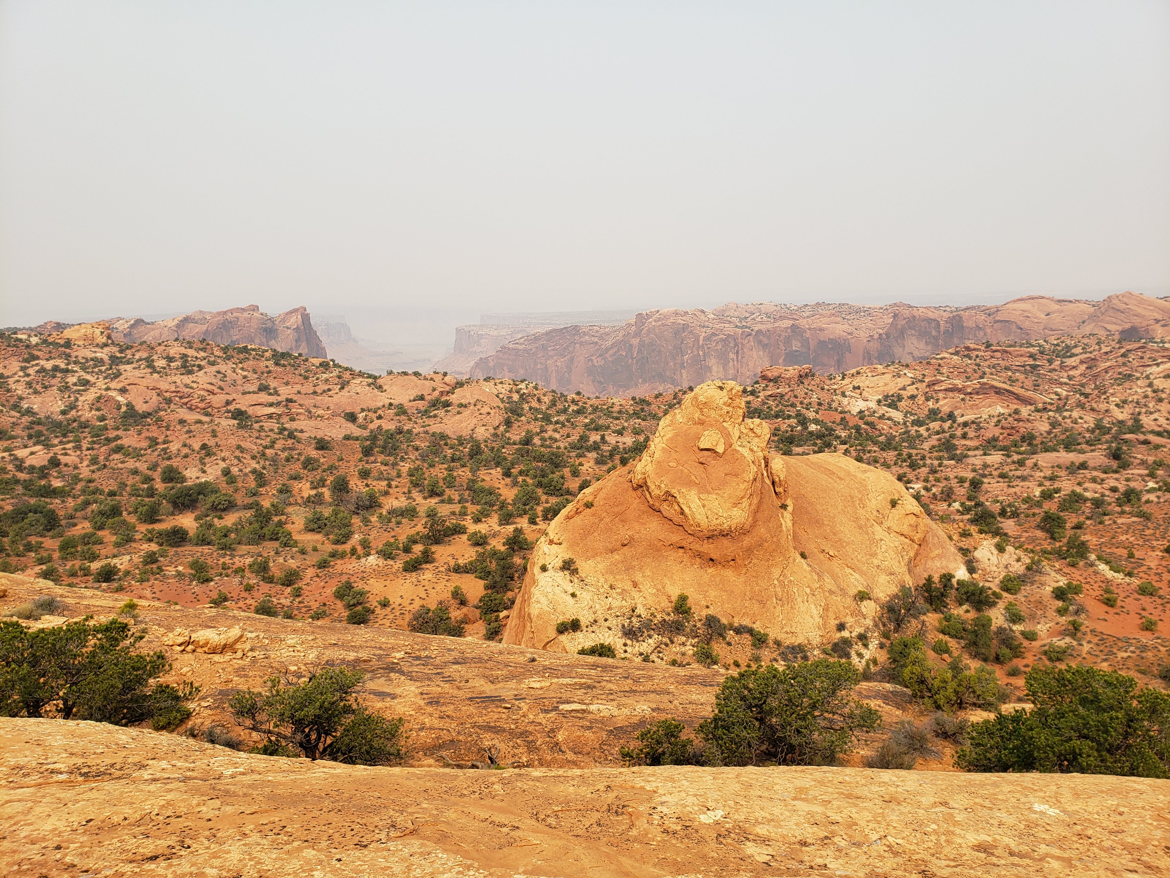
Our next stop was at Aztec Butte which had two large hills, one with a grainary and one that had beautiful 360 degree views. To get to the top of both hills there were some steep scramble sections of the hike that Leah did not like. When we got back to the parking lot there was a group of two men that appeared to be stoned. They asked us, “how was Aztec Butt?”, with a little snicker. Great, guys. It was great.

Next we headed to a short hike up Whale Rock. It didn’t really look like a whale but the views were nice.
Back in the parking lot I made a miraculous discovery. Back at Mesa Arch we applied sunscreen and I had accidentally placed the sunscreen bottle on the roof of the car. Without knowing it, we had then driven around for the next six miles or so with it wedged between the roof rack and the car. We couldn’t believe it was still there.
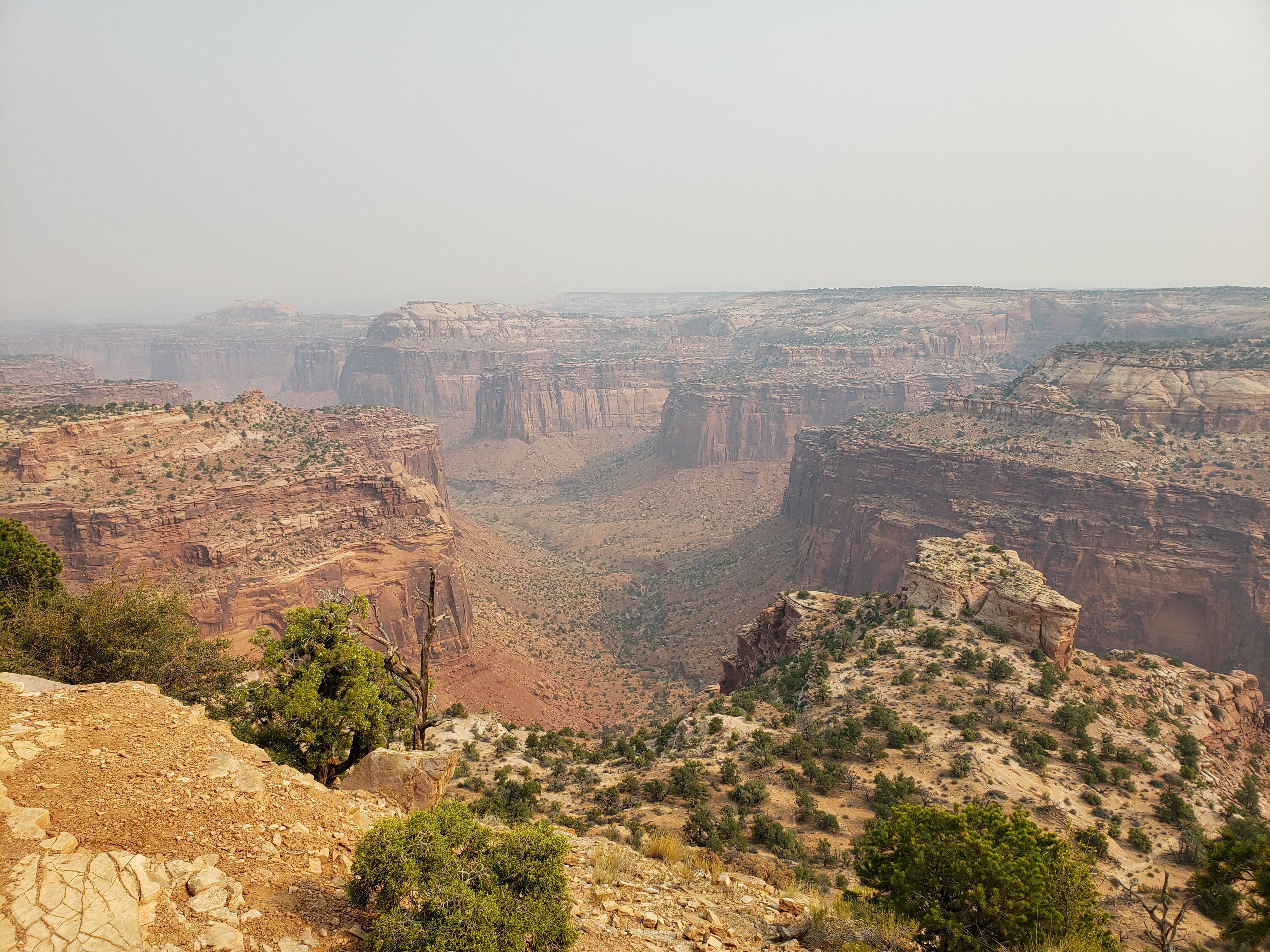
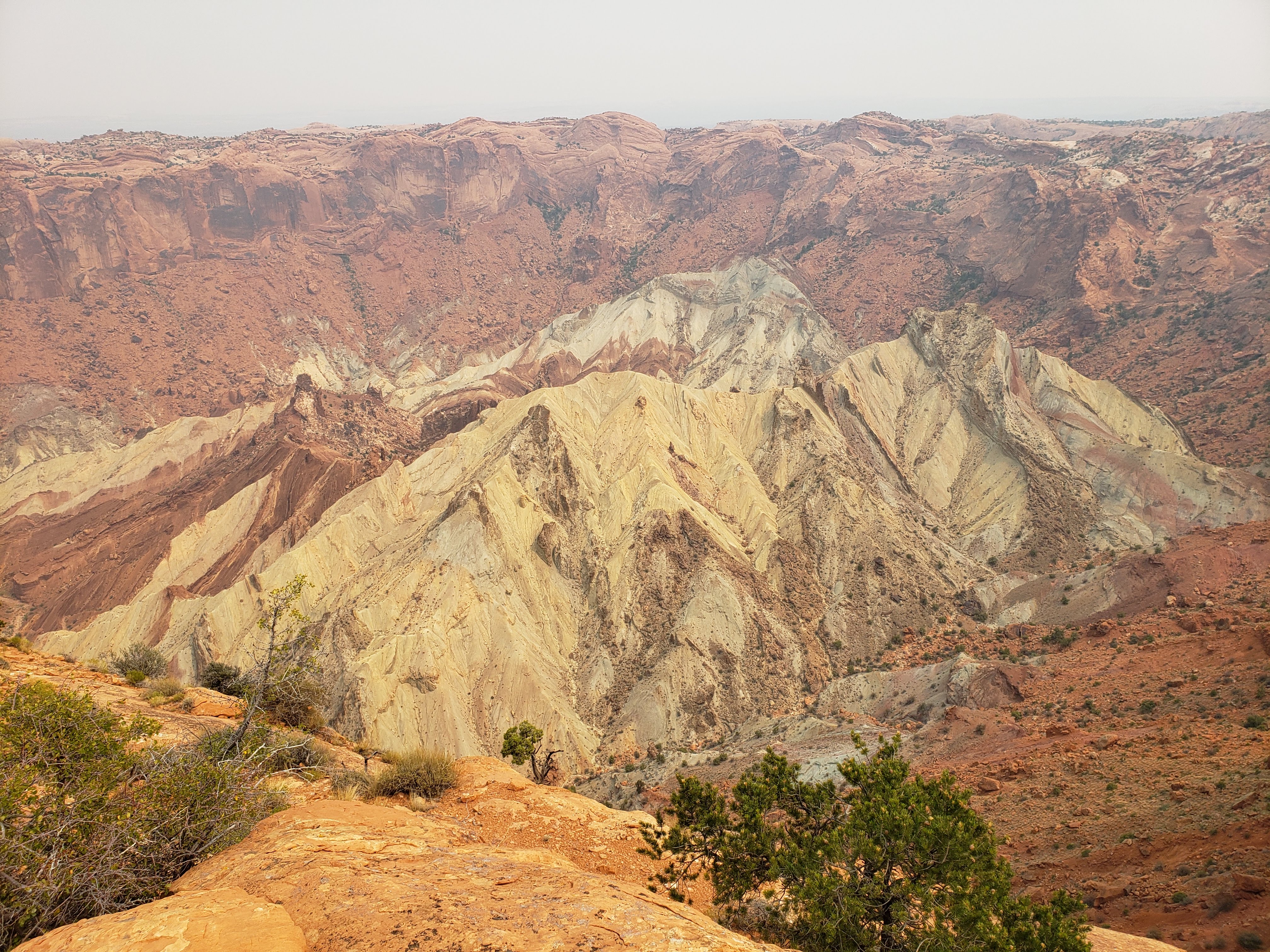
Our next stop was Upheaval Dome—a unique geological feature that is approximately three miles wide. Its origins are not precisely known but there are two main theories. One is that it’s a salt dome that has flowed up through the rock layers over the years. The other theory is that it’s the result of an impact crater. Either way it was a cool site to see. We visited the main viewpoints which were highly recommended by the guide books that I read.

After returning to the parking lot we ate lunch at the picnic area next to Upheaval Dome. Our next stop was the Green River overlook. It’s right next to the campground at the Island in the Sky section of Canyonlands National Park. I had considered staying at that campground—called Willow Flat—but there were only 12 sites, they weren’t bookable, and the nearest water source was at the visitor center. We drove through the campground and some of the sites seemed fine, but maybe not the best situation.
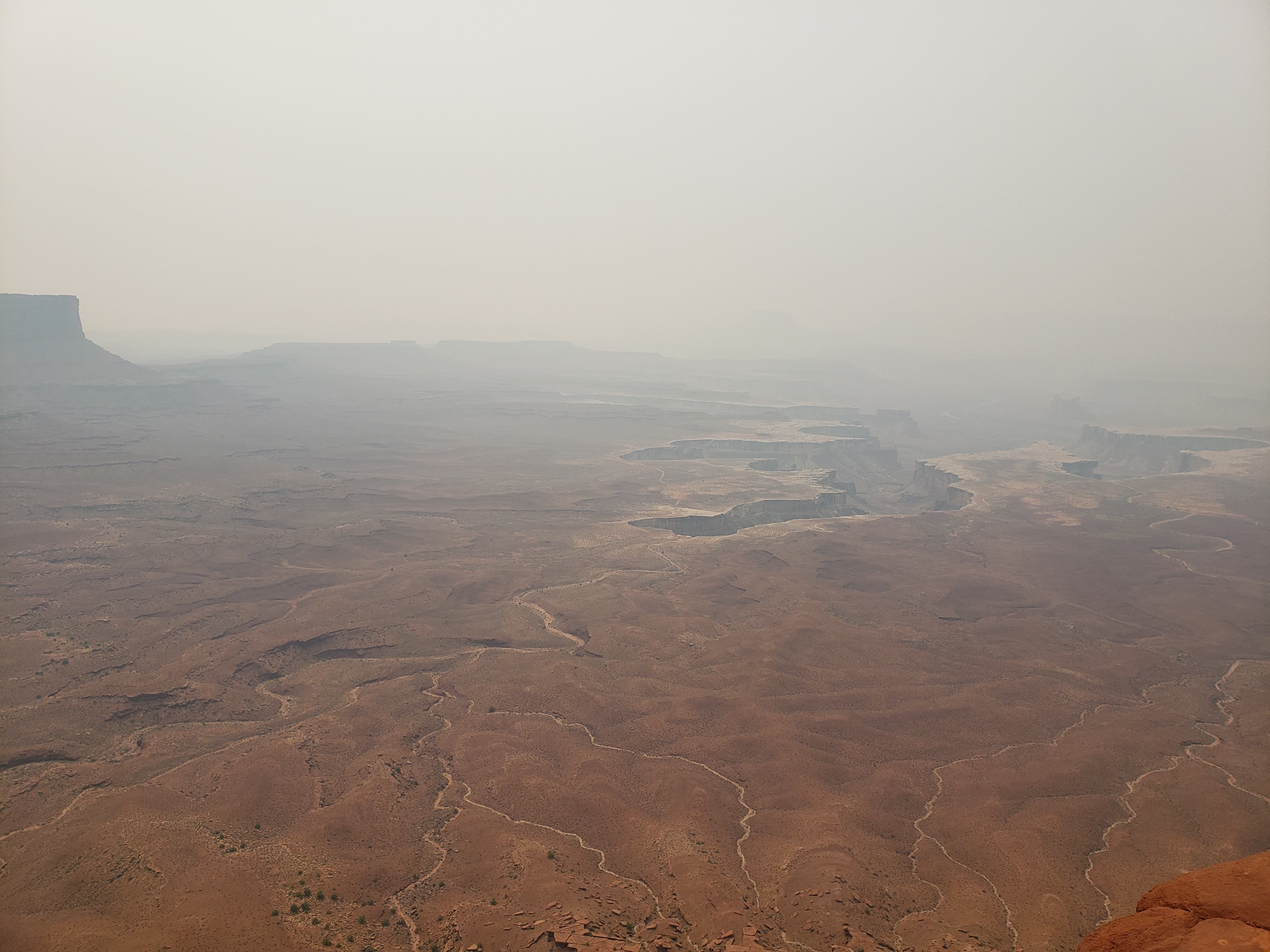
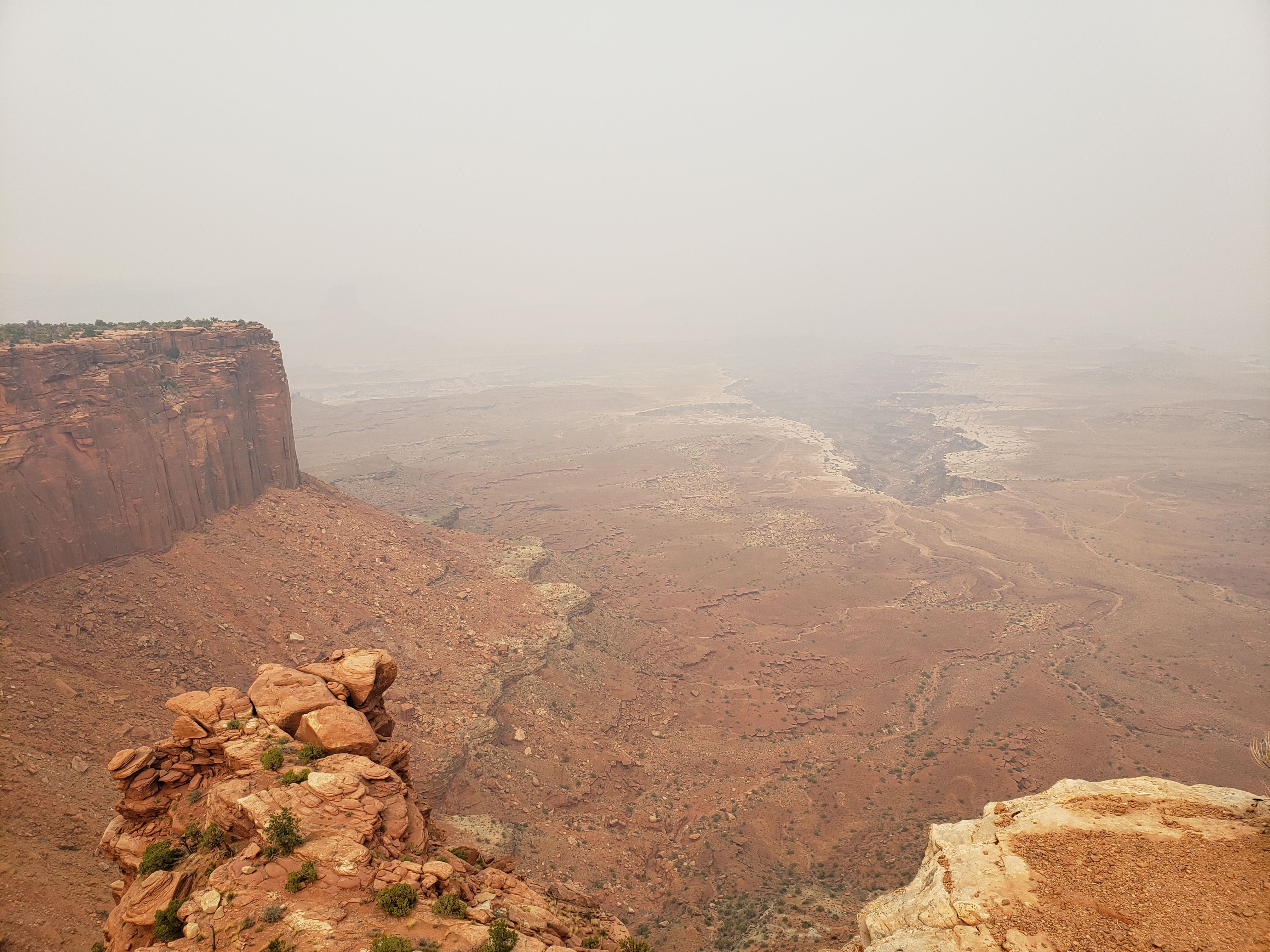
Our next stop was the hike out to Murphy Point. It was quiet and the trail was flat. We only saw a few other people. If I did it over again I’d probably skip Murphy Point. It was pretty but the views were similar to others and it wasn’t a short hike (3.6 miles in total). Also the relative haziness throughout the day made some of the wide vistas harder to see and a little less impressive.
Our next stop was Grand View Point overlook. There were views from the parking lot and also a short trail that followed the canyon rim and provided more great vistas.

Next we stopped at the White Rim overlook trail. We were feeling beat so we decided not to hike the trail. Instead we had a snack at the picnic area next to the trailhead. It wasn’t as hot as yesterday—the high was only around 90 degrees. The wildfire smoke seemed to block out some of the heat from the sun which probably helped the temperature stay a little lower.
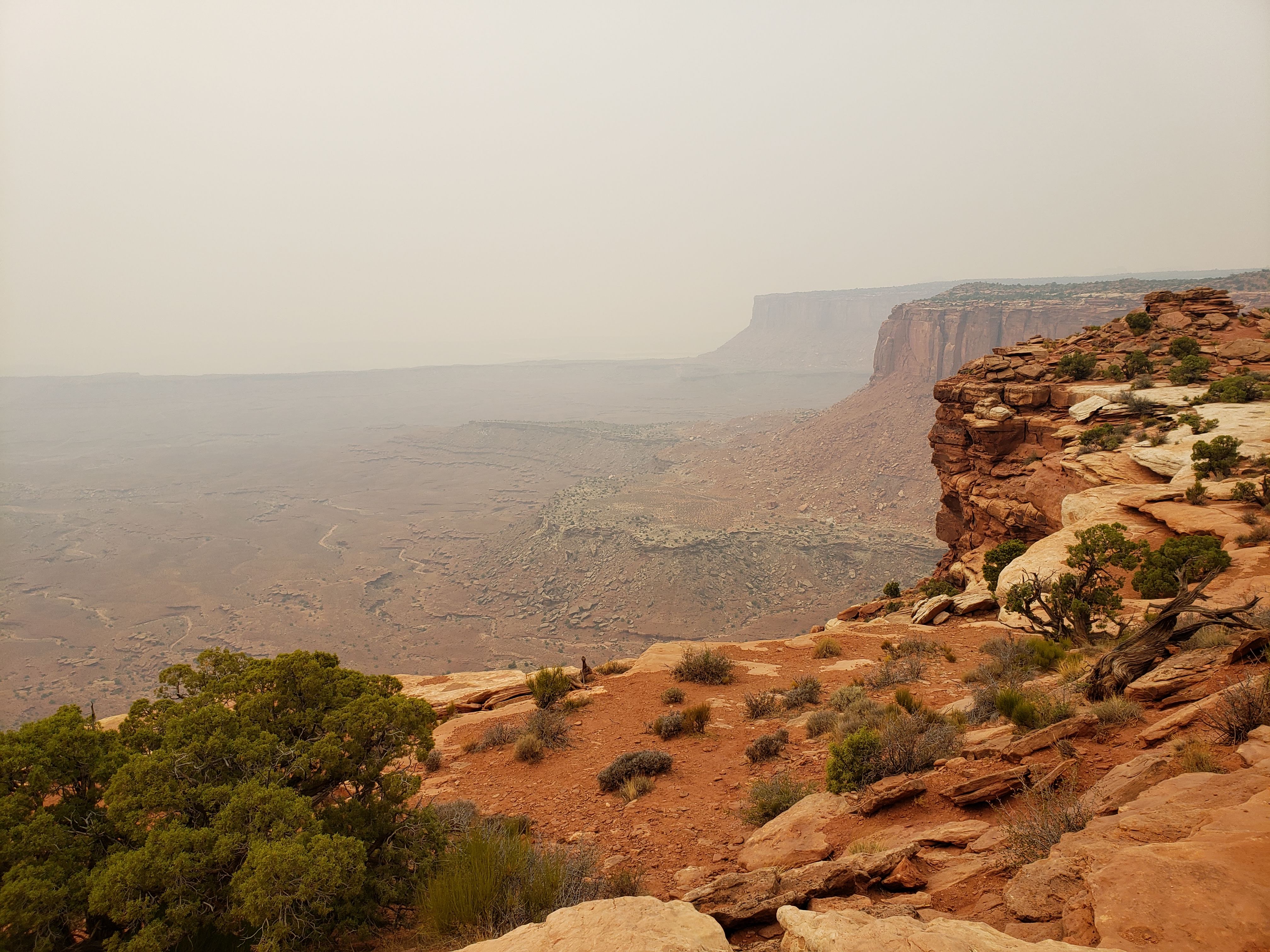
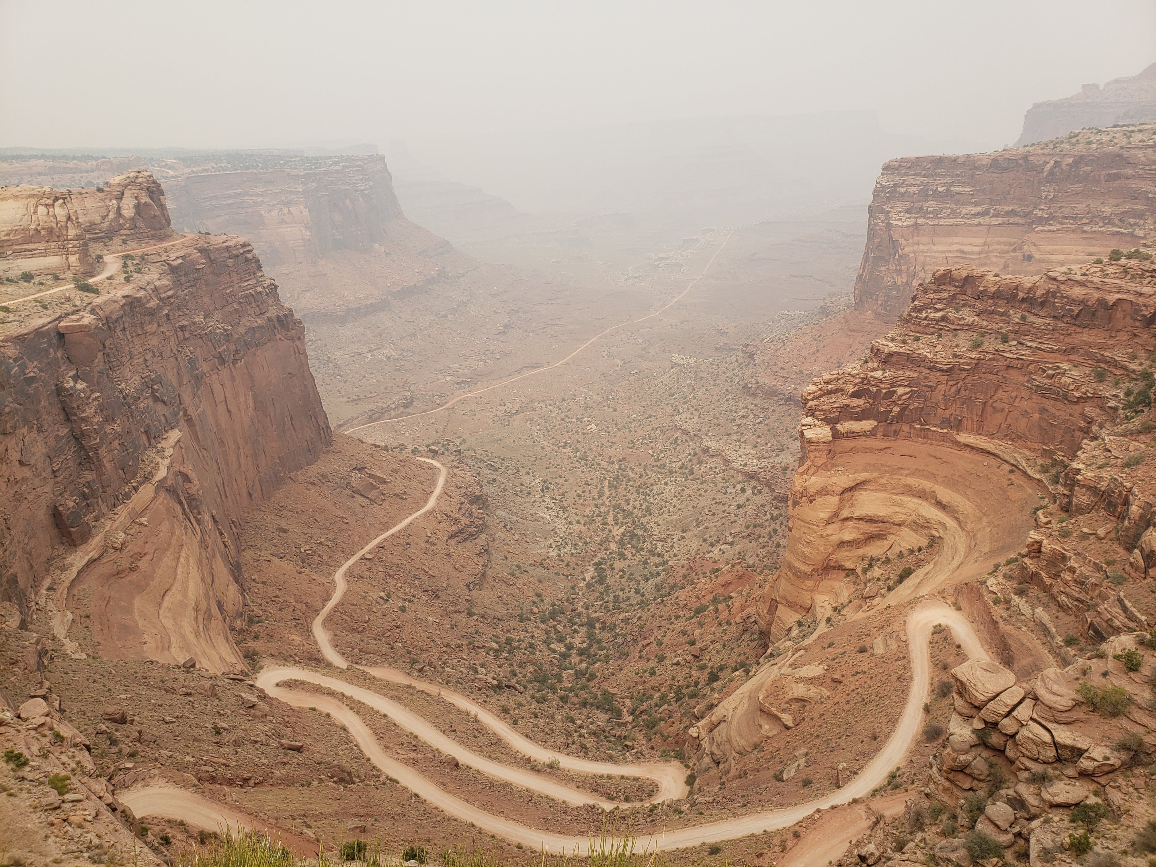
Our last stop on the way out was the Shafer Canyon overlook. It also happens to be the location of one of the main access points for the White Rim Road. Here’s the creepy looking road down that Leah was scared to look at.
We left Canyonlands National Park and started driving back to our campsite at Arches National Park. If you’ve been paying attention you’ll notice that we forgot to take a National Park sign photo. Big mistake. We better remember to take one when we’re at the Needles section of Canyonlands National Park the next day. We had also considered going to Dead Horse Point State Park (it was a backup campground location if I couldn’t find sites at the National Parks) which is very close to the Island in the Sky section. We decided that the views would be similar, our time was pretty limited, and there was no need to really push it.
We got back to our campsite at Arches National Park and started a fire using the wood from Dick. We ate veggie dogs that we cooked over the fire for dinner. I had beer and Leah had wine. We used some of our body wipes to clean up. After a couple of days of hiking in the hot sandy desert they were a welcome cleanse.
There was a chance of rain overnight and lows in the 50s were projected. There were even some reports that we’d see some snow. We left the rain fly up, but this time for actual rain. The wildfire smoke made stargazing pretty lousy. Our plan for the next day was to hike to Landscape Arch in Arches National Park and then to drive to the Needles section of Canyonlands National Park.
Total miles hiked: 10.5 Weather: Hot and hazy, high of 92
Day 5 – Arches NP and Canyonlands NP
We woke up around 7 AM to a light rainfall. It had been very windy the night before. As we began to rise and shine and leave the tent, the rain started to fall harder. We huddled underneath the opened trunk door of the car to eat breakfast. The temperature was in the low 40s. The rain didn’t seem to want to let up and we finally had to pack up what had become a very wet tent. The fine particles of wet desert sand were sticking to everything. It was all kind of a mess. We loosely packed the tent into the car, knowing that we’d have to dry it and wipe it off later. I felt a little foolish for not waking up 30 minutes earlier so that we could have packed everything up before the rain started.
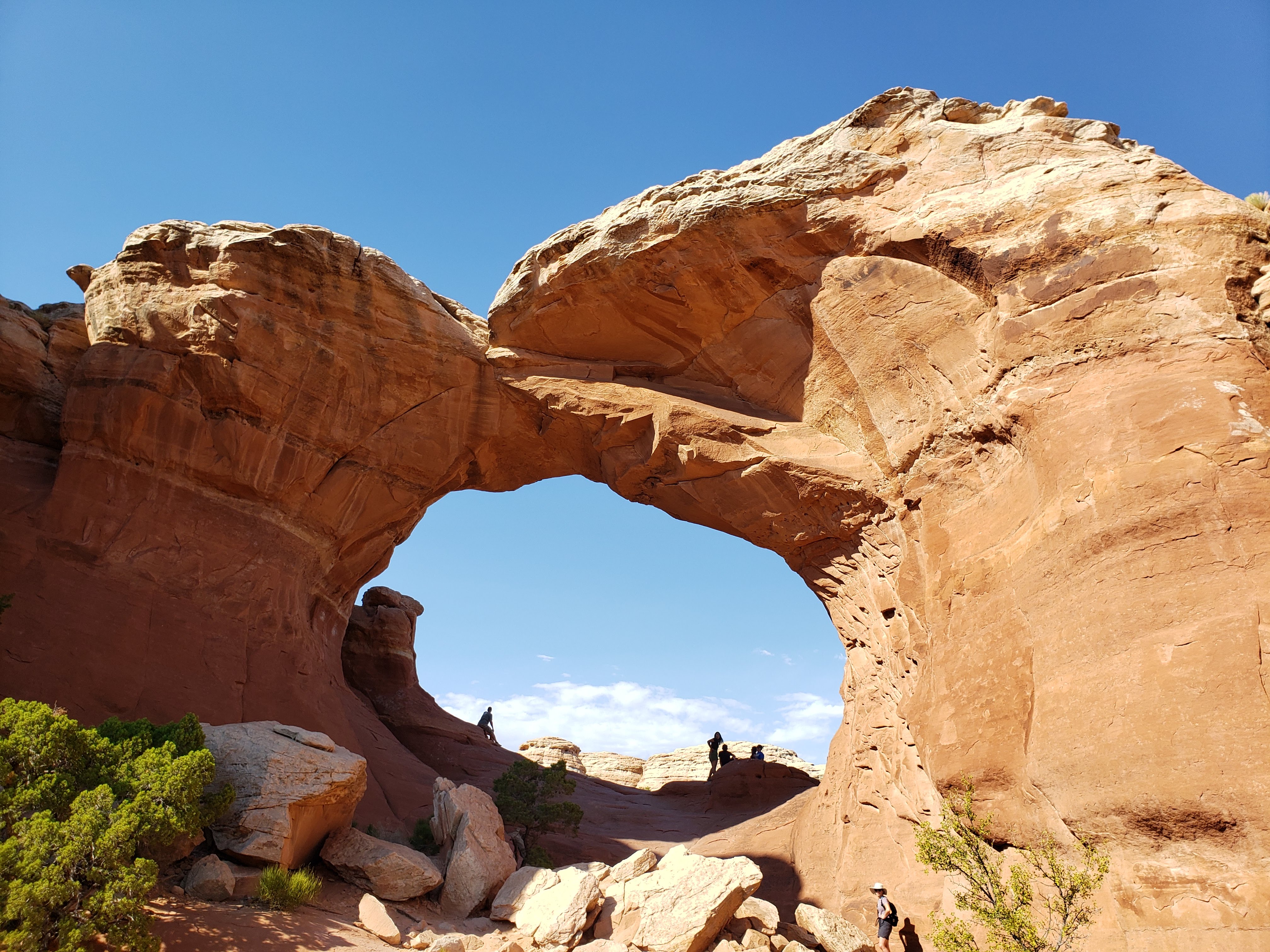
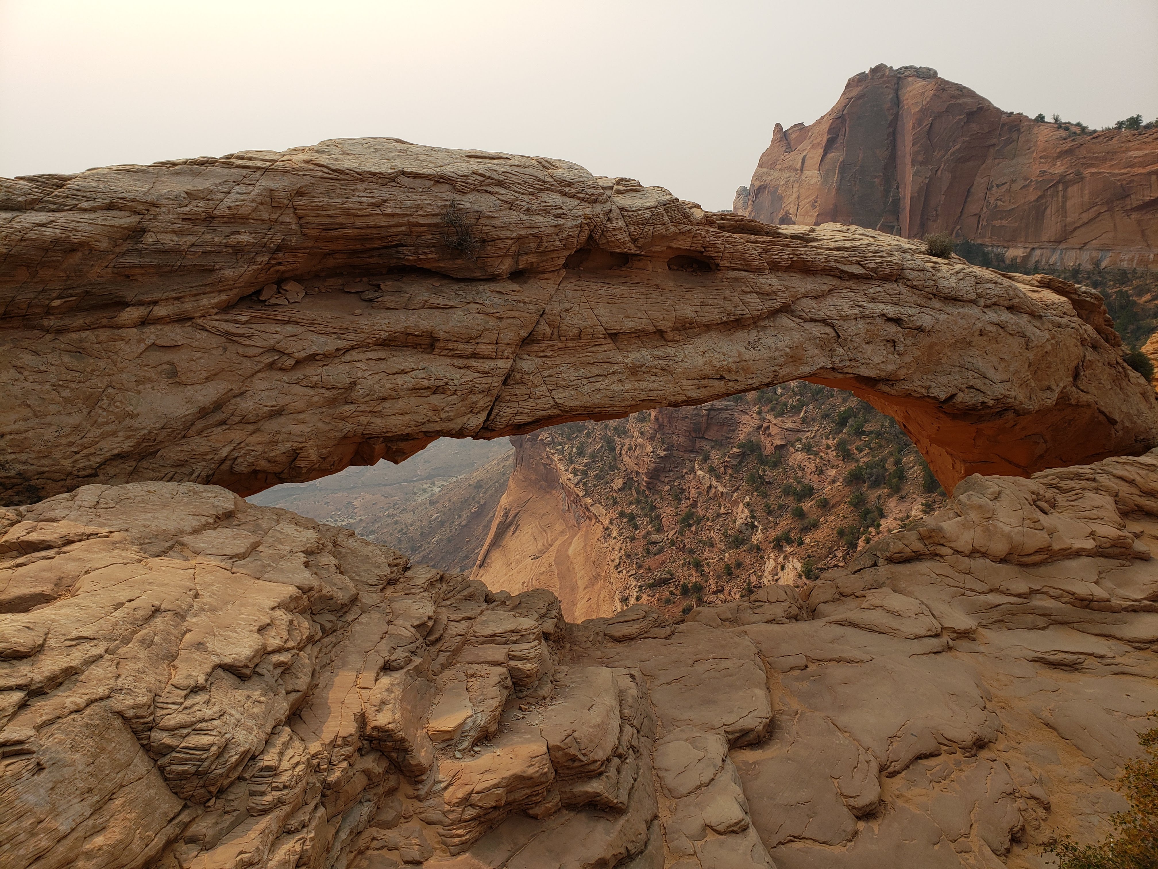
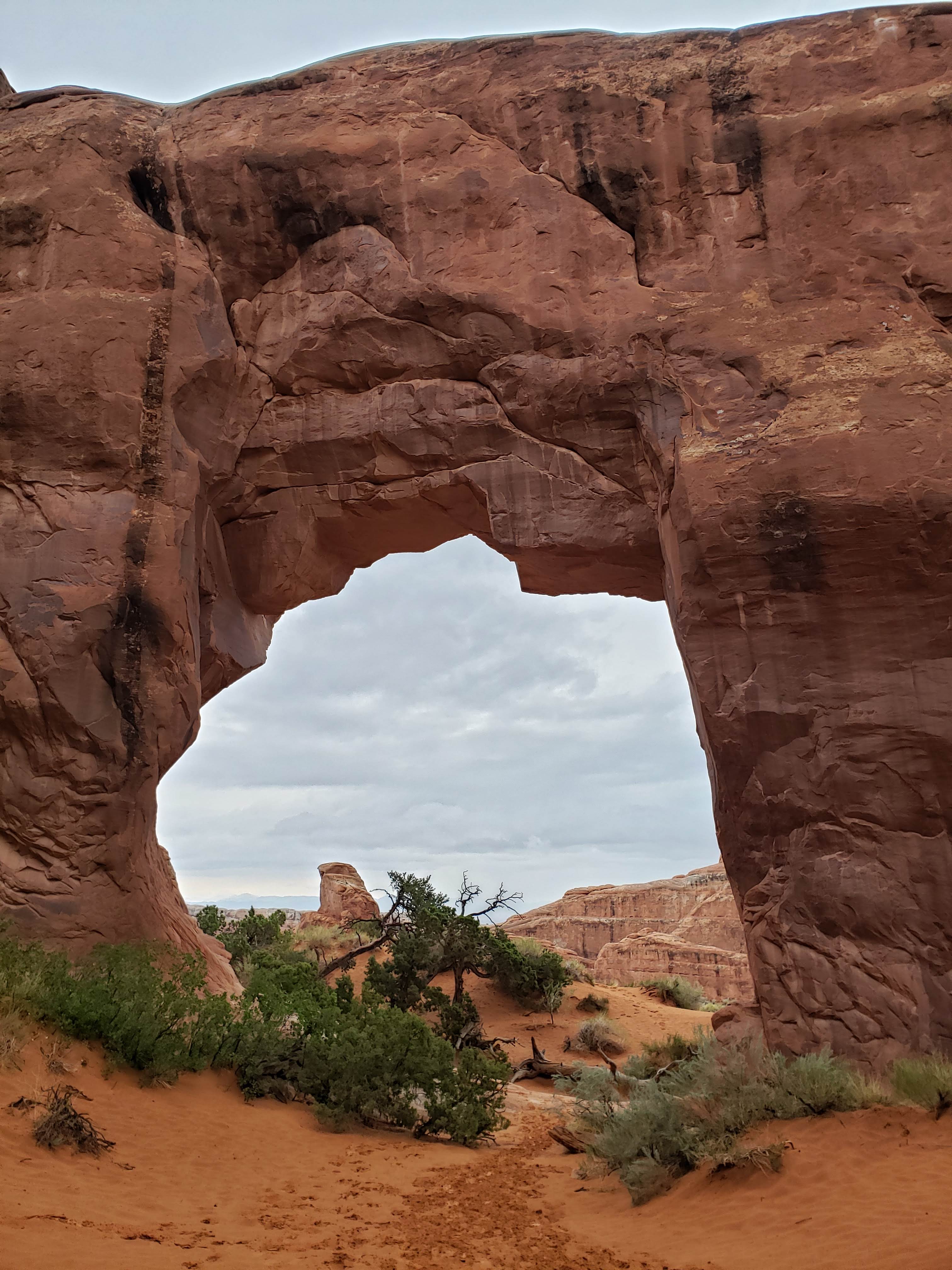
We headed to the Devils Garden trailhead, our last stop at Arches National Park before leaving for good. It was cold, dreary, and windy. There weren’t many cars parked at the trailhead. We were planing to at least hike to Landscape Arch, which at 306 feet across in the longest arch in North America. Due to time constraints and weather we weren’t sure how many other arches we’d get to on the hike. Our first stop was at Tunnel Arch.
Next we hiked a little spur trail to Pine Tree Arch. I guess it got that name because there’s a pine tree kind of underneath it.
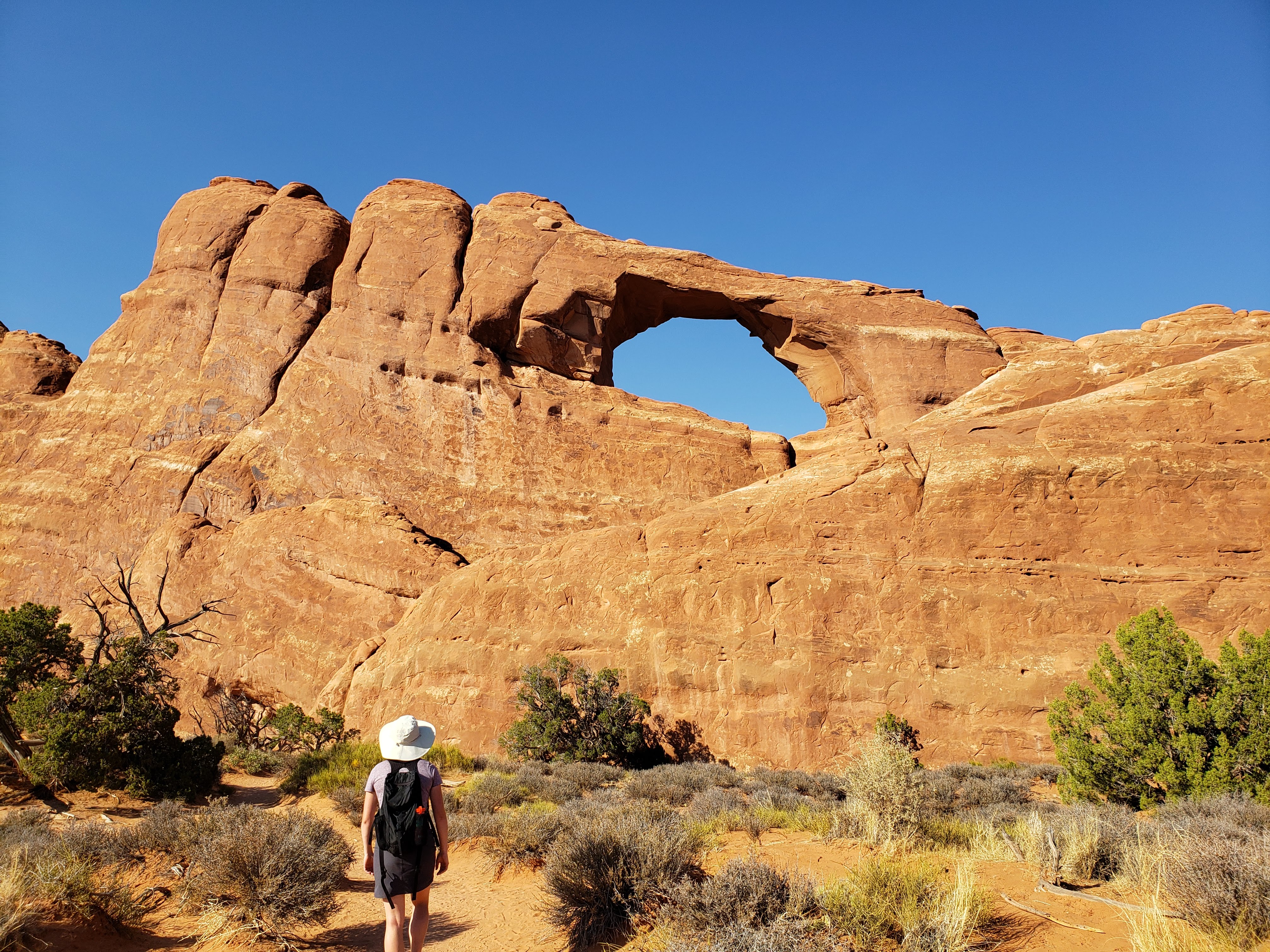
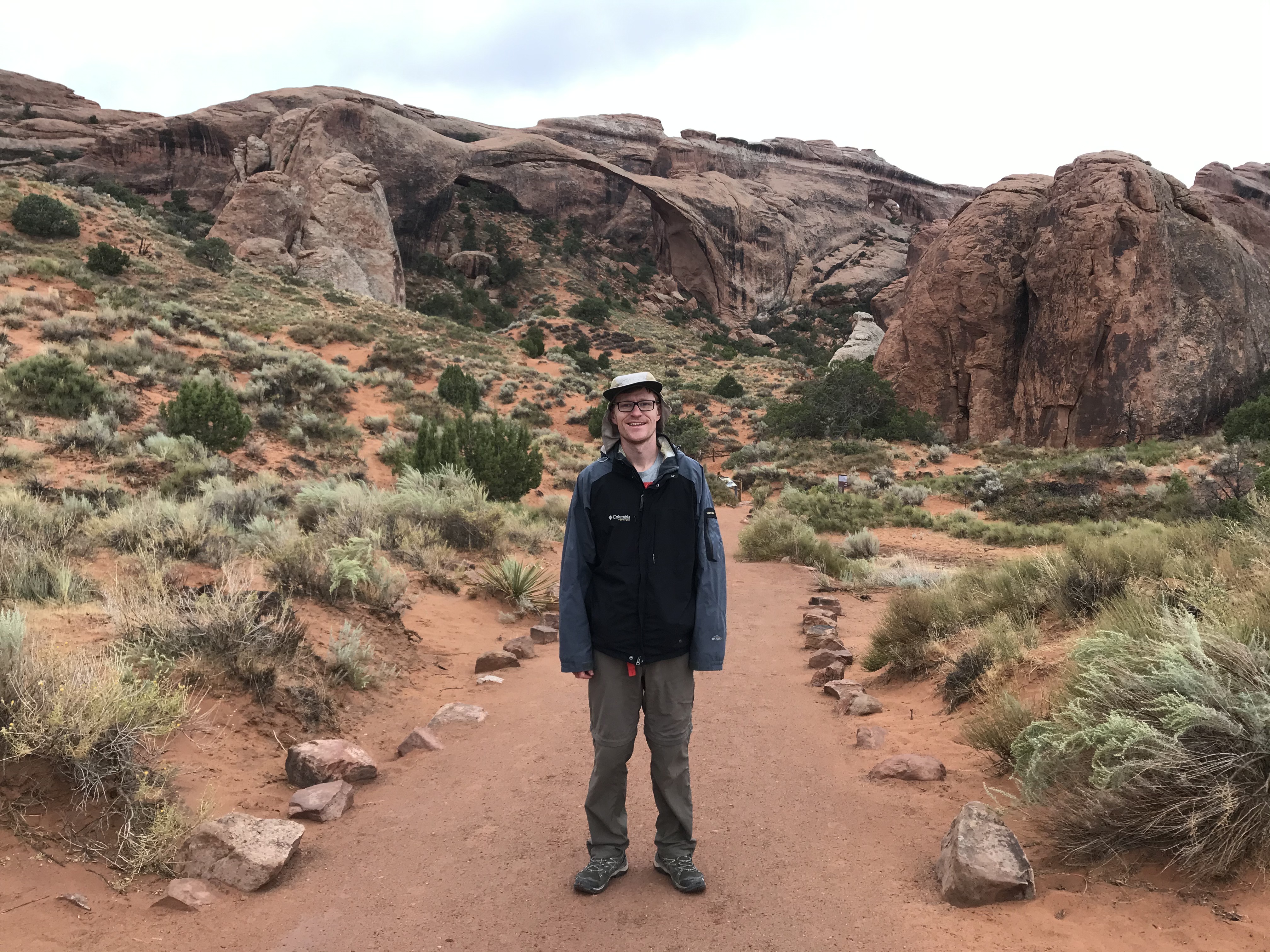
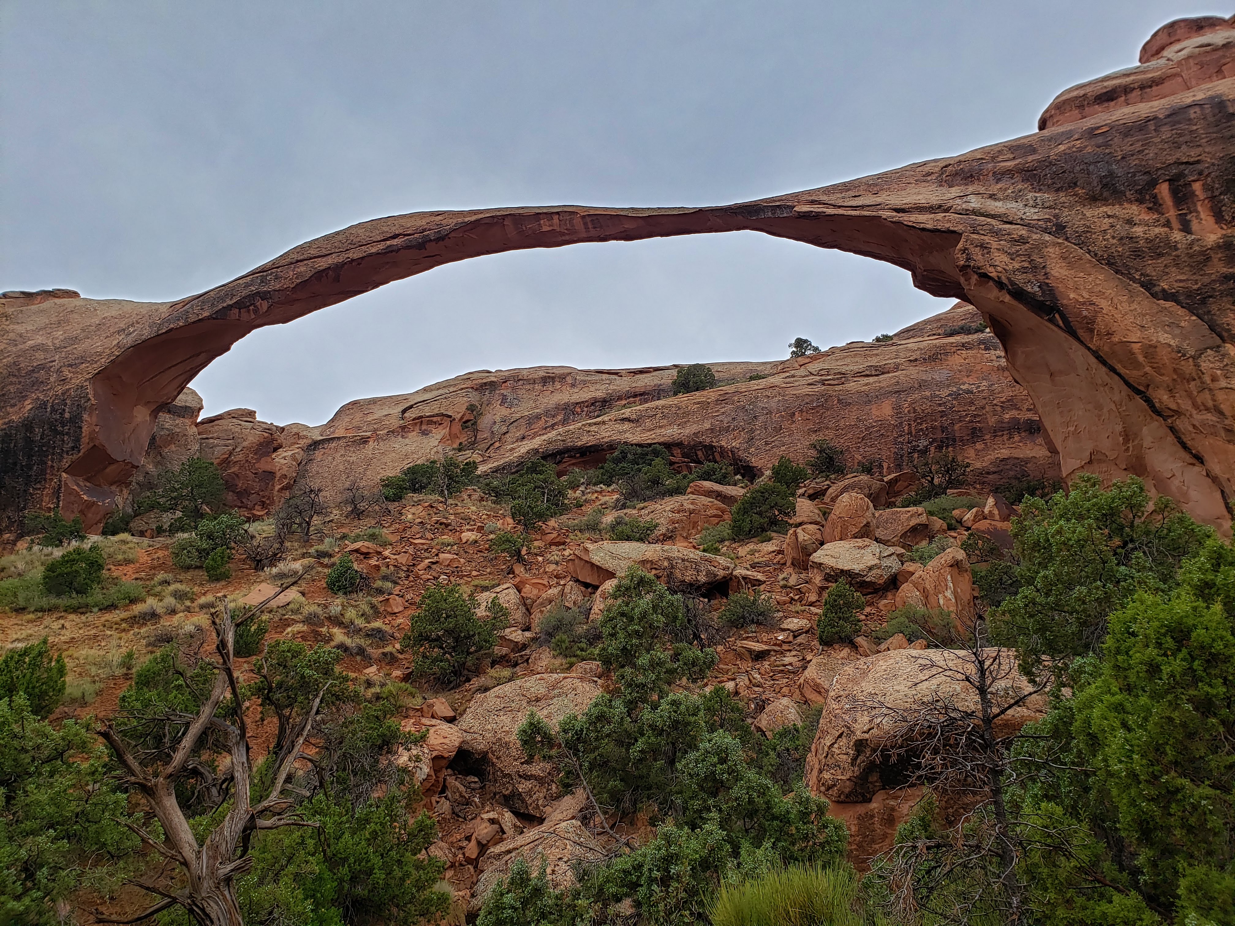
Our next stop on the hike was at Landscape Arch. It was hard to get a good picture of it—you had to have your camera in landscape mode (just some arch humor). In the 1990s there were a few large rockfall events that occurred which caused the park to close the trail the went underneath Landscape Arch. Here are a couple photos, one Leah took of me in front of Landscape Arch where you can mostly make out the curvature of the arch and one I took from much closer that really highlights the expanse.
We had been thinking that we’d try to make it out to Double O Arch but ended up talking to a couple that said they had turned around before that point. They said that they hiked to Partition Arch and Navajo Arch and then turned around. They said that the trail was primitive and the rainy conditions made it slippery and dangerous.
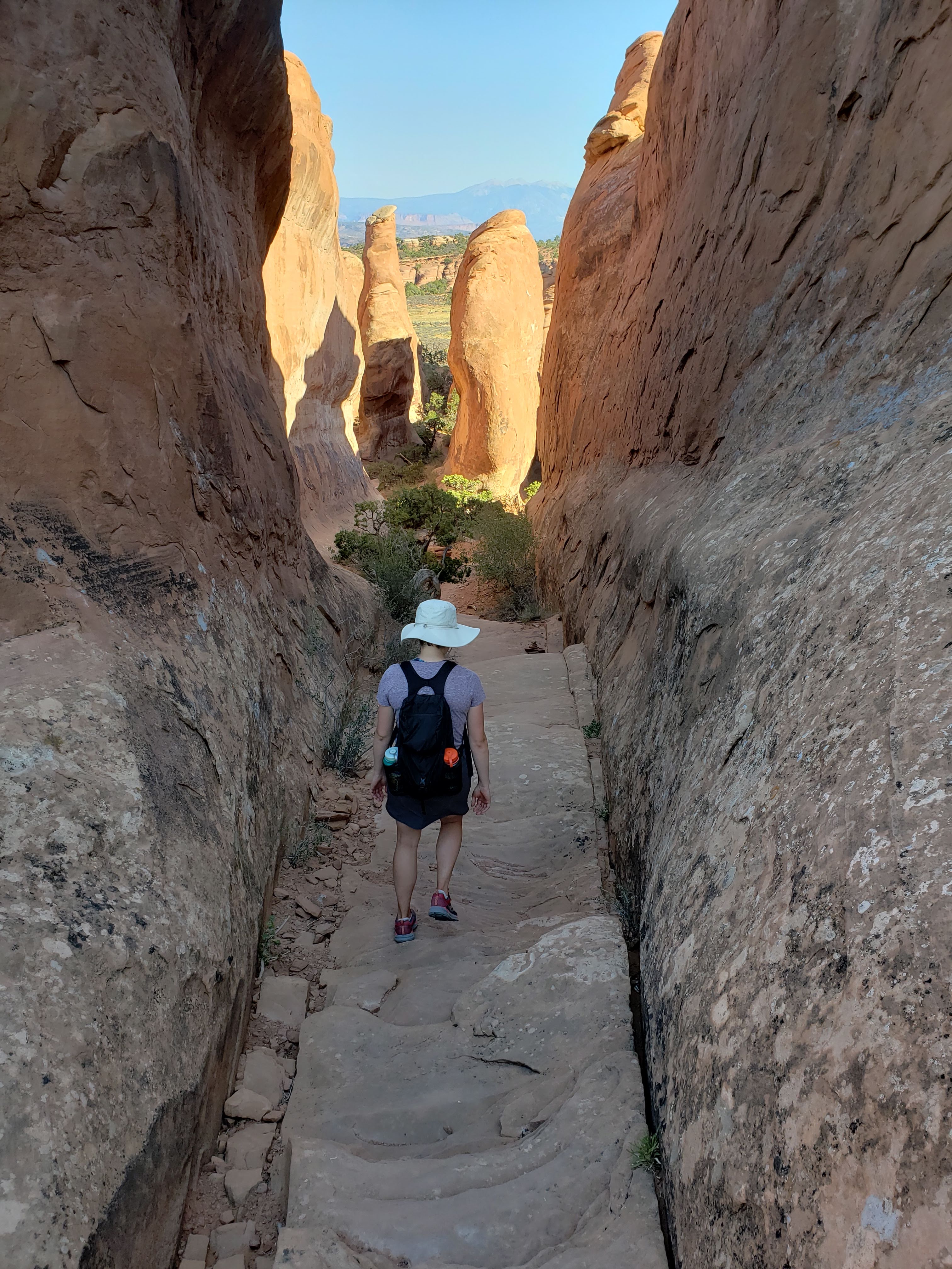
I usually have a hard time turning around or stopping a hike before we finish it. But the couple we talked to was right, the trail did get more primitive. There were some scrambles which when wet were treacherous. We decided to at least get to Partition Arch and Navajo Arch before turning around. Not long after starting the primitive section of the hike we ended up a little bit off trail. We did eventually make it to our destination.

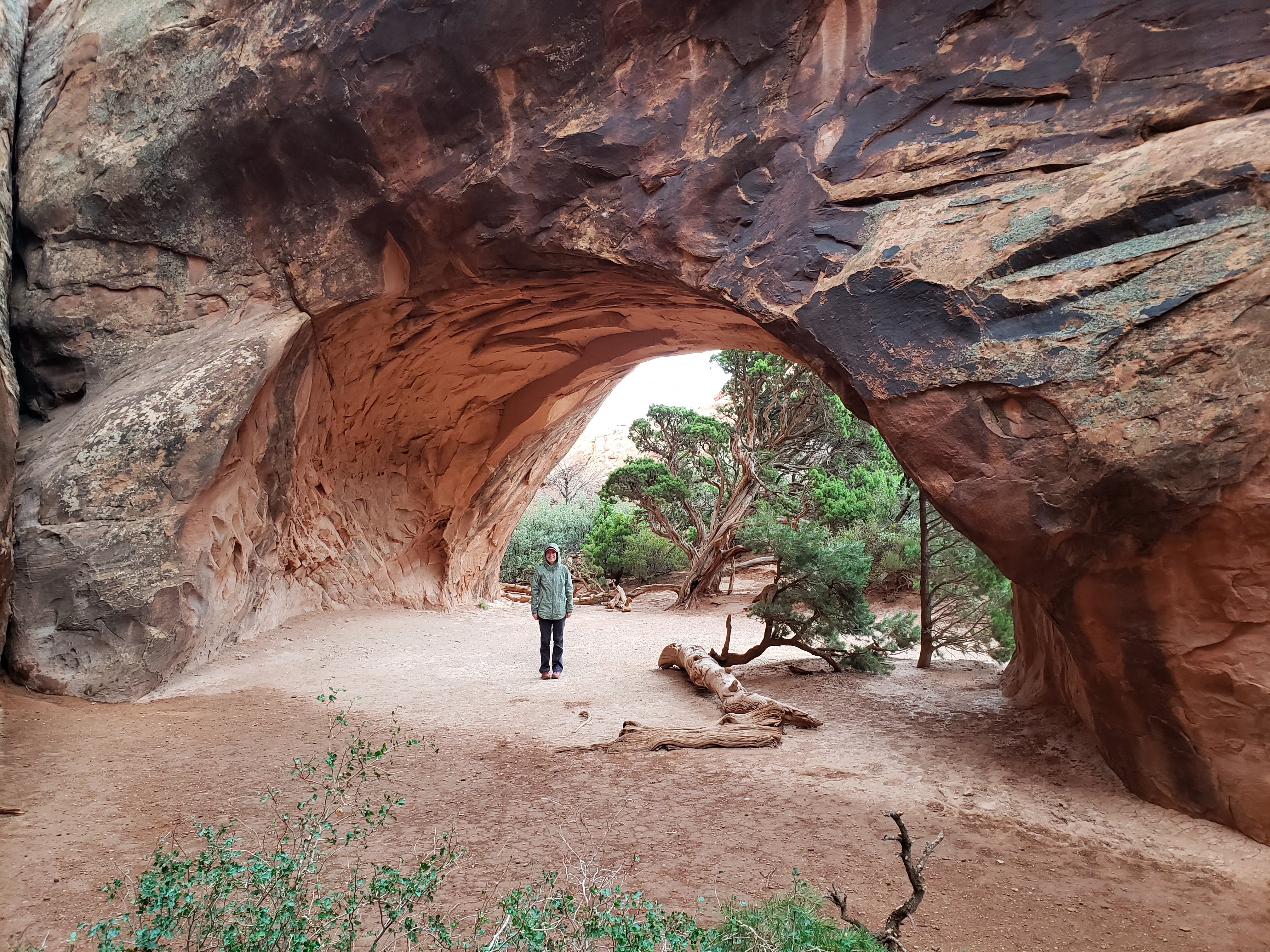
On our way back to the trailhead we found the place where we had gone off trail while going the opposite direction. The actual trail looked worse, with a long scramble up a wet and slick rock fin. We opted to return the way we came, albeit not on the proper trail. This time we were the rule breakers. I was a little bummed that we didn’t hike all the way out like I would have liked, but we had plenty more to do that day in the Needles section of Canyonlands National Park. When we returned to the Devils Garden trailhead parking lot there were a lot more cars and people.
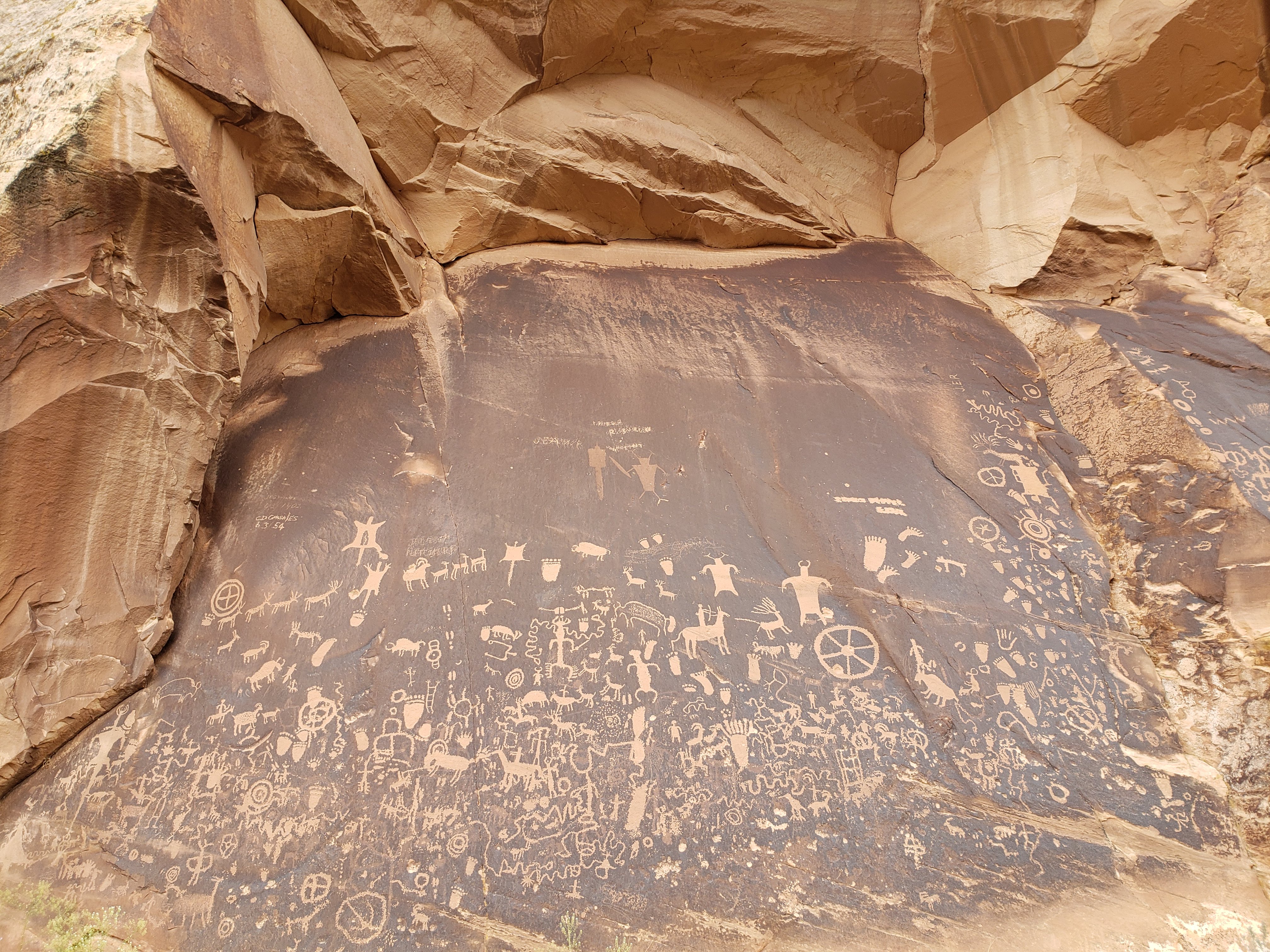
We drove out of Arches National Park for the last time. We headed south through Moab towards the Needles section of Canyonlands National Park. From Moab to the visitor center of the Needles section is about a 90 minute drive. We turned off the main highway onto a long and winding road that led to Canyonlands National Park. Along the road we stopped at a section of petroglyphs called Newspaper Rock. Leah was going to use the restroom at the parking lot for Newspaper Rock but thought otherwise when she saw that it was full of garbage.
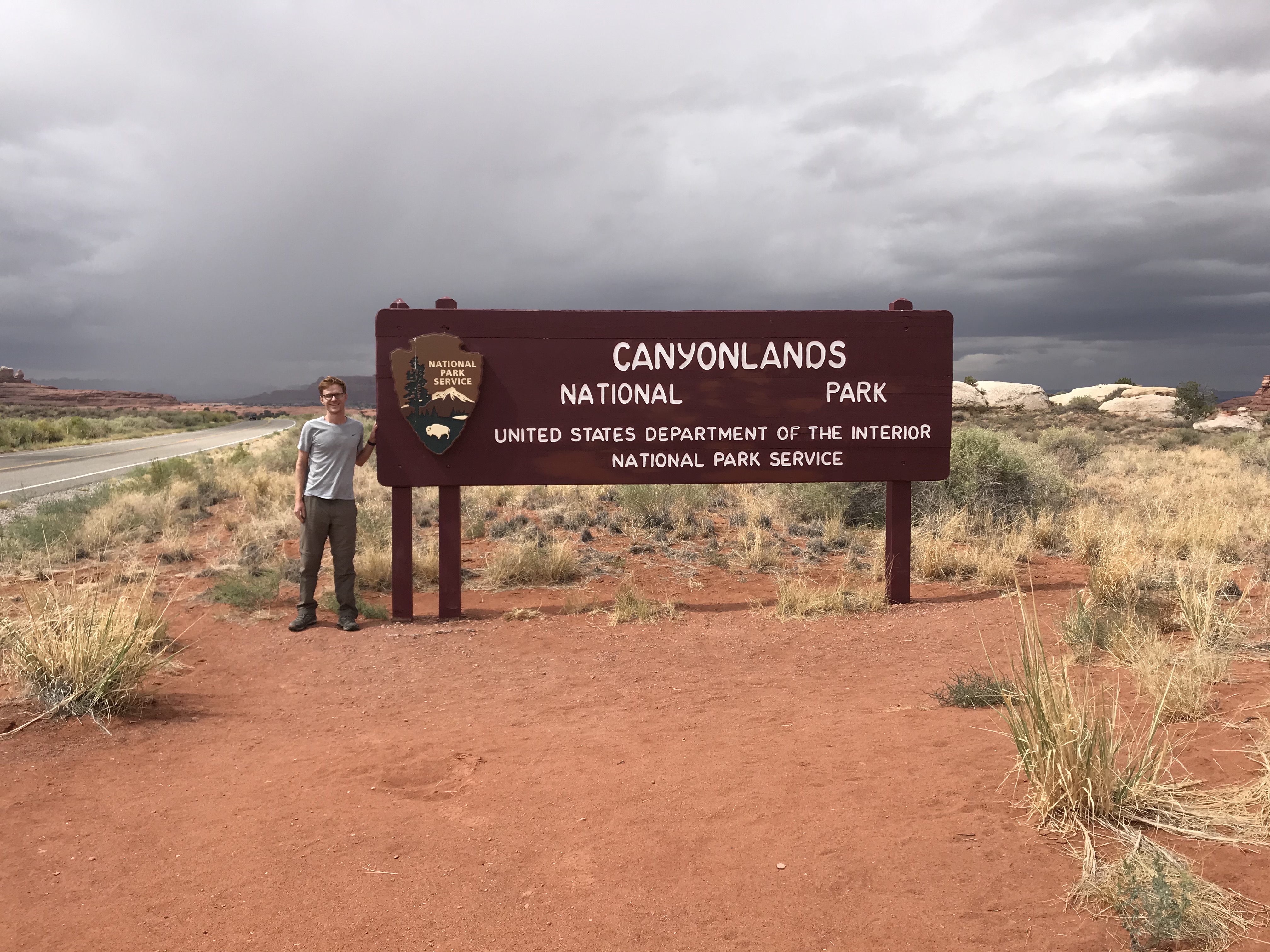
The road leading into the Needles section was beautiful as well as remote. It felt so far removed from the busy roads and people of the previous days. When we finally entered the park we made sure to take a National Park sign photo.
First we stopped at the visitor center to talk to a park ranger. We asked for day hike suggestions and he gave us questionable routes and distances. After a little bit of back and forth, a hike (that we had read about in guide books) out to Chesler Park was brought up by us. He then mentioned that this hike is probably the best showcase of the pinnacles that give the Needles section its name. You think he would have led with this information? Gosh, it sure felt like pulling teeth to finally get the answers that we were looking for. He was not one of our favorite rangers. The park store was closed for lunch so we decided to eat our lunch as well. We had a cold lunch in the cold and windy parking lot. Temps were still in the 40s but at least it wasn’t actively raining.
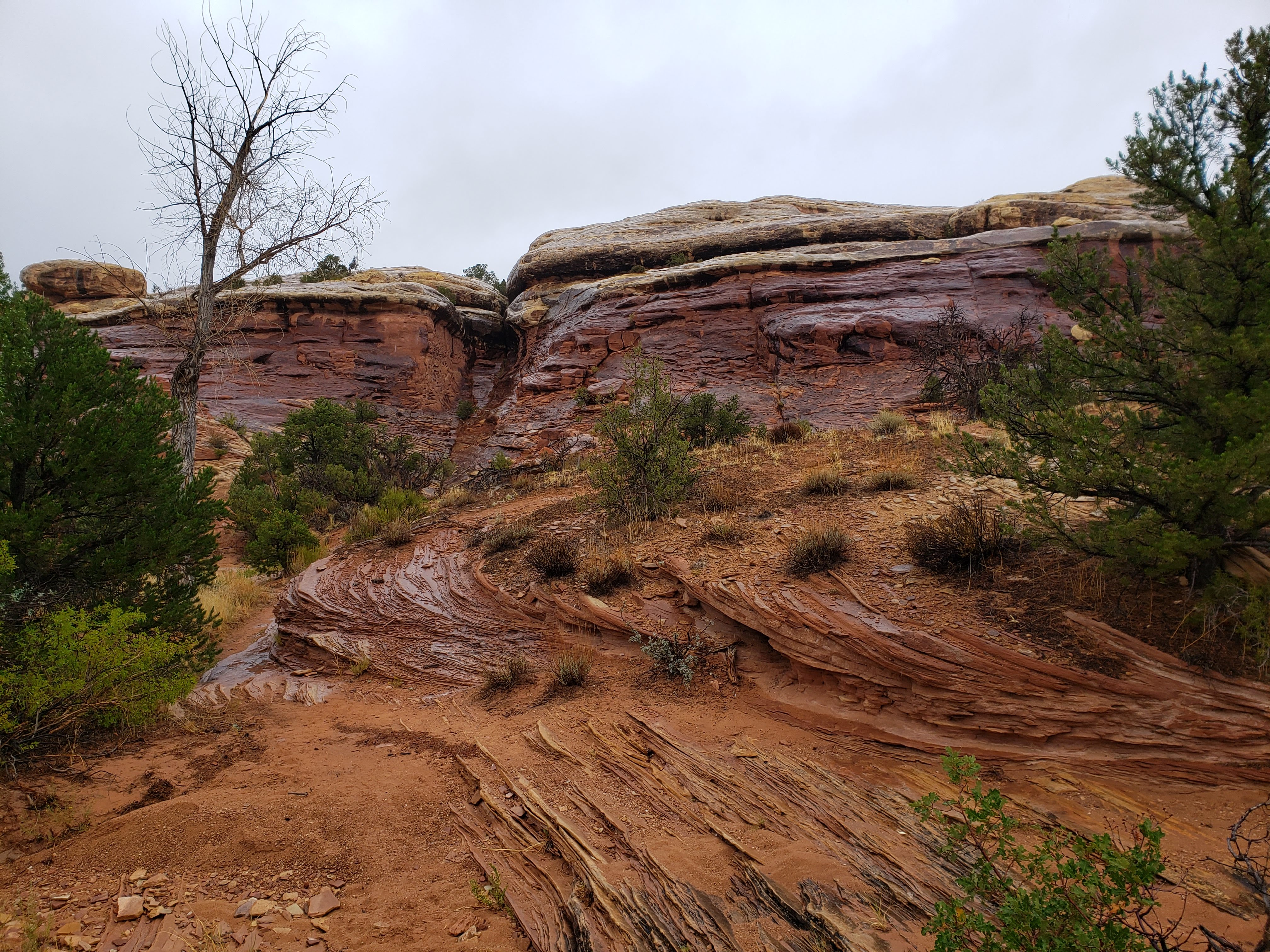
Our first hiking stop in the Needles section was at Roadside Ruin. As the name implies it is just a short roadside hike. There was a grainary but it wasn’t as cool as the one at Aztec Butte in the Island in the Sky section.
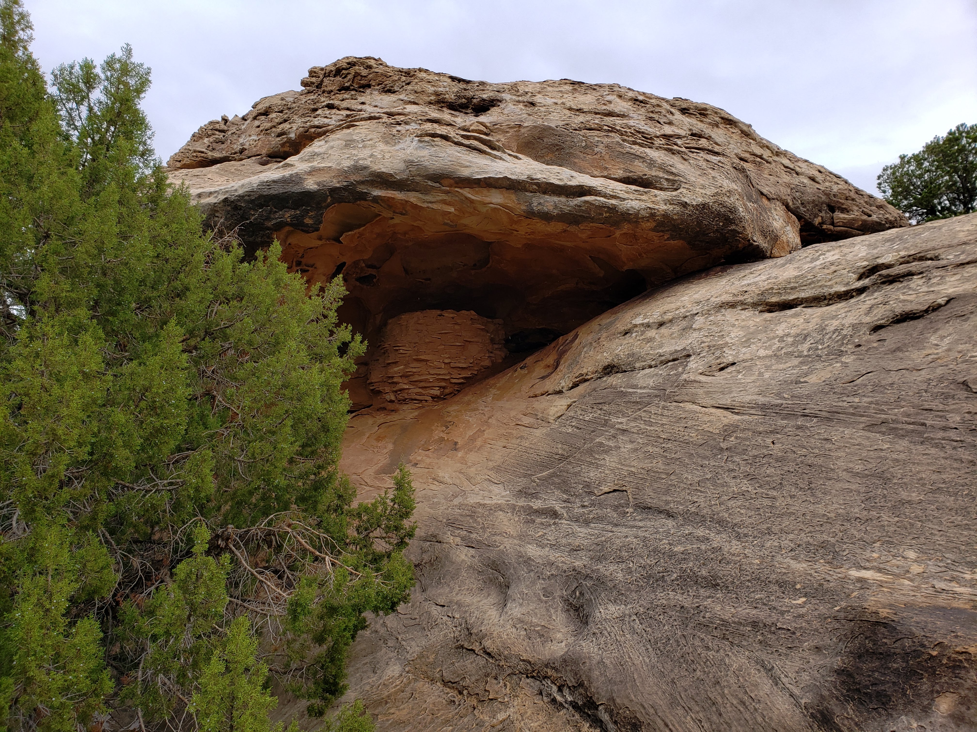
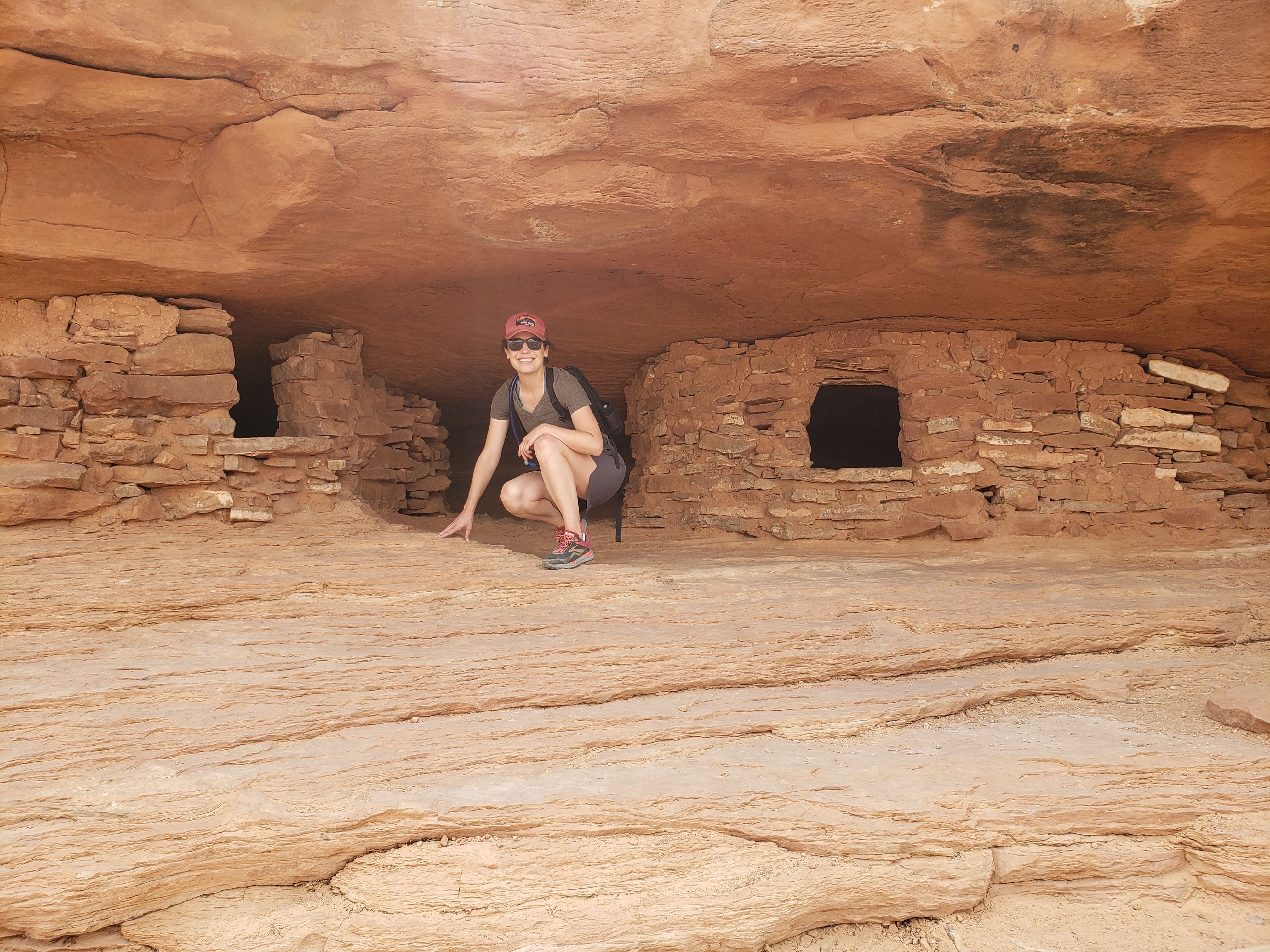
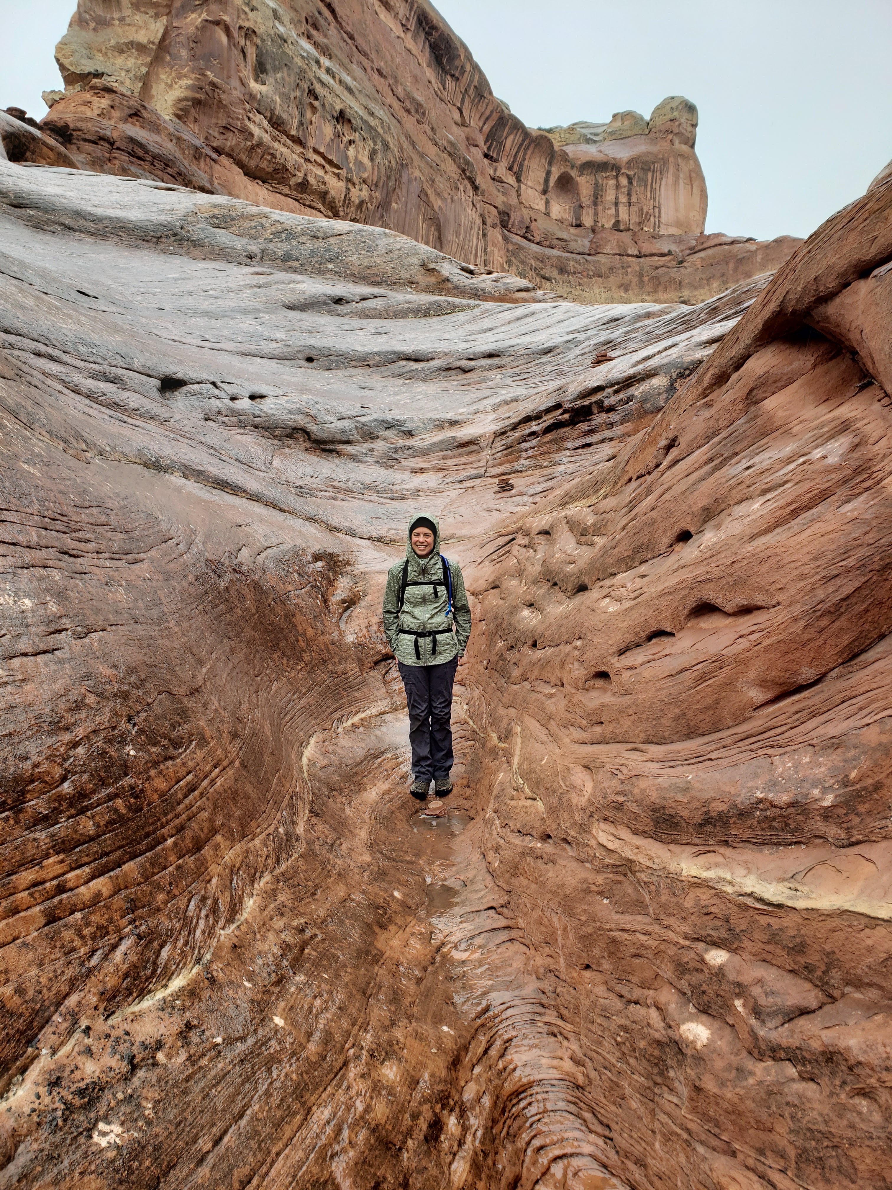
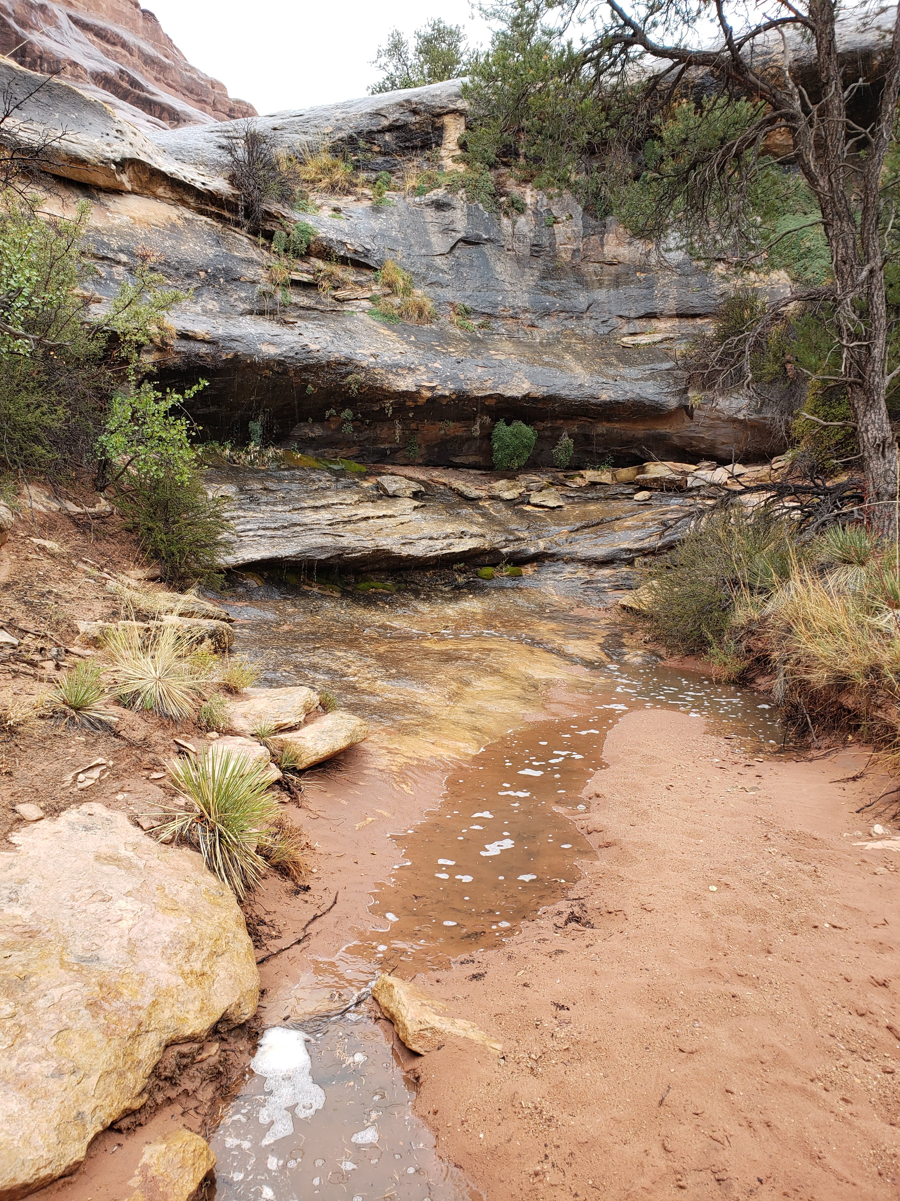
Our next stop was at Cave Spring. It’s a short trail that passes by ruins of historic ranching operations that were active until 1975. As the name would imply, there’s an active spring in an alcove of the cave—a vital source of water in the vast desert that surrounds it. On another wall of the cave there was some rock art left by the ancestral Puebloans who inhabited the area 1,000 years ago. There’s also a ladder that takes you on top of a mushroom shaped rock formation—the surface of which is an example of slickrock—with views in all directions.


Next we stopped at an overlook for Wooden Shoe Arch. It was so far away that the photo is really not that impressive, but here it is regardless. In person you could see the arch better and it made sense why it’s called Wooden Shoe Arch.

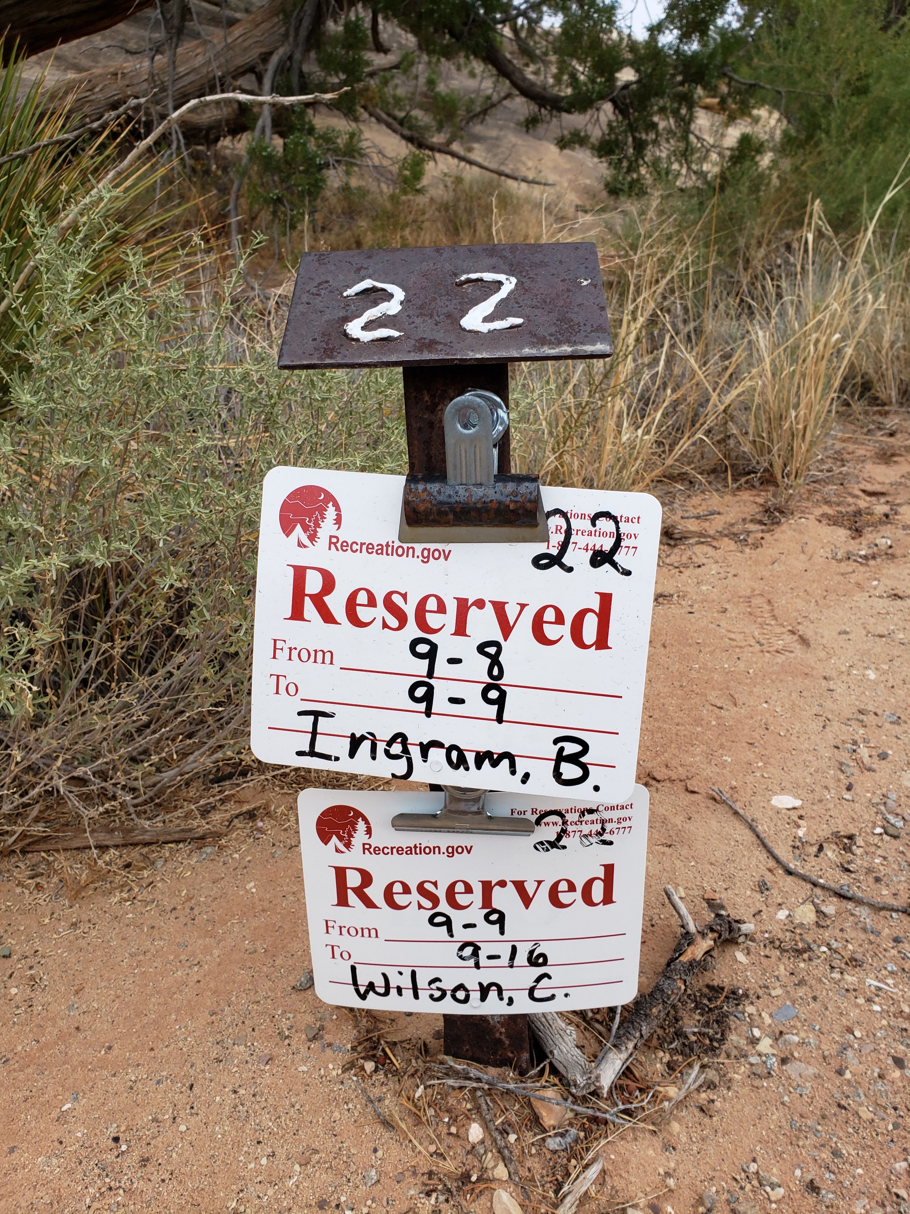
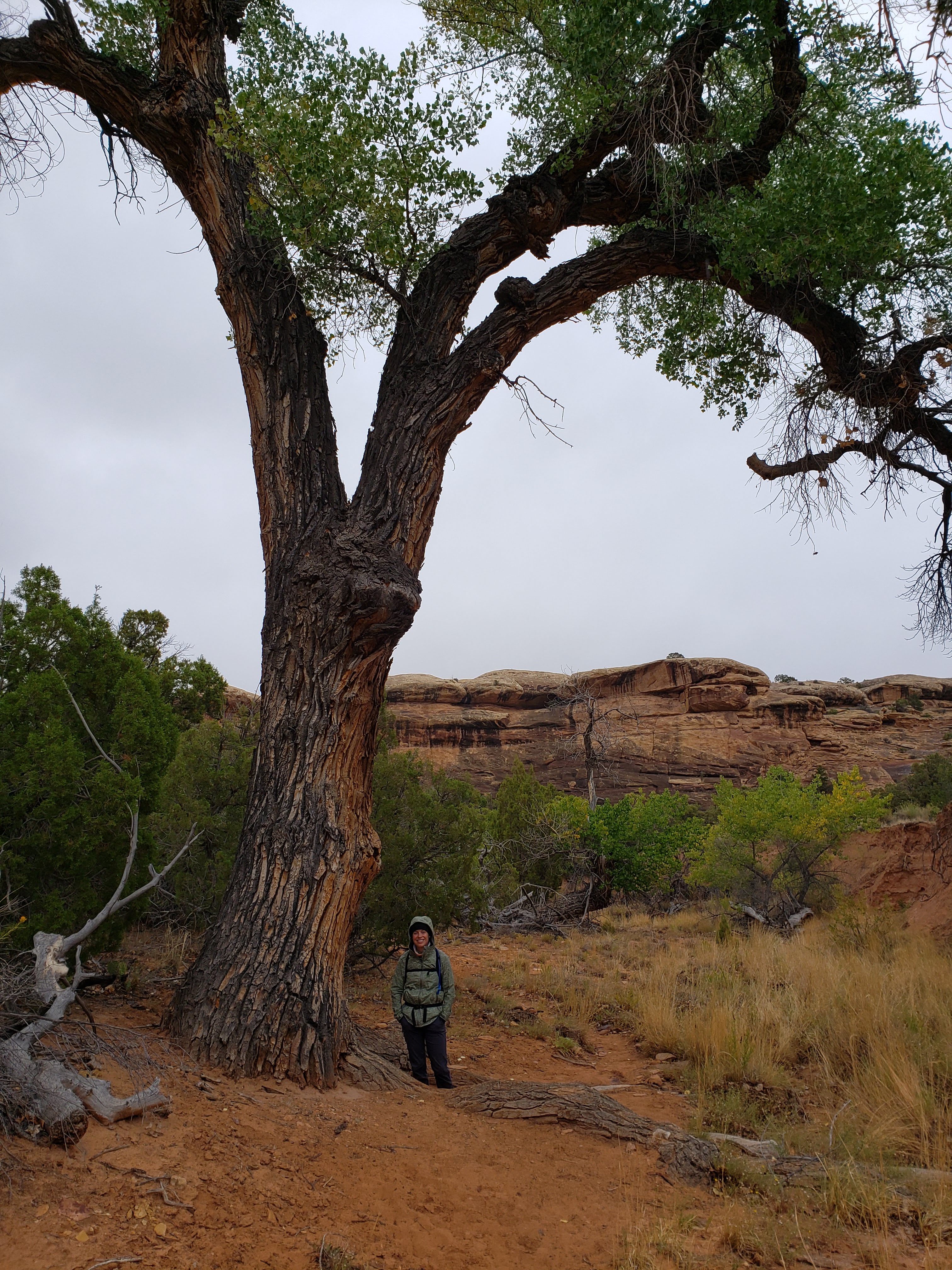
Next we headed to the campground to set out our wet tent so that it could dry a little bit before we had to set it up again that night. There was another site that had a picnic table that fit entirely underneath the overhang of a large rock formation. The campground was really cute and pretty intimate—just 26 total sites. I though that we ended up with a really great site (#022 for anyone that’s curious). It was on a smaller loop of the campground and we only had 2 other campsites visible from ours.
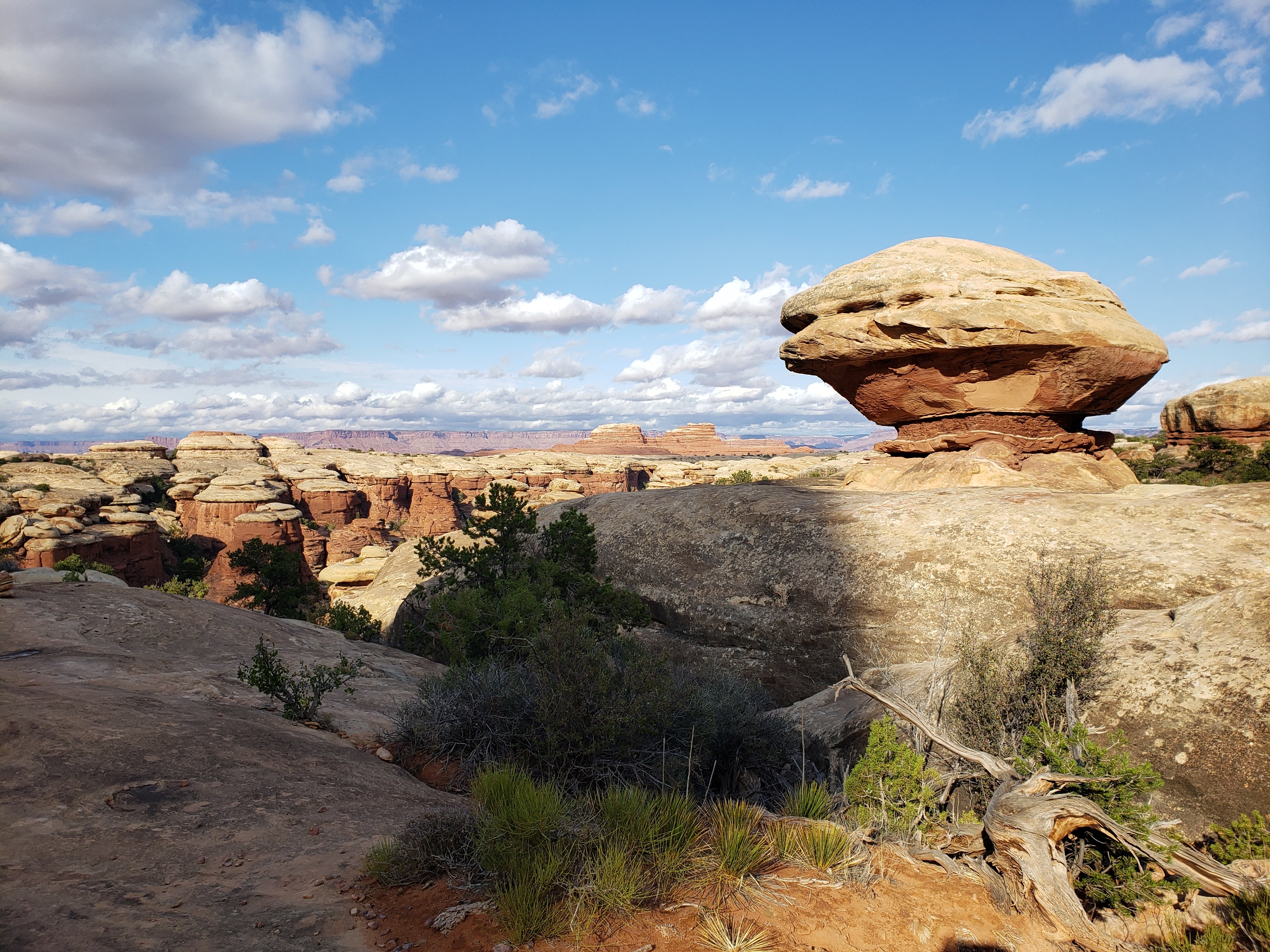
A quick side note, this campsite was my favorite site of the entire trip. It was amazingly beautiful, quiet, had drinking water, and there were flush toilets. We only ended up spending one night there but I could have easily spent a few more. A small spoiler to some thoughts I’ll share later; Canyonlands National Park was my favorite park we visited on the trip (with some caveats and expanded opinions explaining my choice coming in a summary section). I took the following photos once we had returned to the campground that night and set up camp but I thought they’d be good to share now since I’m talking so much about the site.

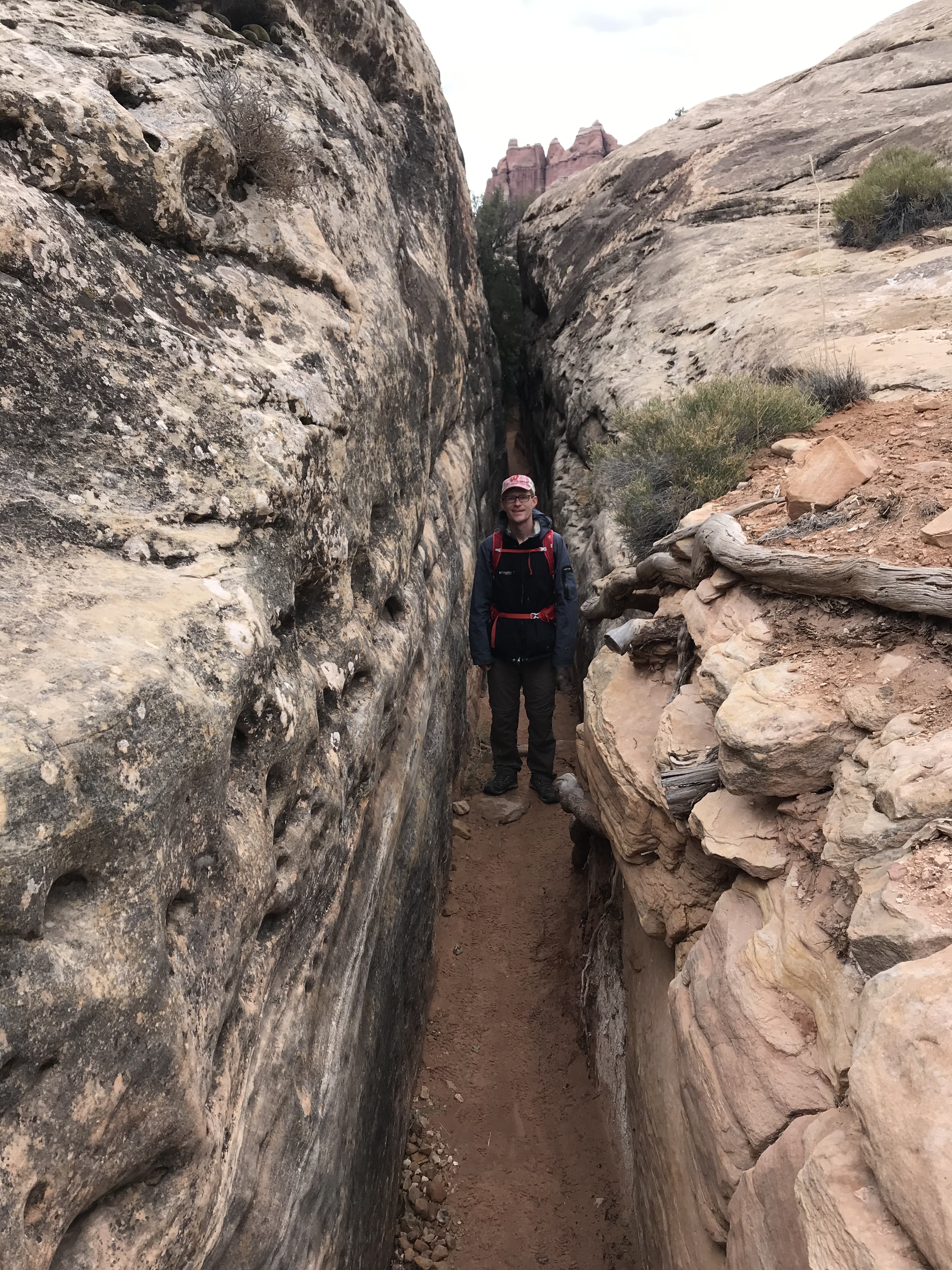
After leaving our wet tent to dry at the campsite we headed to the Elephant Hill parking lot. To get there we had to drive on a narrow and bumpy dirt road that was partially washed out in a couple spots. The Elephant Hill parking lot is one of the main access points to the backcountry hikes at the Needles section. There were a decent number of cars there, though it was hard to tell how many of them were from day hikers like us or people camping overnight in the backcountry.
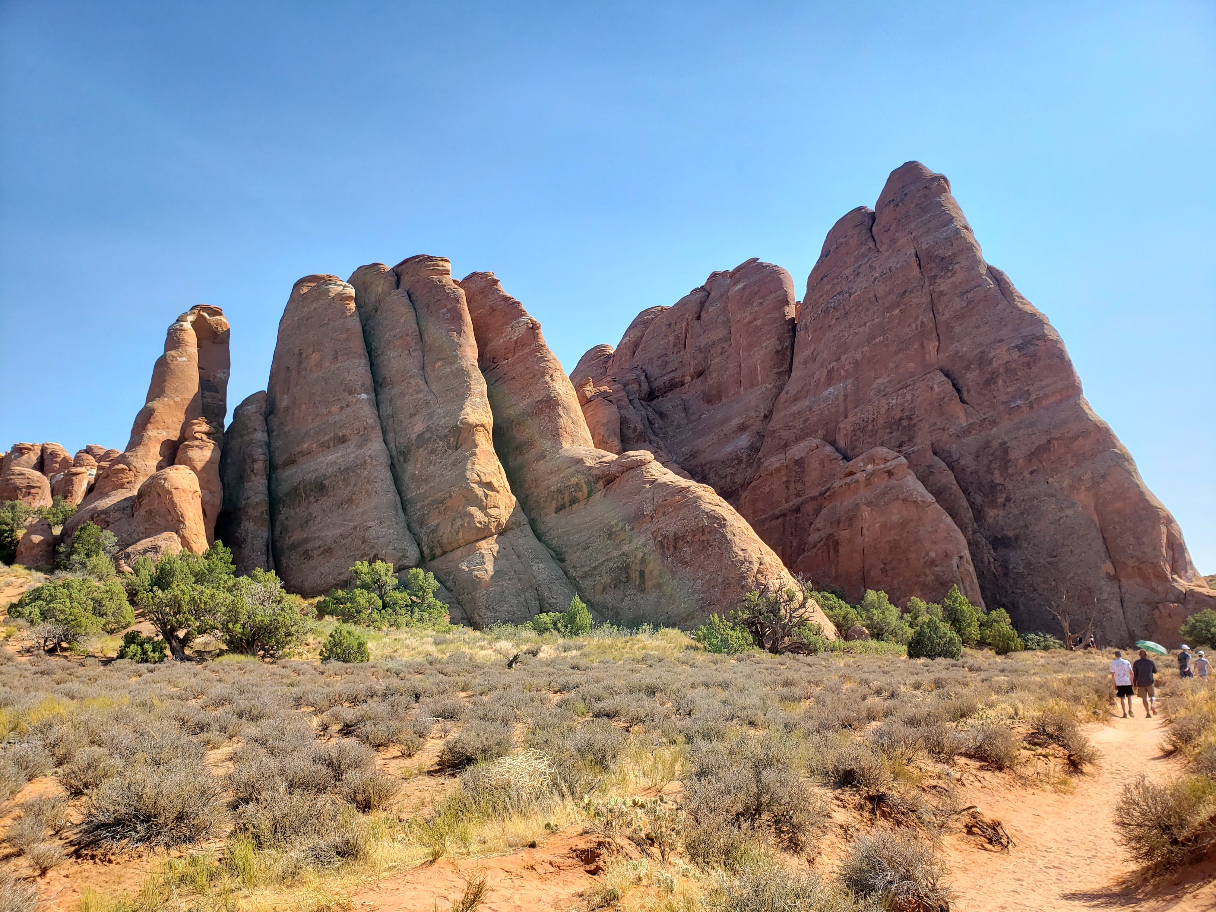
The Elephant Hill parking lot is the start of the Chesler Park Viewpoint Trail. The hike to the viewpoint is about six miles round trip which seemed like a doable distance to hike before it got dark. The hike was beautiful. We traversed cairn strewn boulders and dirt paths carved into canyons. The trail was mostly up and down with about 700 feet of absolute elevation gain from start to finish—though many more feet were gained and lost along the way.


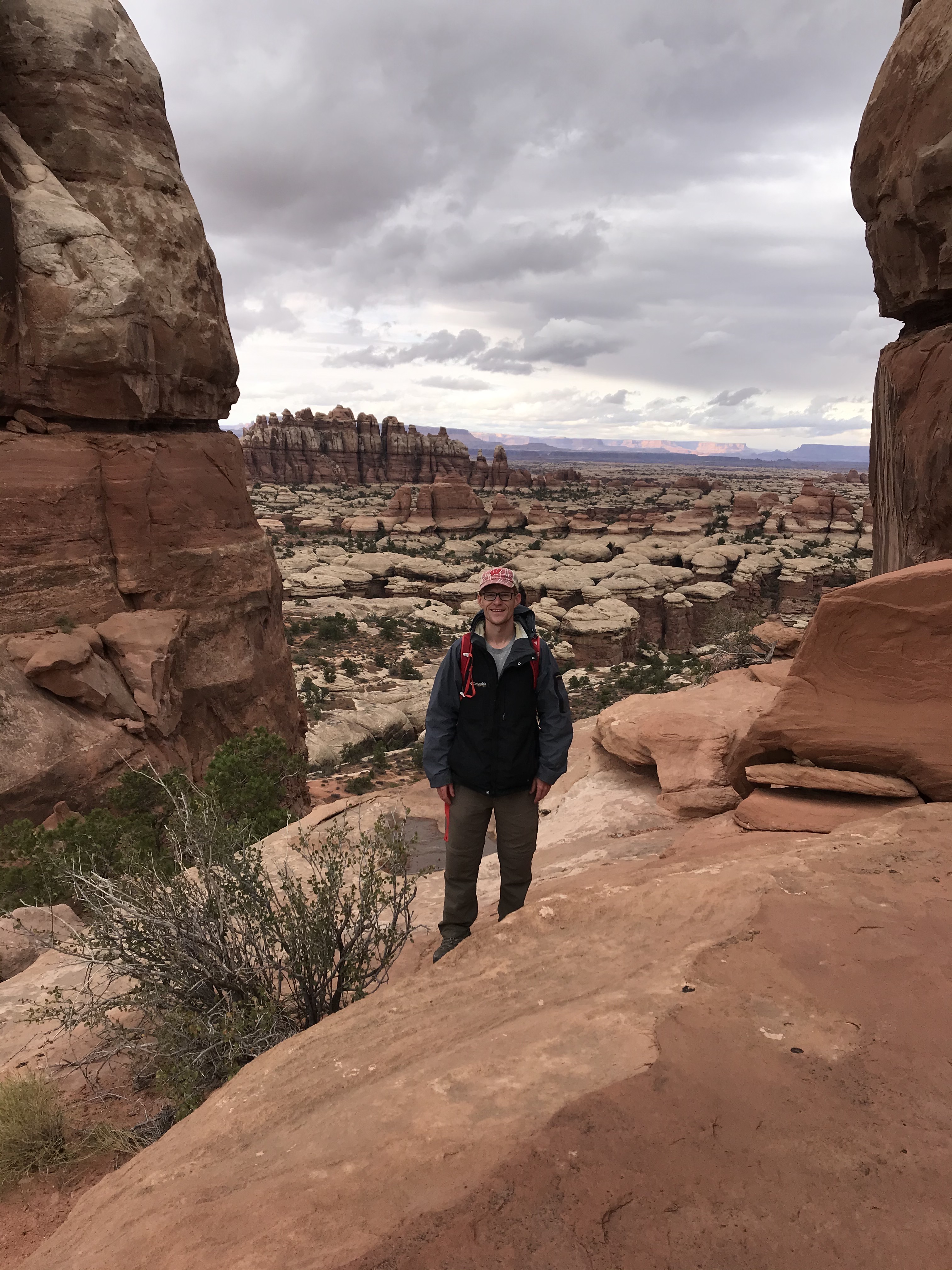
After finishing the hike Leah declared it to be her favorite of the trip so far. I’d have to agree. The trail was moderately difficult and long enough that it felt like a good workout but also short enough to be an enjoyable day hike. There weren’t many people on the trail, a common theme of the Needles section of Canyonlands National Park. We did see some people that were just heading out as we got back and we questioned how far they’d get before it got dark. We also saw two men that were loaded up for an overnight backpacking trip—a great idea if you ask me.
We got back to our car and drove back along the access road to the Elephant Hill parking lot. While driving on the narrow road we ran into a familiar vehicle. It was our Minnesotan friends that we had met the day before at the Island in the Sky section of Canyonlands National Park. We rolled down the car window and stopped to chat for a little bit. They were just heading out on a day hike—it seemed late to be starting a hike—after we can only assume having worked during the day (it was a Tuesday after all).
We got back to camp and set up the tent, ate snacks, and drank wine (Leah) and beer (me). It was still cold out but at least it wasn’t raining. I lit a fire (using the leftover wood that Dick gave us) and we roasted veggie dogs for dinner and s’mores for dessert. The view out the back of our campsite was beautiful.
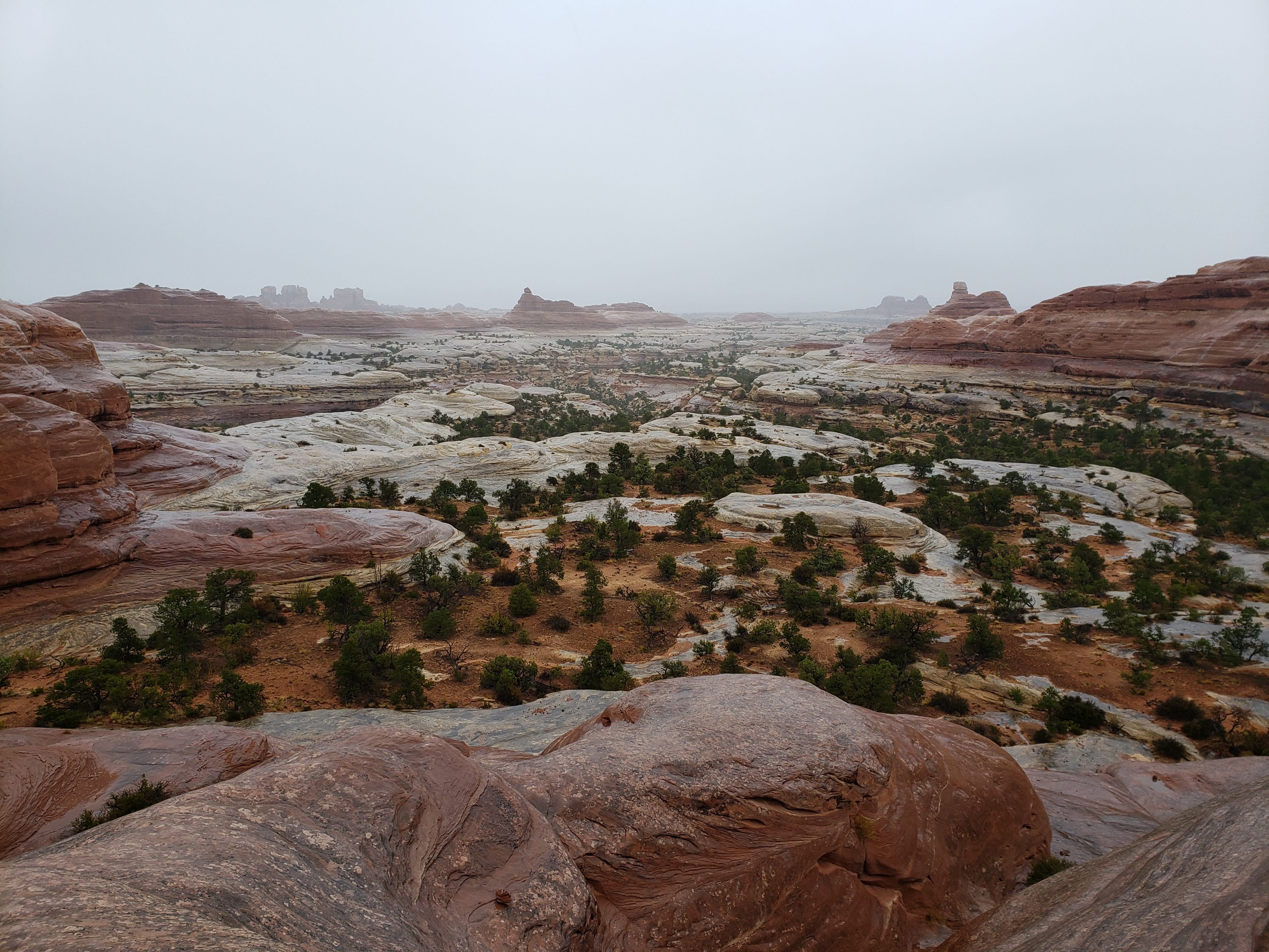
There was rain and/or snow in the upcoming overnight forecast with lows in the 30s. This isn’t the kind of weather that we were expecting while planning this trip. It was a nice change from 105 degree heat but it definitely made for a colder night. On the positive side, we avoided rain in the late afternoon and the sun made some appearances. We sat by the fire and planned out our next day. We were going to do some hikes in the morning in the Needles section and then leave Canyonlands National Park. I was really liking Canyonlands National Park. It was quiet with lots of long and varied hiking options. It was another bad night for star gazing—too many clouds.
Total miles hiked: 10.0 Weather: Cool, windy, and rainy—highs in the 50s
Day 6 – Canyonlands NP and Natural Bridges National Monument
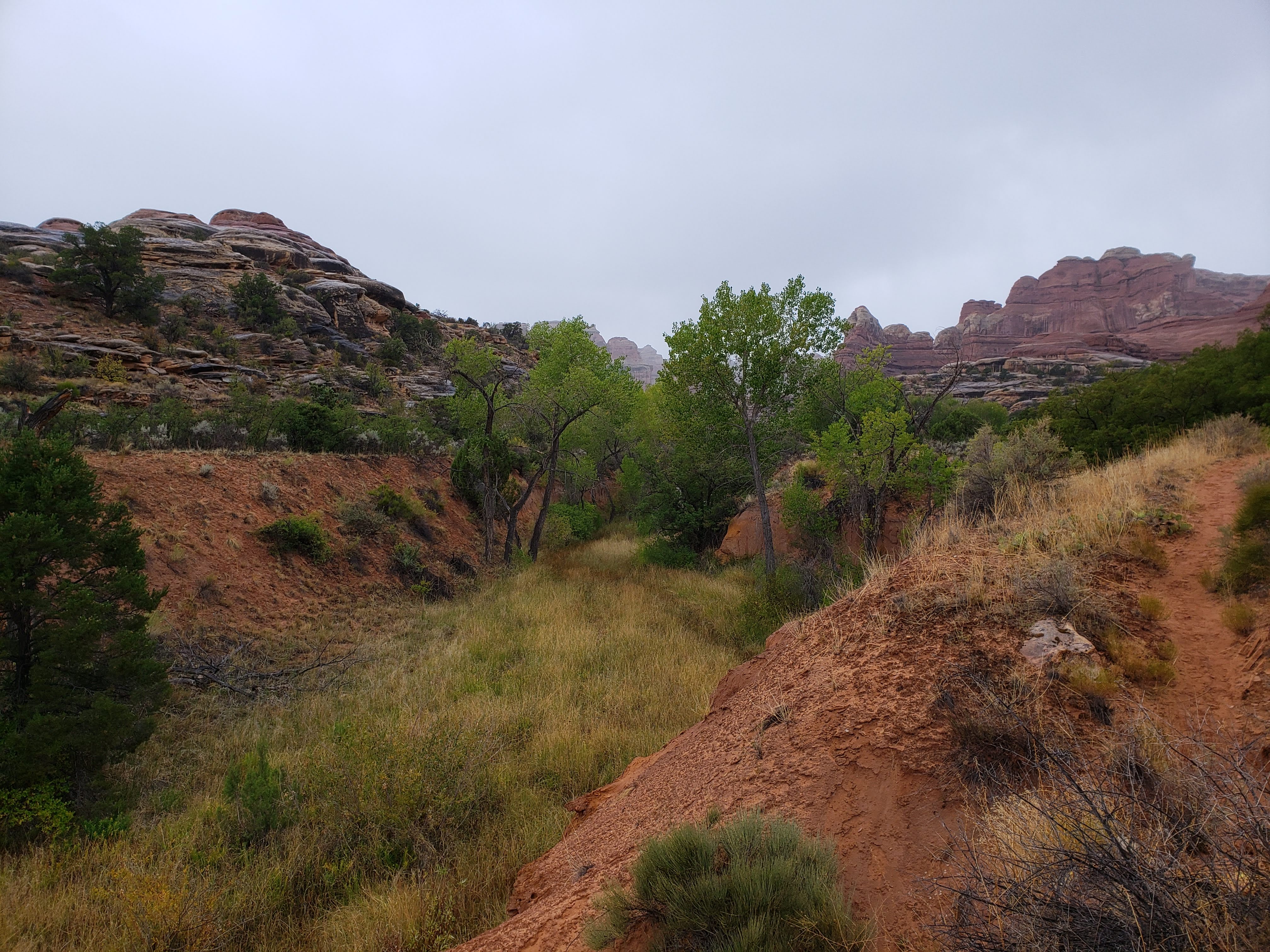
The cold didn’t bother me overnight. It was still chilly in the morning when we woke up but it wasn’t raining so we packed the tent right away—we didn’t want to make the same mistake again. We ate a quick breakfast and headed off to our fist hike of the day, a loop through Squaw Canyon and Big Spring Canyon. It started to rain just as we left the campsite.
The hike was about 7.5 miles long (though it was hard to get an accurate measurement from the map). It was dreary out and temps were slightly above freezing with a light drizzle. We didn’t let the weather deter us—what else were we going to do all day? The hike started on a mostly flat and open section.

The trail gradually enters Squaw Canyon and you hike along the canyon bed for a while. We started to see more vegetation than we had seen in days. I was blown away by all of the biodiversity inside of Canyonlands National Park.
As the hike went on we slowly started to notice the larger and larger canyon walls building up around us. I was also hoping to see more mammals since there was so much green vegetation. No luck on that front.
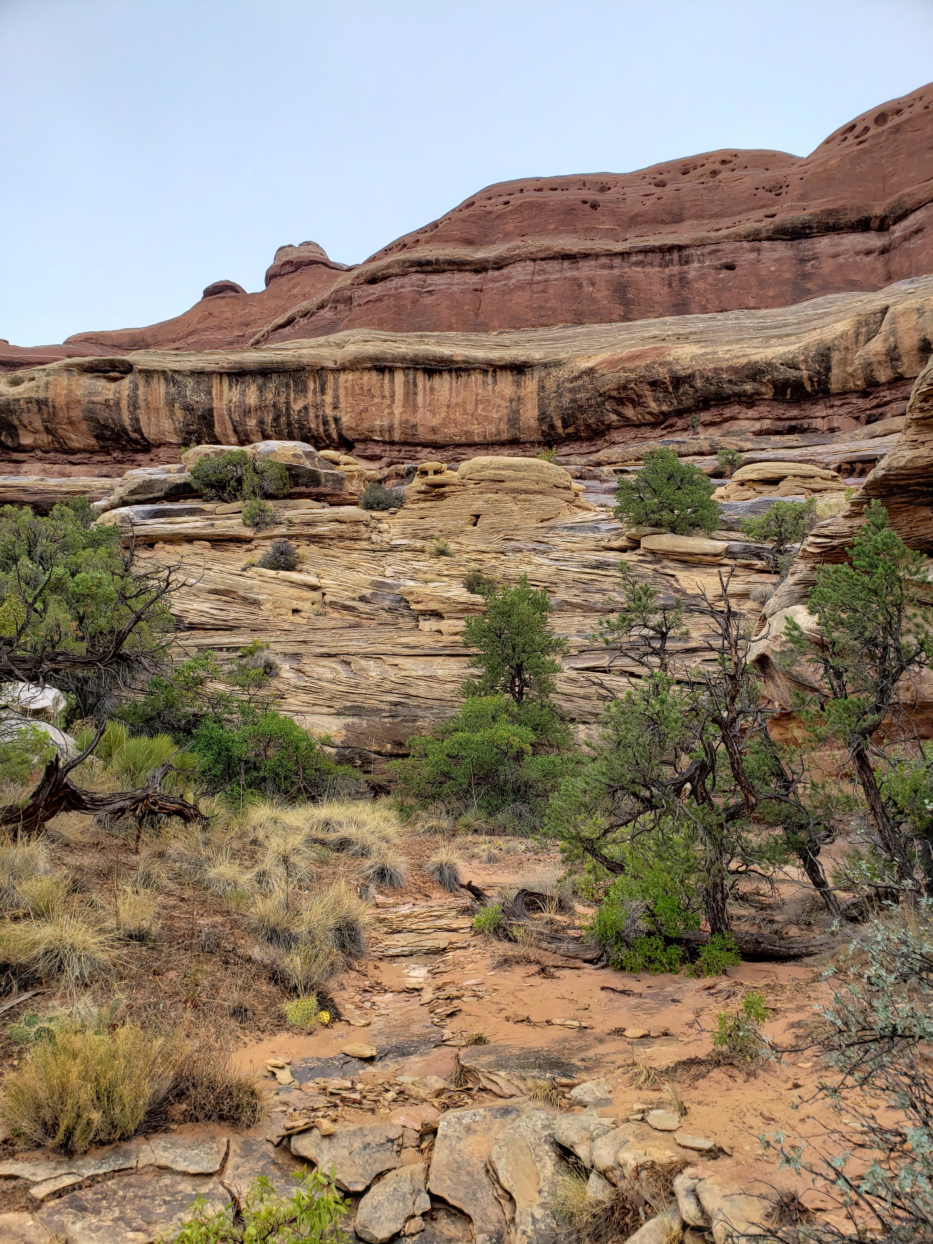
The rain started to pick up as we hiked. It made for an interesting experience both in the scenery as well as the footing. The rocks weren’t too slick—though they are unironically called slickrock. I only slid once on a small drop.


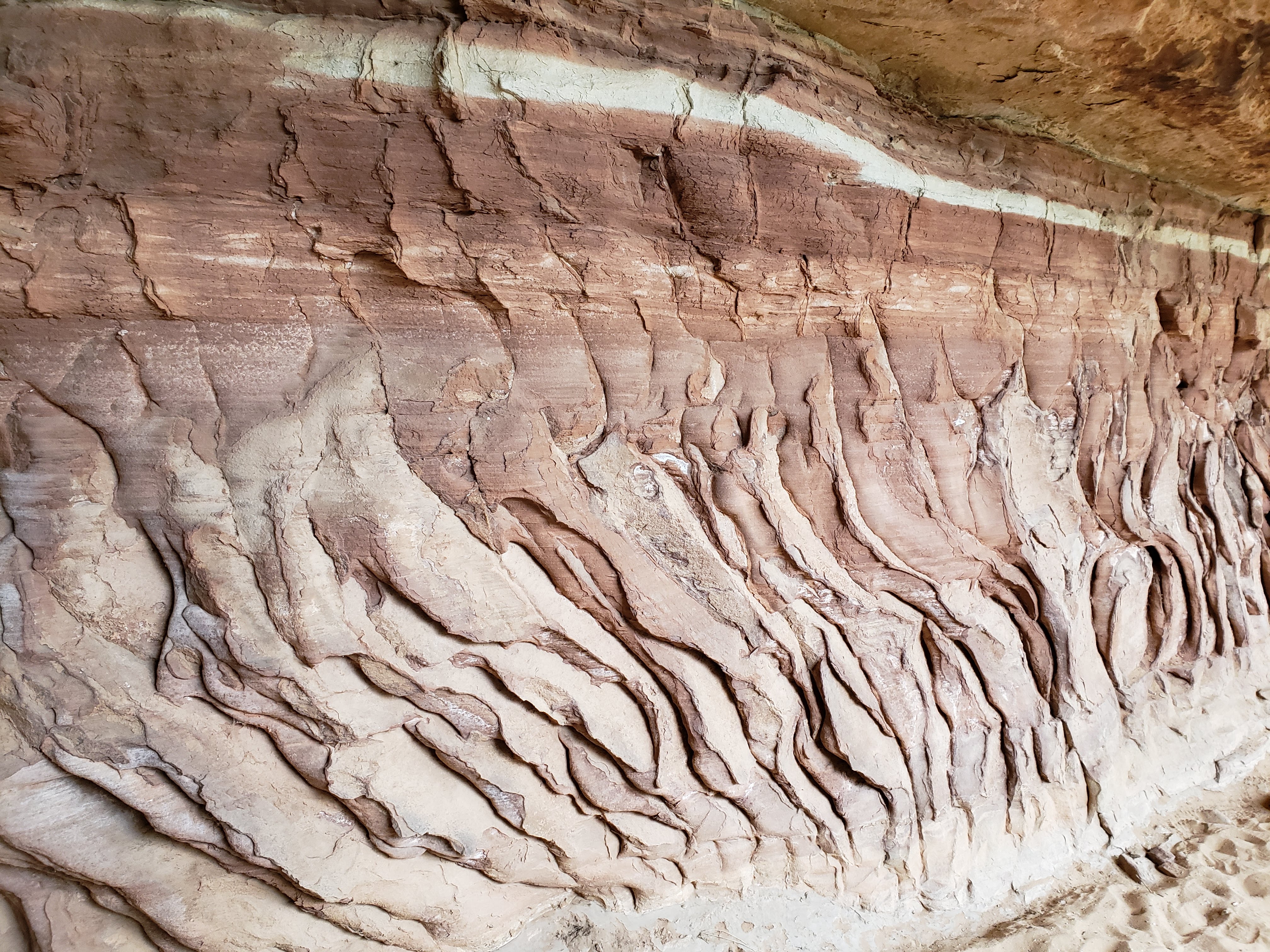
Another cool thing about the rain was that it clearly laid out the paths that the water took as it flowed over the rock faces and into the canyon. Millions of years of erosion and paths of least resistance led to the landscape that we were viewing.
We were close to getting lost at a tricky spot in the trail. After following the Squaw Canyon for a while, you eventually start hiking up along the top of the canyon on a rocky surface with only cairns to guide you. We stopped seeing cairns (which is never a good sign) and weren’t sure what to do. I was thinking we’d continue to follow the canyon as it seemed like the only thing to do. Leah wasn’t so sure. We compromised and backtracked until we found cairns again and paid close attention to where the next ones might be. It turned out that this was the point in the trail where we had to scale over the canyon ridge and out of Squaw Canyon and into Big Spring Canyon. Crisis adverted—credit to Leah.

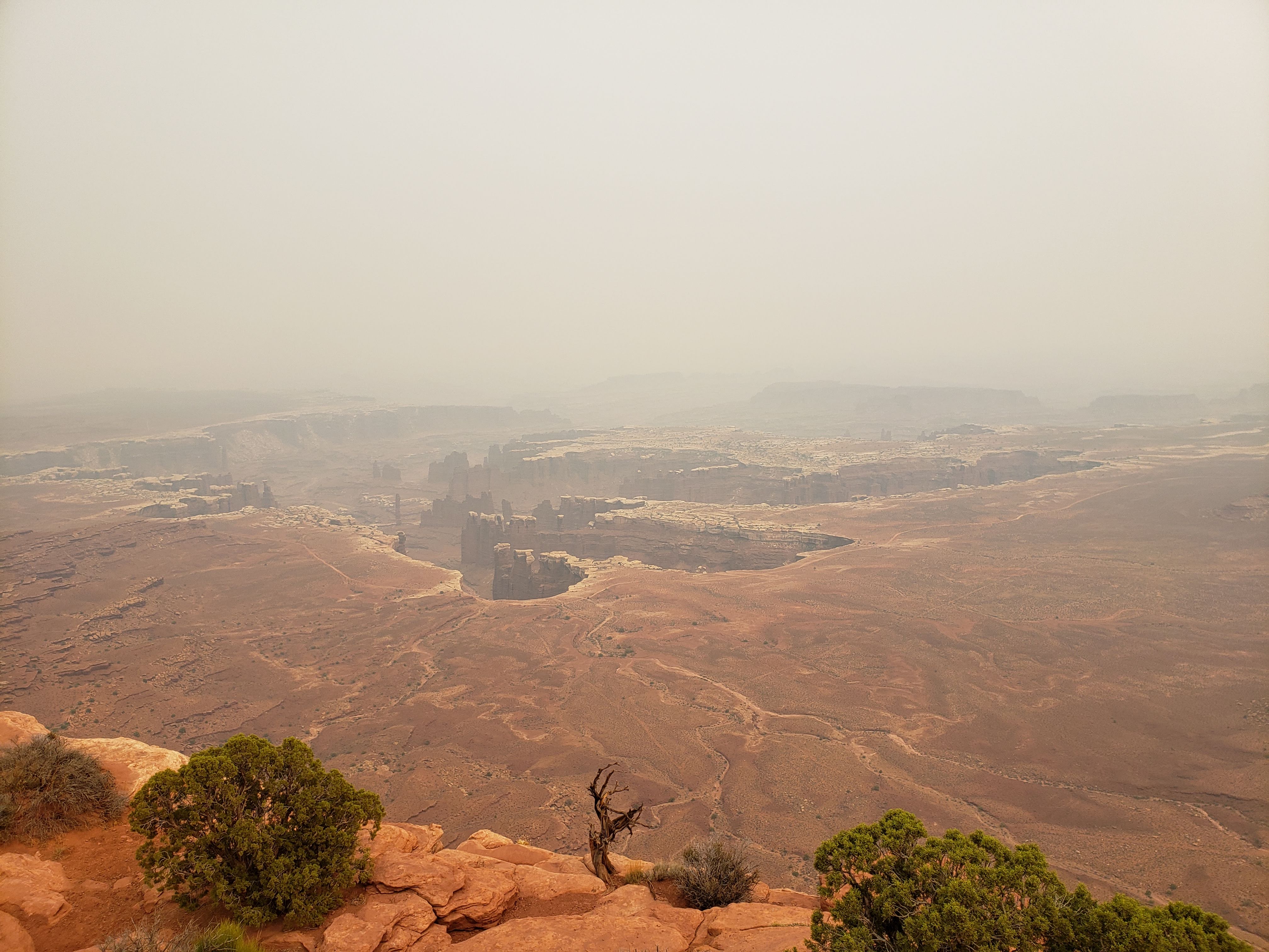
Throughout the entire hike we had only seen one other group—just two people. Once we got back closer to the parking lot we passed a few more groups and the trail appeared to be getting a little more crowded. Nevertheless it was a very quiet hike. We got back to the car and were absolutely soaked after 7.5 miles in the rain (which had picked up its intensity as the morning went on). It was also about 45 degrees out so not only were we doused but we were also chilled to the core. Next we headed to Pothole Point to do a small hike. We were still wet and cold and the views were hindered by the rain and clouds.

We decided to skip the Slickrock Trail. It was a little bit longer than we wanted to hike (about 2.4 miles) at that point due to coldness, hunger, and timing. Instead we drove to the end of the park road and to the Big Spring Canyon Overlook. It turned out that you had to hike out an unknown distance in order to get a better view. With the weather as it was we decided to not look around very much. The other cool thing about this stop is that it’s the trailhead for the Confluence Overlook Trail—an 11 mile trail that takes you to an overlook at the confluence of the Colorado River and Green River. This was way more than we had time for on our trip but I added it to my mental bucket list.
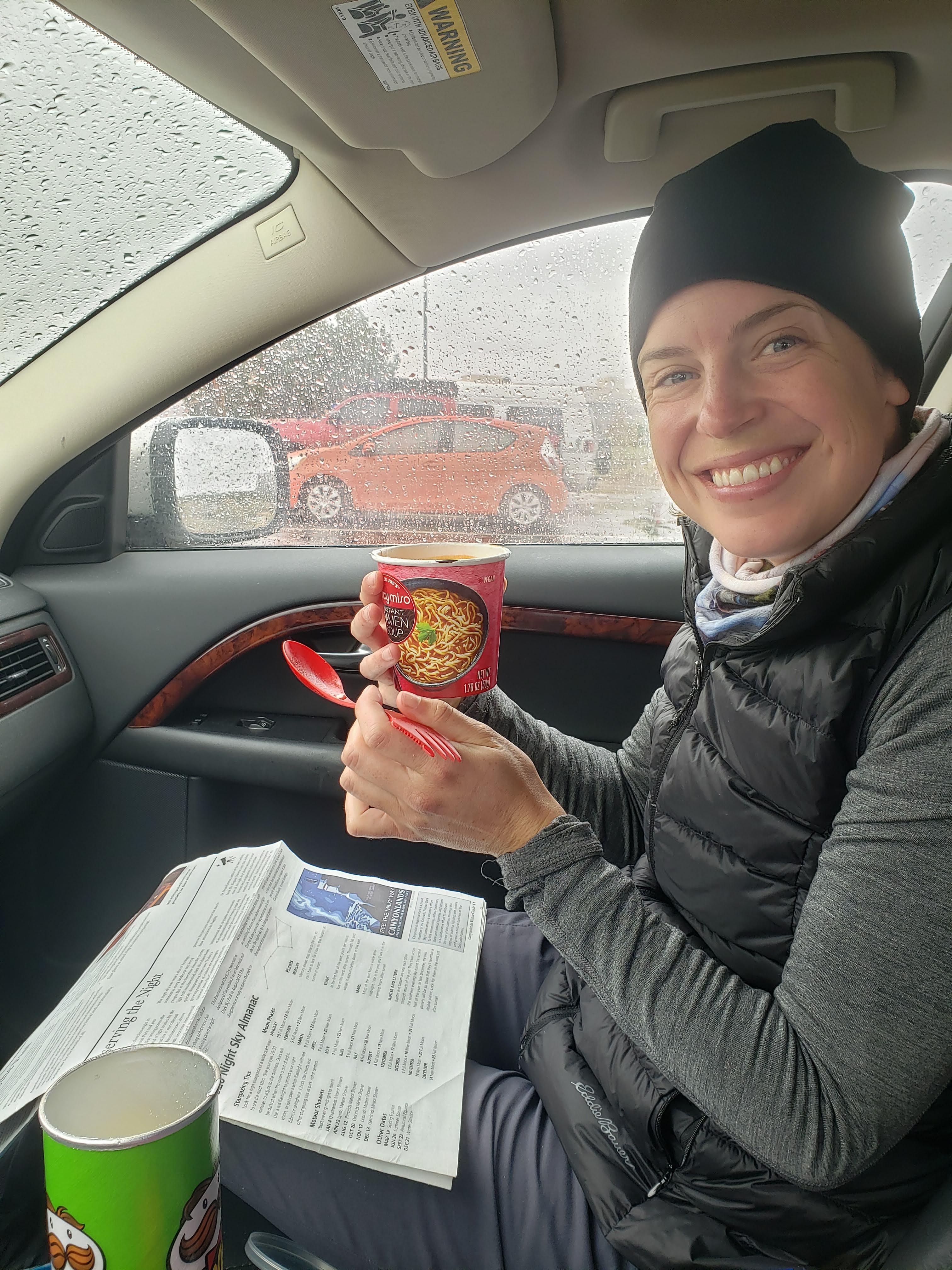
Next we drove out of the park, stopping at the visitor center to use the restroom and poke around the gift shop briefly. We decided to eat lunch in the parking lot. I boiled water on our stove to pour into miso soup cups—a new camping food item that I had purchased for us to test out. We sat inside the car (it was still raining) and warmed up as we slurped down the hot soup and ate Pringles and Oreos. The hot soup cup idea was a success.
We started driving again and left Canyonlands National Park. Just outside the park boundary we started to see snow on the ground. Then the rain that was falling from the sky turned to snow. We finally got back onto the main highway and it had turned into a proper blizzard. We passed one major accident where an RV was jackknifed on the side of the road. Driving conditions were not good and Leah was thankful that I was driving.
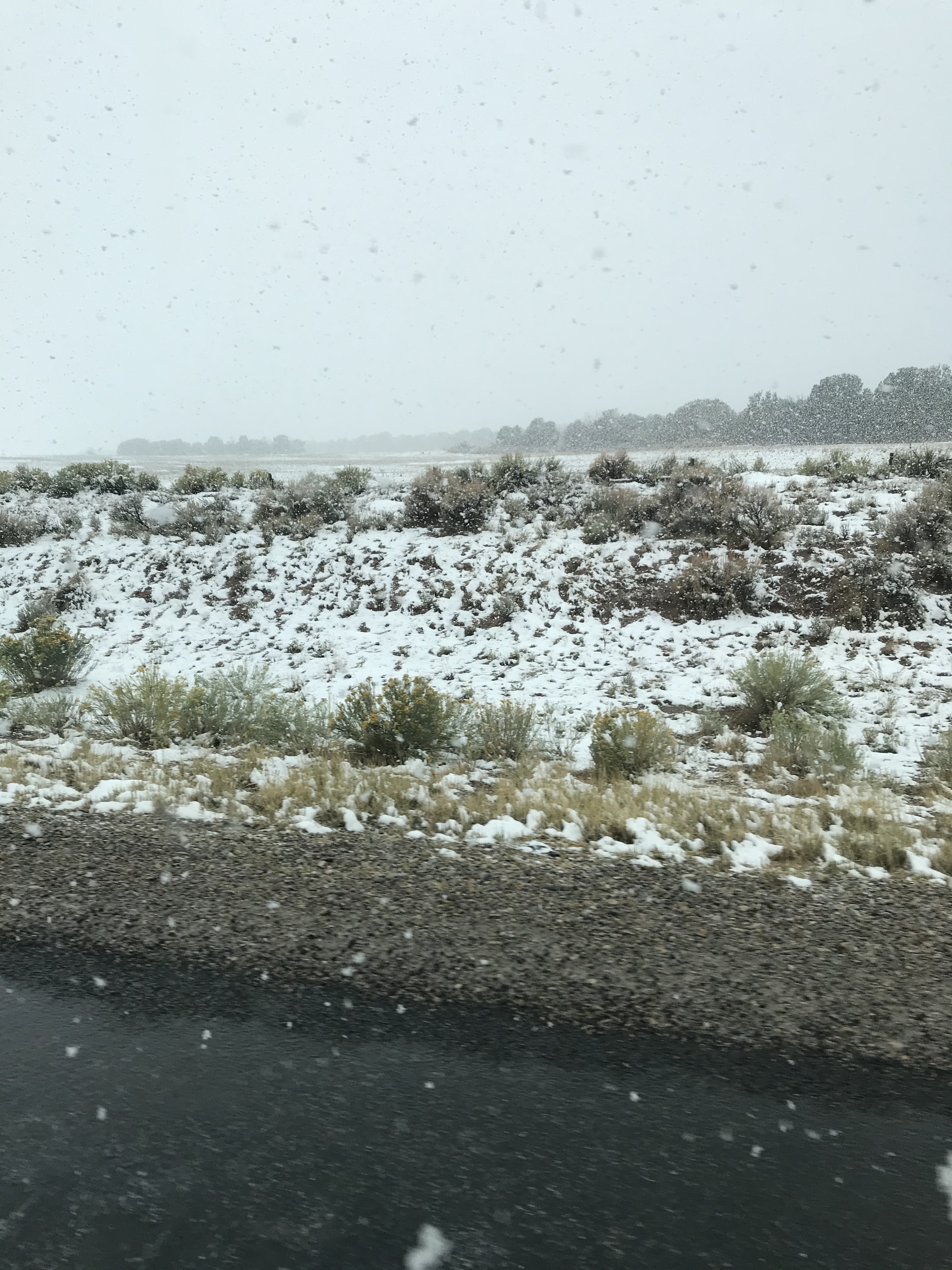
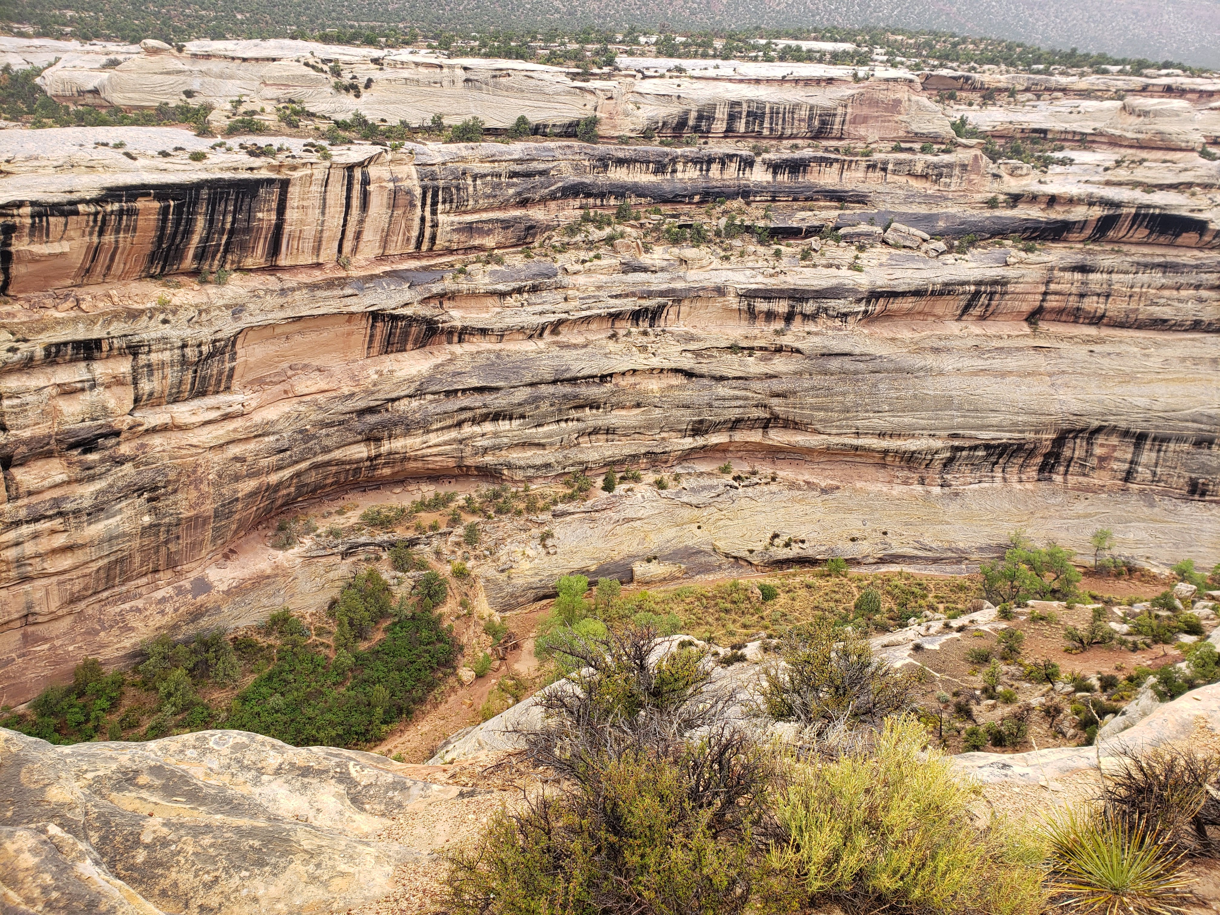
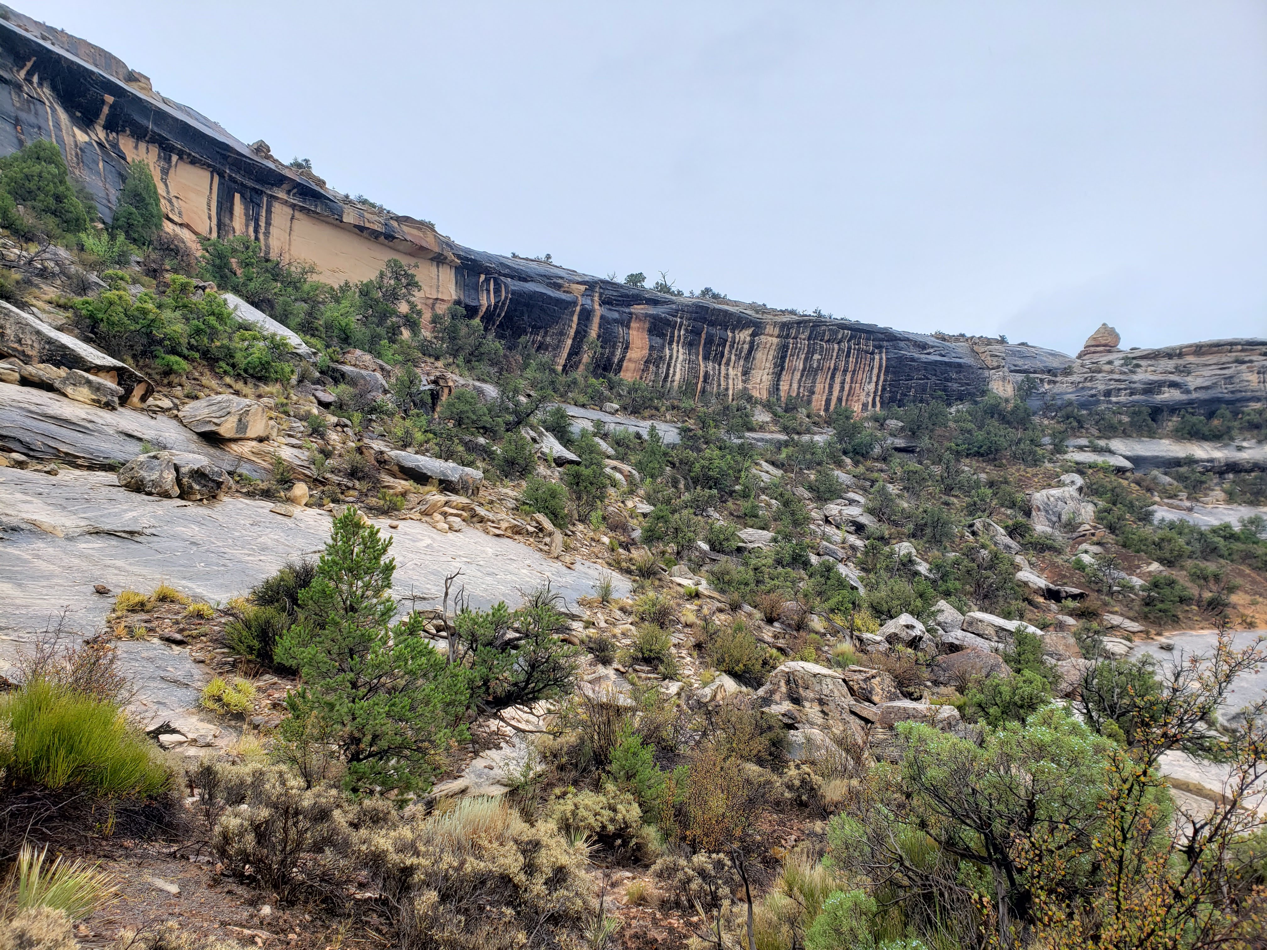
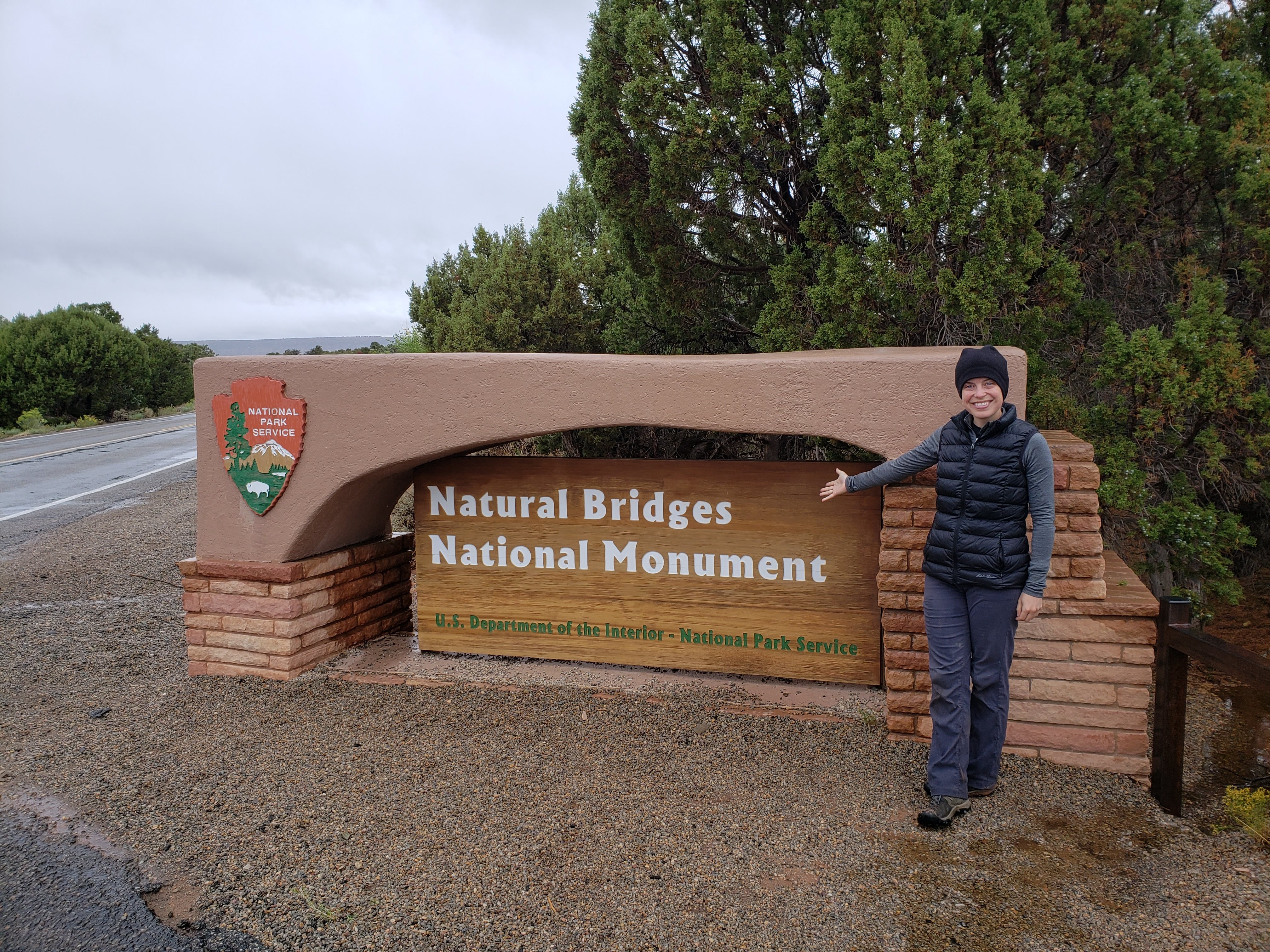
We stopped in Blanding, Utah for gas. I told Leah that we didn’t need to get ice for the cooler because the outside air temperature was refrigerator temperature. Eventually we got to the turn off for Natural Bridges National Monument. We drove along a long and mountainous road to reach Natural Bridges National Monument. Once we got there, the parking lot was almost empty and the visitor center was closed (it was indefinitely closed due to COVID) so no postcard or sticker. We stopped and grabbed a map. I don’t know how popular Natural Bridges National Monument normally is. It’s a little off the beaten path. And it was 42 degrees and raining—we had driven beyond the blizzard by this point. But we only saw a couple other cars the entire time that we were there.
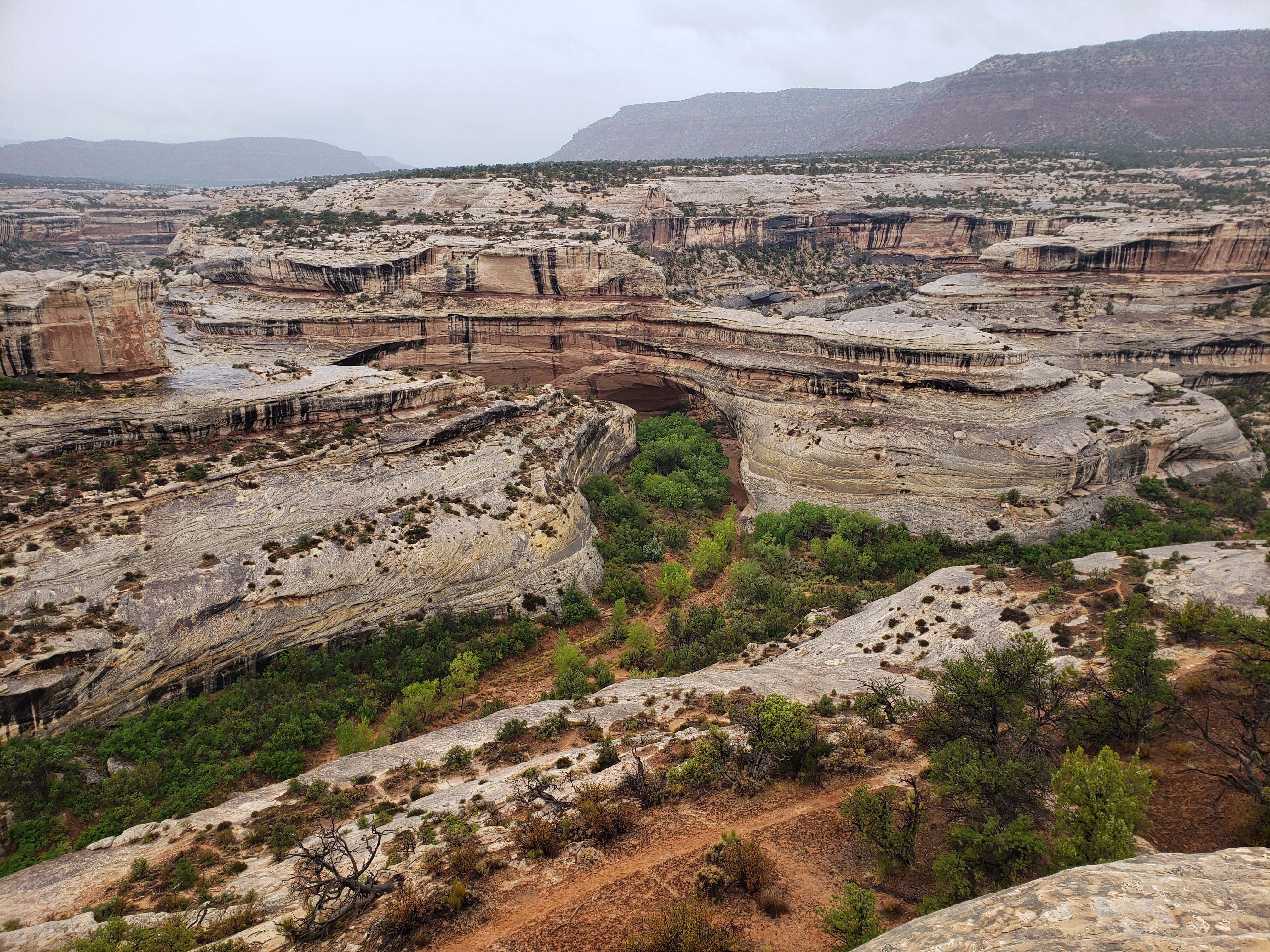
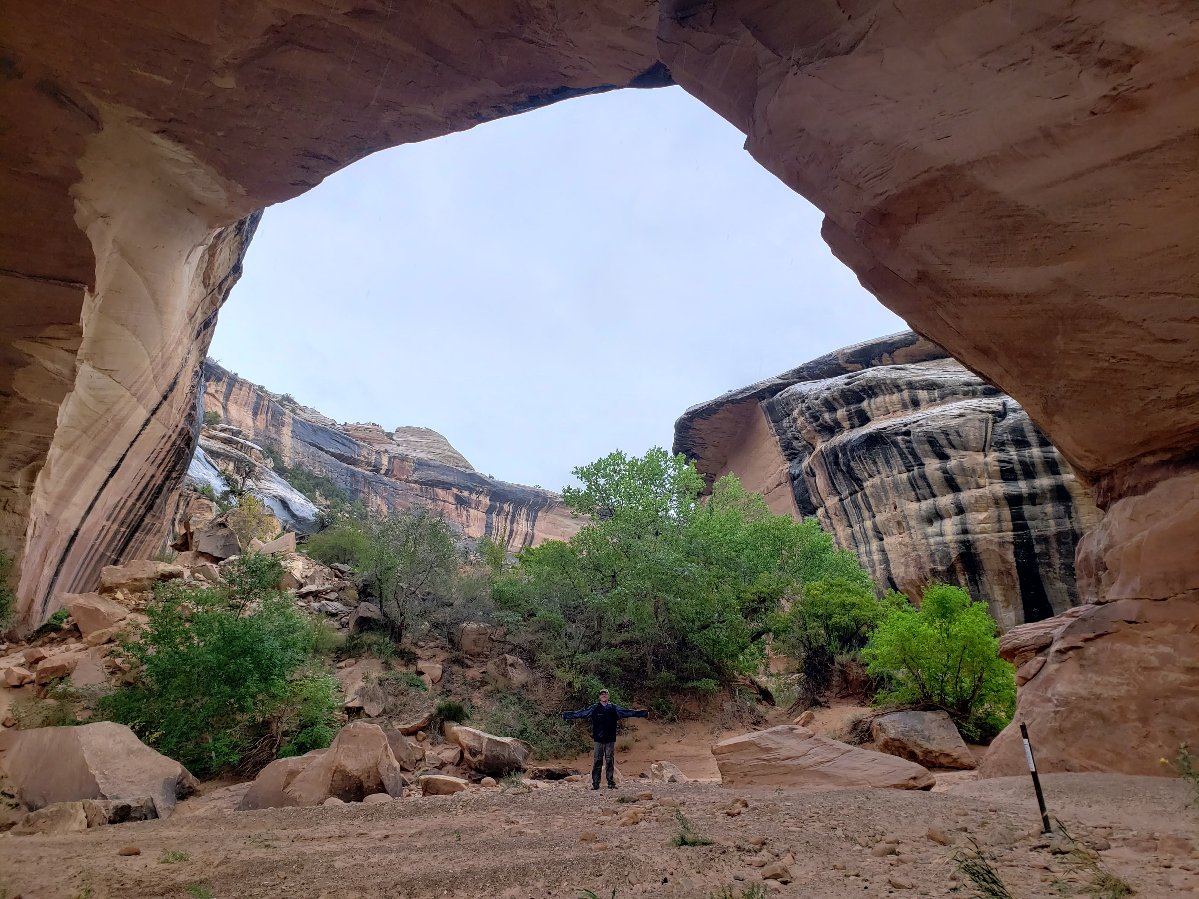
We started driving along the loop through the park. The first stop—after a couple overlooks—was at Sipapu Bridge. Sipapu Bridge is the longest at Natural Bridges National Monument—spanning 268 feet. Bridges look a lot like arches with the main difference being that bridges are formed by active moving water. In other words, bridges form in riverbeds (which are usually dry because it’s the desert). All three of the named bridges on the map are connected by one big loop trail that follows the canyon floor. At each of the three trailheads you can also hike down to the canyon floor. The hike down at Sipapu Bridge is the hardest because there are multiple stairs and ladders that help you ascend and descend. We started the hike but Leah didn’t want to go down the wooden ladder in the rain so we stopped about one-third of the way down. I probably would have gone all the way down but Leah is the safety captain.

Next we hiked out to the Puebloan Overlook. This was a shorter hike that didn’t include a bridge but still had a cool view of the canyon and some cliff dwellings.
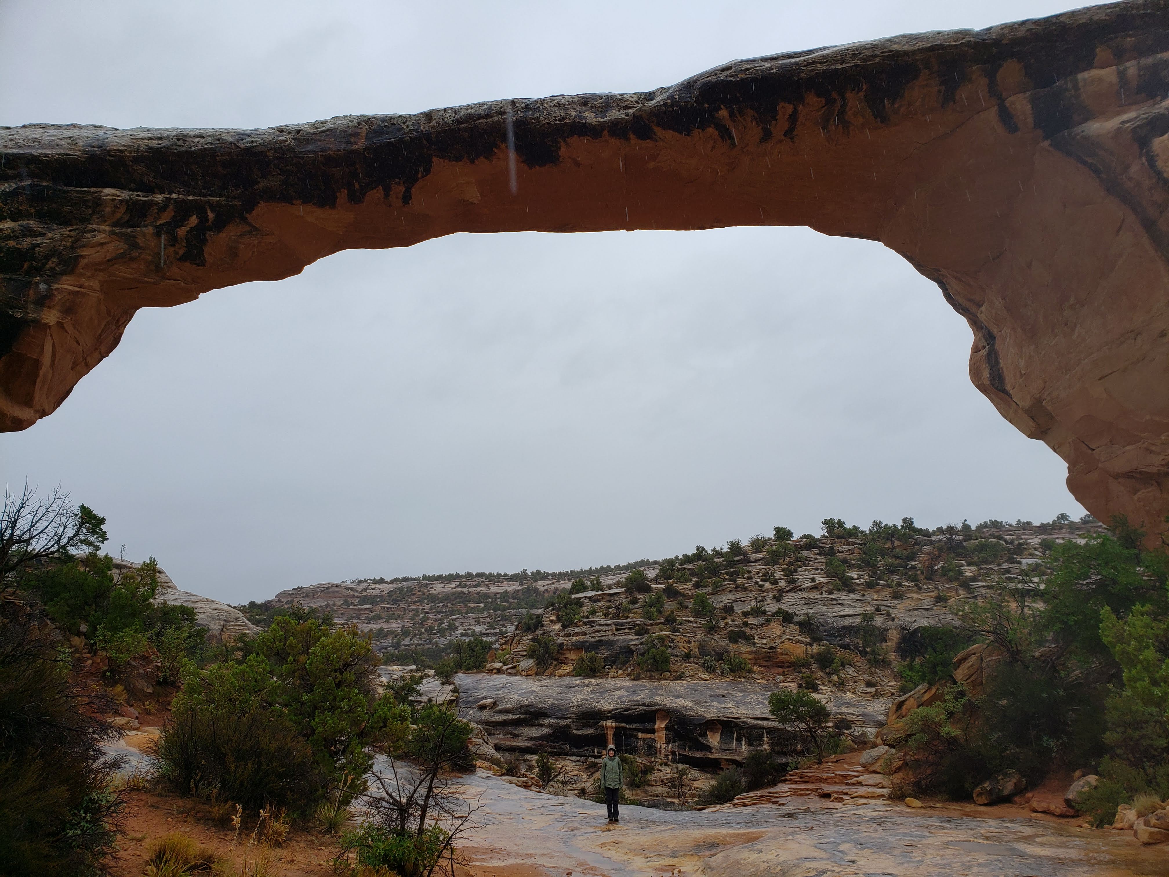
One of the few people that we saw at Natural Bridges National Monument was a woman that was wearing flip-flops and driving a rental car. She asked us about how to pay for entrance to the park. We told her that if it wasn’t obvious how to pay by self-registration then it probably wasn’t that big of a deal. I mentioned that we had already purchased an annual park pass so we didn’t have to pay. We continued along the park loop and stopped at Kachina Bridge. This time we hiked down to the bottom.
Next we stopped at the third and final of the named bridges—Owachomo Bridge. We also did the hike down at this one. Owachomo Bridge is the smallest of the three at 180 feet across and it’s only 9 feet thick. Seems unstable.

We finished out the loop and returned to the park entrance. There is a campground at Natural Bridges National Monument that I was hoping we could stay at but it was also closed indefinitely due to COVID. It would have been very convenient to stay there because it would have accomplished two things. One, we wouldn’t have had to drive far that night (we had been rushing some of the hiking at Natural Bridges National Monument in order to beat the sunset). Two, it would have meant that all of our nights of camping on this trip would be at National Park units—either parks or monuments. Unfortunately, this wasn’t an option. So instead I had already booked a KOA an hour-and-a-half away in Monument Valley. As we left we took our National Park sign photos.
We took the direct route south to Mexican Hat (the name of the city). There was a sign that advised there would be a 10% grade, switchbacks, and a one lane gravel road. RVs, semi-trucks, and trailers were warned not to proceed. Leah was freaked out by the sign. I said that we should press on. I was also driving. It was by far the fastest route and the alternative would take us all the way back to where we had turned off the main highway for Natural Bridges National Monument. The road also seemed fine for a long time. We even saw cars coming from the other direction so it had to be good, right? It turned out that it was the last three miles that were harrowing. We basically followed gravel switchbacks from the top of the mesa down to the canyon floor. Leah couldn’t watch. I was doing fine.
By the time we got to the canyon floor it was just about past sunset and everything was getting dark. Unfortunately, this made for bad viewing of what’s called the Valley of the Gods. We finally arrived in Mexican Hat, Utah which gets its name from a sombrero-shaped rock outcropping on the northeast edge of town. We thought we could find a place to get dinner. It was getting late and we weren’t planning on cooking. There appeared to only be one open restaurant and it seemed kind of sketchy. There wasn’t even a Subway. It was kind of a sad looking town.
We stopped at the San Juan Inn—named for the San Juan River that flowed nearby. We didn’t have any other options. We decided to dine in the restaurant (there were about four other people eating there and we were able to space way out and sit in a different section). It was strange to eat inside a restaurant. It was our first time doing it since the pandemic had started six months ago (and we have yet to do it since). I ordered the Navajo burger and Leah ordered the Navajo tacos. They were both served, as their name implied, on Navajo fry bread instead of a burger bun and taco shell, respectively. My burger was good. The whole process of eating there took a while because as it turned out there was only one person working—meaning she was taking orders and making the food. We both used the restroom and noted the signage warning about not clogging the toilet.
We finally hit the road again—later than we had hoped but satisfied. We drove into Monument Valley but it was completely dark so we couldn’t see anything. During my trip planing I was hoping that we’d be able to see Monument Valley that night. Instead we’d have to backtrack a little the next morning to see it. We arrived at the KOA which was located right next to the highway. The rain subsided a little and was only a faint trickle. We set up the tent and I took my first shower in days. It was warm and nice and I felt very clean. Leah decided to take a shower in the morning instead.
Our plan for the next day was to drive straight to Zion National Park. There was some rain predicted overnight but it was supposed to clear up by the next day. Maybe we’d be done with cold temps and rain for the rest of the trip? I had picked the roadside KOA due to it’s convenience and price but I was worried that the car noise from the highway might keep me up at night. Oh well. Nothing I can do about it now.
Total miles hiked: 11.1 Weather: Cool, windy, and rainy—highs in the 50s
Final thoughts on Part 1
We did a lot of driving to get out to Utah. In the future (if there isn’t a pandemic) I think we’d fly out and rent a car. I did some quick calculations and the cost of the flight and rental car are easily offset by the cost of gas and wear and tear on our personal vehicle, as well as the extra nights of lodging while driving.
Moab was crazy. I’d like to visit and check out the restaurant and brewery scene sometime in the future (again, during non-pandemic times).
Arches National Park was really cool. It’s very iconic and worth going to for sure. It was also very crowded and hard to get away from people. I always make mental notes of the things I’d like to do if I ever return to a place. My “if/when I go back” list for Arches National Park is the Fiery Furnace, the complete Devils Garden Loop Trail (of which we only did part), and Tower Arch. Outside of those items we pretty much covered the entire park (minus some off-road vehicle stuff). At about 77,000 acres Arches National Park is the second smallest of the Big 5 in Utah (only Bryce Canyon National Park is smaller) so there isn’t as much backcountry exploring to do.
At the Island in the Sky section of Canyonlands National Park there was still a bunch of hiking that we didn’t get to, though most of it went down towards a river. My “if/when I go back” list for the Island in the Sky section is the Neck Spring Trail and hikes down to the river like Alcove Spring or the circumnavigation of Upheaval Dome plus the trail down Upheaval Canyon to the Green River. Another thing that would be cool is driving the White Rim Road in an off-road vehicle or possibly bikepacking it if I felt adventurous.
At about 338,000 acres Canyonlands National Park is the biggest of the Big 5 in Utah (but only the 23rd biggest park in the National Park system). I really appreciated the size of it. It made for lots of long hike possibilities and tons of overnight camping options. It also meant that—along with it being farther from the main highway—it wasn’t crowded. We saw a lot less people at Canyonlands National Park compared to Arches National Park. I really appreciated the quietness and solitude.
Speaking of quiet, the Needles section of Canyonlands National Park was even less crowded. The Needles was where I fell in love with Canyonlands National Park. The scenery was so varied and beautiful. Plus there were a bunch of trails that all sounded really fun. My “if/when I go back” list for the Needles section is the Confluence Overlook Trail, Peekaboo Spring plus Angel Arch, Druid Arch, Devils Kitchen, the full Chesler Park Loop, the Slickrock Trail, and possibly the Lower Red Lake Trail down to the Colorado River. That’s a lot of things to do, but I feel like I could spend a week in Canyonlands National Park and never run out of things to do.
Natural Bridges National Monument was really cool. It doesn’t seem like a lot of people go there. It doesn’t get the same kind of hype as the Big 5. I think if you’re in the area and have time it’s a worthwhile stop. If you are short on time and need something to cut, it might be best to skip it. My “if/when I go back” list for Natural Bridges National Monument is to hike the full loop trail that connects all three bridges (about 8.6 miles). That includes hiking down—or up—the ladders at Sipapu Bridge. Hopefully it isn’t raining the next time. Other than that there isn’t much to do. Natural Bridges National Monument is only about 7,500 acres and there aren’t any backcountry opportunities.
We did a lot of driving to connect these different parks and sites but overall I was happy with the timing of things. I felt like we had adequate time to see each park without being rushed while still leaving lots to do if and when we return.
